


Top Things to do in Sirdal Municipality
What to do and see in Sirdal Municipality, Southern Norway: The Best Things to do
Discover the best top things to do in Sirdal Municipality, Norway including Lyseveien to Lysebotn, Hadvardshei Summit, Roseknuten, Hoyt & Lavt Sirdal, Sirdal Husky Farm, Bjornestad Skisenter, Alsheia Alpint, Flerehei, Sirdal Skisenter, Havsynsknuten.
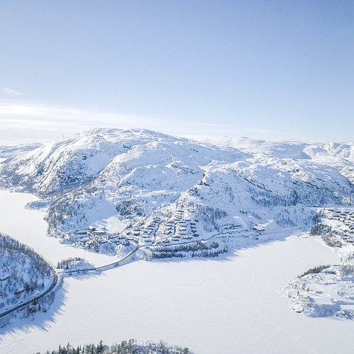
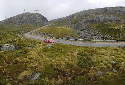
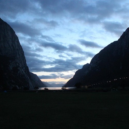
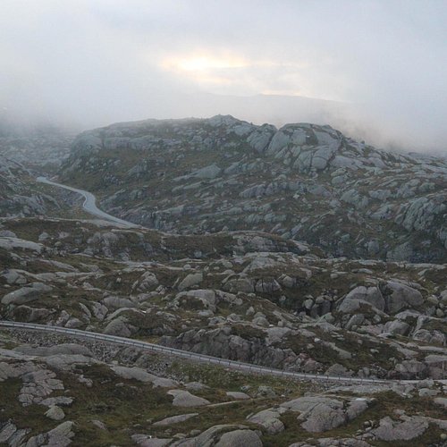
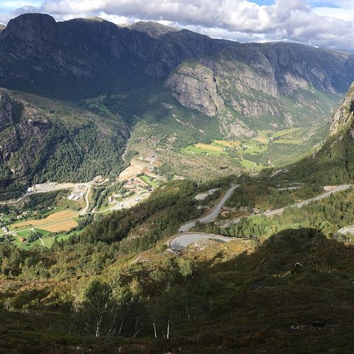
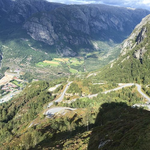
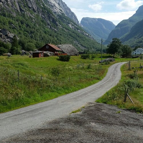
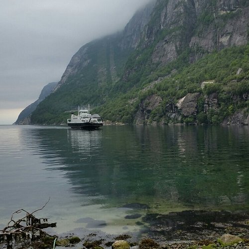
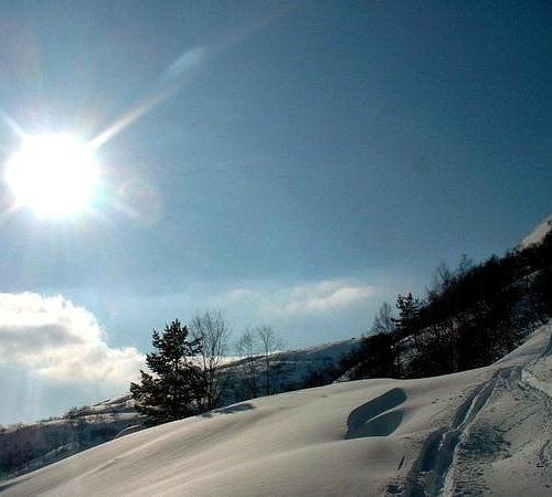
1. Lyseveien to Lysebotn
Overall Ratings
5.0 based on 22 reviews
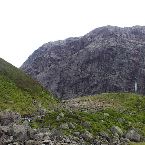
Starting Point:The walk starts on Lyseveien between Sirdal and Lysebotn, about 1 km west of Grydalen. You can park on Borsteinshyttens carpark, located on the opposite side of the road in relation to the trail. Description: Start walking in a north-west direction. After approx 5 minutes cross the stream descending from Matupstjodne tarn and follow the left side of the stream gently upwards. The path here runs along a small hillock on the south side of the tarn. Gradually climb up towards the paths highest point. At 970 meters there is a magnificent view across the Lyseheiane. From here start the descent towards Andersvatnet lake. You must first zig-zag your way down ¾ of a steep ravine and then follow the rock face of Vardekleivane on the right. After approx 100 metres cross the stream that runs from Andersvatnet lake. (Carefully follow the markings and your GPS if you have one).The path continues to the west and the terrain becomes gradually hillier and it may be difficult to find your bearings. You will pass several lakes before coming to a ravine that takes you down to Pollen (tarn). The path zig-zags down this ravine but you get a great view of the waterfall cascading down from Mount Toknuten. At the bottom of the ravine you cross the stream running from Andersvatnet lake. From here, the path gradually ascends on bare rock before you come to a valley to follow. Towards the top of the valley you can see the high mountains of the Lysedalen valley on your right and you get an idea of what awaits you later on on the walk. Lysedalen valley is one of the region's wildest valleys, with their 800/900 metre steep mountainsides that plunge into almost impassable terrain. At the end of the valley you climb over a boulderfield before continuing down the ravine to a green sheltered spot with fresh mountain water. This is a perfect spot for a break! Follow the stream down to where it winds 90 degrees around the mountains down towards Lysedalen valley. You can't fail to be impressed! The magnificent mountains that make up Lysedalen valley greet you in all their splendour. This is not the place for those who may have fear of heights! Like the stream you must also change direction (northwards). Allow yourself approx 1.5 hour to get down the steep mountainside. Carefuly zig-zag your way down. You will copme to a birch forest at approx 420 metres. It may be difficult to find the path here, as it also zig-zags through the dense forest. Look for stone cairns and red marks on the trees in the forest. When you get to a prominent overhang, the path turns 90 degrees towards the innermost farms you can see far below in Lysebotn. At 85 metres turn right, towards the spot where you must cross the river by climbing over some large rocks. There is a wire rope attached to one of the rocks, which makes crossing easy. Follow the right side of the river westwards. You then come to a grazing area for sheep, and pass through a gate that takes you onto the land of the innermost farm in Lysebotn. Remember to close the gate behind you. Cross the grazing land and use the steps that have been erected for you to cross the fence at the other end. After 100 metres you come to another fence that will lead you through a little gate into the parking area at the farm. For a detailed description including maps and information etc buy the guidebook 'Hiking in Sirdal' which includes Kjerag and Sirdals Seven Summits.
Reviewed By mihaella19 - Haugesund, Norway
Have only one thing to say : it's worth every second to spend there both on the road /Lyseveien or at the fjord down at Lysebotn .Every piece of nature is mesmerizing .
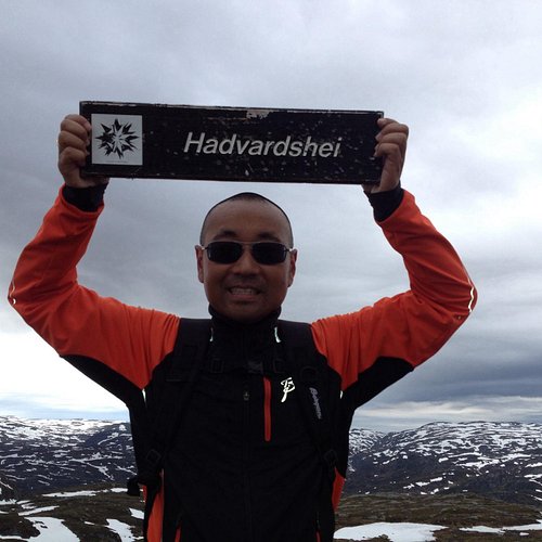
2. Hadvardshei Summit
Overall Ratings
5.0 based on 1 reviews
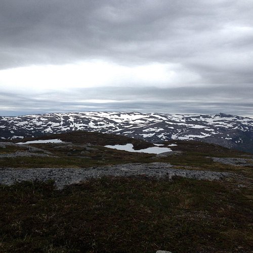
Starting point: park at the upper carpark at adneram ski lift located just off Bergetjodn. Description: from the carpark, follow the road/ski trail that runs down the mountain, at the first intersection turn right and follow the trail that runs south of the lake. At the end of the lake you will see three tracks, follow the middle one. On top of the hill, turn right and follow the trail to the top of the ski lift . Allow about 25 minutes to the top of the lifts. Cross under the lifts and continue northeasternly along the narrow path. In general you should follow the ridge of the mountain. After a short journey you will reach a small marsh, here turn right down a small glen, before again going up the mountain edge, first through a small birch wood, then across two small valleys. After approximately 15 minutes walk round the mountain, bearing north on the small mound from which you see Rubedalstjodna on the left handside, and Hassteinstjodn in the distance on the right. Go down the hill and cross the valleys that cross here, before you climb up the slightly steeper slopes in a northwesterly direction. When the path becomes less visible continue up the mountain ridge. Keep to the left and follow the stone cairns that will lead you back to a small tarn. Allow 25 minutes. At the tarn, turn west. You cross a stream that flows out of the tarn and pass similar small tarns. After a short anount of time you will cross the valley creek that runs east-west. Hadvardshei is now to your left, take the easiest road to the top where you can enjoy a 360 degree view over the mountain moors. For a detailed description including maps and information etc buy the guidebook 'Hiking in Sirdal' which includes Kjerag and Sirdals Seven Summits. Click here for Maps and GPS Coordinates Accommodation: Suleskard Fjellsenter Stavanger Turistforening Contact: Arild Rosnes +47 51 84 02 17
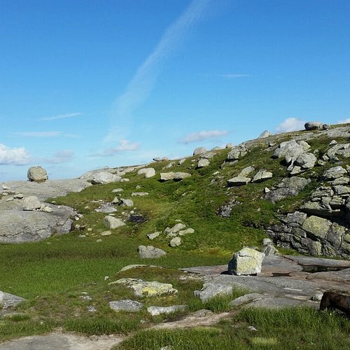
3. Roseknuten
4. Hoyt & Lavt Sirdal
Overall Ratings
5.0 based on 5 reviews

Klatreparken består i hovedsak av ulike typer løyper i trærne, med varierende lengde og vanskelighetsgrad. Løypene består bl.a. av vaiere og tauverk som er bygget inn i det naturlige terrenget, og lar deg oppleve en spennende verden fra tretoppene. I Høyt & Lavt klatreparker legger vi til rette for utfordrende aktiviteter og rå opplevelser i et sikkert miljø, for alle aldre og ferdighetsnivåer.
5. Sirdal Husky Farm
Overall Ratings
4.5 based on 22 reviews

Sirdal Husky Farm creates authentic experiences through a mix of history, people and nature. We stake our pride on sharing the treasure of unspoiled nature with our guests. We love recounting local history and giving guests the chance to engage in meaningful fun and play between humans and animals. We offer husky adventures and teambuilding for companies, as well as activities for families, groups and school classes.
6. Bjornestad Skisenter
Overall Ratings
4.0 based on 1 reviews

Bjornestad Skisenter is located in Sirdal in Vest-Agder. 100 km from Stavanger and 40 km from Egersund. 1 skilift, cafeteria offering light meals, ski-and snowboard rental and snow canons. Open during the winther season: Mon-Fri 16.00-21.00 Saturday and Sunday 09.00-21.00 School hollidays and public hollidays :09.00-21.00 Take the FV42 road in the direction of Tonstad. Great opportunities for off-piste skiing and excellent terrain for cross-country skiing.
7. Alsheia Alpint
Overall Ratings
4.0 based on 3 reviews

alsheia is the largest ski field in Sirdal with six lifts and a large amount of runs suitable for all levels. At alsheia you can also be able to ski in the evenings as there are several flood lit tracks. In addition, you will find a large cafeteria, ski rental with an extensive range of cross country and slalom skis, snowboard and all other equipment you will need. We also have a ski school with possibility for private lessons. Two of the lifts are located behind the mountain at Nystol, this is a perfect location for families as this is a sunny and peaceful area. For the youngest ones there is a free kid’s ski area near the cafeteria. During the ski season alsheia arrange a range of events, for instance races for amateurs and active skiers. It is also possible to arrange events for businesses, schools and others. Check out our for up to date information about weather conditions and opening times.
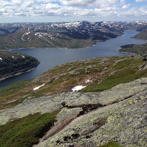
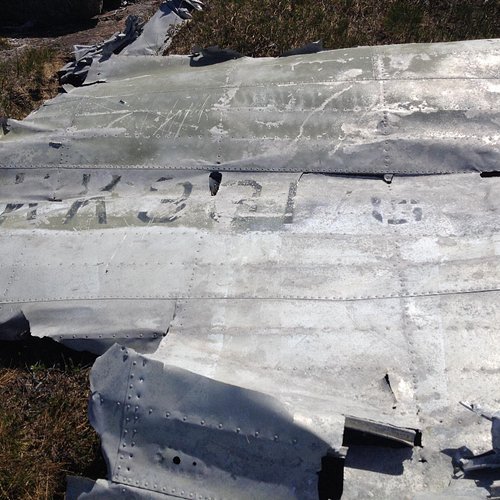
8. Flerehei
Overall Ratings
4.0 based on 1 reviews
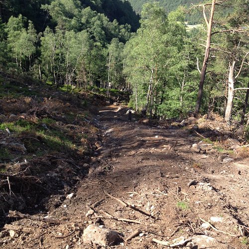
Starting point: Turn off Highway 468 at Lunde church in the direction of oyne. Drive over the bridge and park at the first farm on the right. Description:The hike begins at a small farm in the oyes. From here follow the forest road to the summit allowing approximately an hour for the steep ascent. At the top, where the road travels down towards the Midtstolsvatnet, turn right and follow the red markers up Glovreknuten. Initially in a south-easterly direction over the flat areas, then up in a southerly direction. After about 15 minutes, cross a stream here the path runs east through the marsh area. At the end of the moor the trail continues up a small hill. During the climb, you will see a small lake on your left. Once at the top you will see the path again carrying on in a southerly direction throught the hillltops. On the flatter section you have to cross a bog and then you will come to a small lake on the left handside. Continue in the same direction until you reasch a small cavern now you have the top of Glovreknuten on your right. On top of the cavern you will see directly on Flerehei. Continue down the hilly landscape, you will pass a lake on the right handside, and shortly after you cross a stream between two lakes. Follow the stream on the left side of a small knoll, from which you walk on the left side of the lake before embarking on the final climb to Flerehei. First travel through a small valley with large stones, then zig zag up a small hill, before the last gentle climb over the bog and heath to the crash site. A memorial monument stands a short distance up from the aircraft remains. For a detailed description including maps and information etc buy the guidebook 'Hiking in Sirdal' which includes Kjerag and Sirdals Seven Summits.
9. Sirdal Skisenter
Overall Ratings
4.0 based on 10 reviews
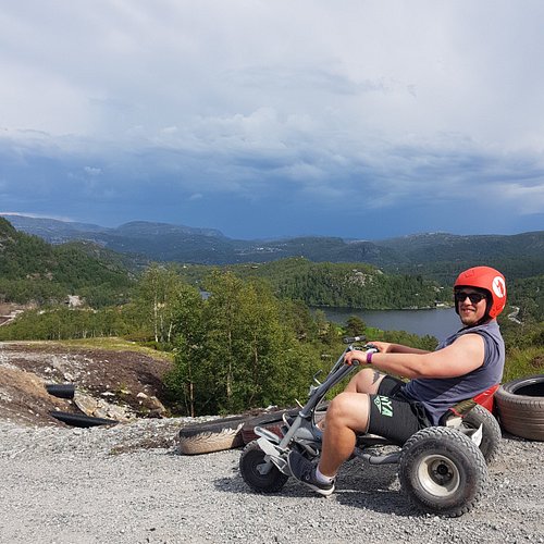
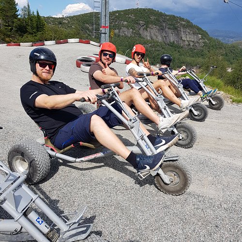
We have numerous fun activities and experiences for the entire family. Our ski resort has 22 slopes and 9 different lifts in Alsheia and Tjørhomfjellet combined. We also offer sci school and ski-rent for beginners and people interested in learning. Book your overnight stay and meals with us and get a beautiful mountain view as a bonus. Sirdal Resort is located in the heart of South-western Norway with short travel time to famous tourist destinations like Pulpit Rock and Kjeragbolten. If you visit in the summer, come visit our Høyt & Lavt climbing park, Mountain Cart or other activities available during summer.
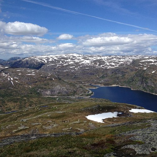
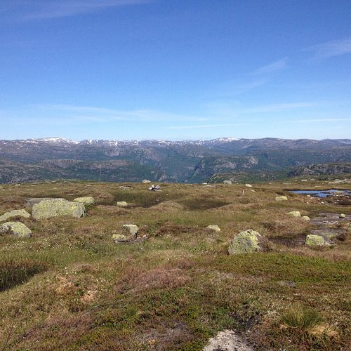
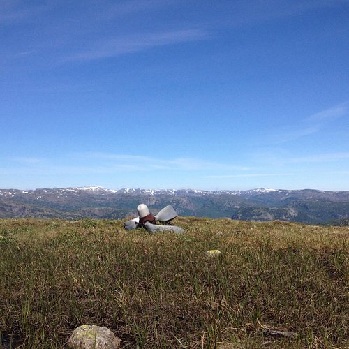
10. Havsynsknuten
Overall Ratings
2.0 based on 2 reviews

Starting Point: park your car at Lindeland Camping and travel north along the highway for approximately 350m until you reach a forest road on the left side of the road. Route Description: the first part of the trail leads up the steep forest road that winds its way up the mountain on Lindeland. You will pass a waterfall on the left hand, allow 20 minutes on the climb or approximately 200 meters to the end of forest road to see this. 400 meters along the forest road you will come to a track road, follow this road until you come to crossroads sign. Turn left and follow the marked trail at Midstol, up hill, (southerly direction). After approx 10 minutes take the path to the west, then southwest, so that you walk parallel to the ravine on the left handside. You will have to travel through overgrown and rocky terrain. On both sides of you, you will clearly see theremains of stone walls. After approx 20 minutes walk, the path forks, you should continue on the marked path towards Midstol opposite a small hill (45 meters). After about 5 minutes you will see an old stone wall, leave the path toward Midstol and go in a north westernly direction, Travel towards the steep slopes, 150 m further ahead down the valley to avoid a bow to the right. You will see Havsyn on the left hand side, travel uphill in a north westerly direction between the rocks, heather and small bushes. You will see Midstol tarns on the left hand side, You must allow about 40 minutes for the 200m climb to the summit. From the top you have 360 degree views of the mountain moors and coast! For a detailed description including maps and information etc buy the guidebook 'Hiking in Sirdal' which includes Kjerag and Sirdals Seven Summits. Maps and GPS coordinates Accommodation: Tonstadli Ferie, Kurs og Misjonssenter