


Top Things to do in Sirdal Municipality
Top 10 Hiking Trails in Sirdal Municipality, Southern Norway
Discover the best top things to do in Sirdal Municipality, Norway including Lyseveien to Lysebotn, Hadvardshei Summit, Flerehei, Hunnedalen to Tomannsbu, Haugen to Fidjeland, Summit of Vardefjell, Bergehei, Hike from Tomannsbu to Stole, Hike from Langavatn to Blafjellenden, Hike from Grydalen to Grauthedlar.
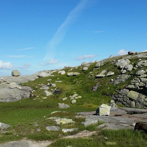
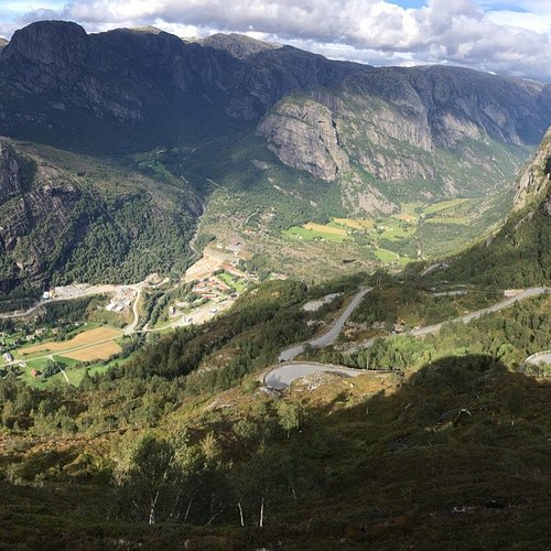
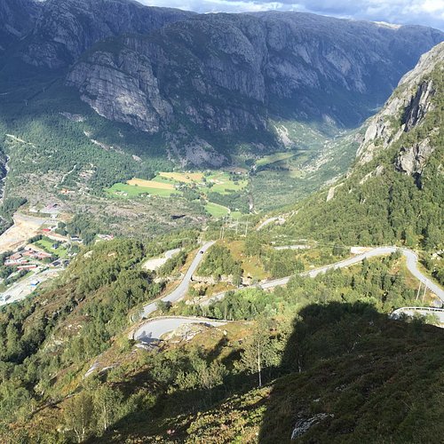
1. Lyseveien to Lysebotn
Overall Ratings
5.0 based on 22 reviews
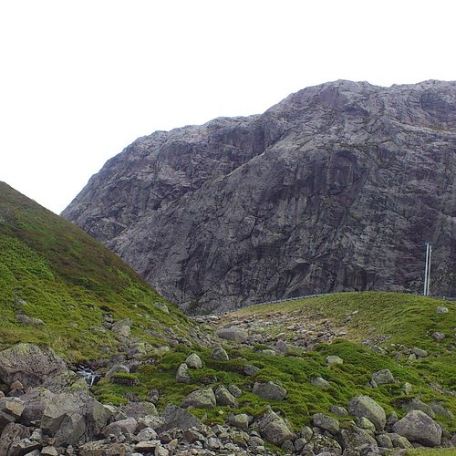
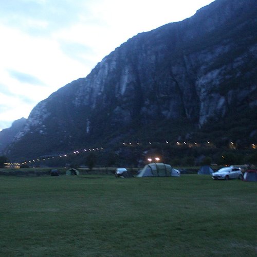
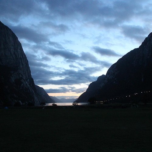
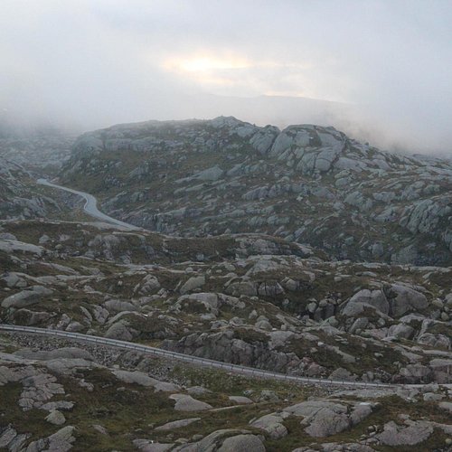
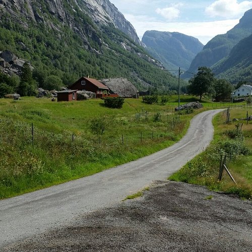
Starting Point:The walk starts on Lyseveien between Sirdal and Lysebotn, about 1 km west of Grydalen. You can park on Borsteinshyttens carpark, located on the opposite side of the road in relation to the trail. Description: Start walking in a north-west direction. After approx 5 minutes cross the stream descending from Matupstjodne tarn and follow the left side of the stream gently upwards. The path here runs along a small hillock on the south side of the tarn. Gradually climb up towards the paths highest point. At 970 meters there is a magnificent view across the Lyseheiane. From here start the descent towards Andersvatnet lake. You must first zig-zag your way down ¾ of a steep ravine and then follow the rock face of Vardekleivane on the right. After approx 100 metres cross the stream that runs from Andersvatnet lake. (Carefully follow the markings and your GPS if you have one).The path continues to the west and the terrain becomes gradually hillier and it may be difficult to find your bearings. You will pass several lakes before coming to a ravine that takes you down to Pollen (tarn). The path zig-zags down this ravine but you get a great view of the waterfall cascading down from Mount Toknuten. At the bottom of the ravine you cross the stream running from Andersvatnet lake. From here, the path gradually ascends on bare rock before you come to a valley to follow. Towards the top of the valley you can see the high mountains of the Lysedalen valley on your right and you get an idea of what awaits you later on on the walk. Lysedalen valley is one of the region's wildest valleys, with their 800/900 metre steep mountainsides that plunge into almost impassable terrain. At the end of the valley you climb over a boulderfield before continuing down the ravine to a green sheltered spot with fresh mountain water. This is a perfect spot for a break! Follow the stream down to where it winds 90 degrees around the mountains down towards Lysedalen valley. You can't fail to be impressed! The magnificent mountains that make up Lysedalen valley greet you in all their splendour. This is not the place for those who may have fear of heights! Like the stream you must also change direction (northwards). Allow yourself approx 1.5 hour to get down the steep mountainside. Carefuly zig-zag your way down. You will copme to a birch forest at approx 420 metres. It may be difficult to find the path here, as it also zig-zags through the dense forest. Look for stone cairns and red marks on the trees in the forest. When you get to a prominent overhang, the path turns 90 degrees towards the innermost farms you can see far below in Lysebotn. At 85 metres turn right, towards the spot where you must cross the river by climbing over some large rocks. There is a wire rope attached to one of the rocks, which makes crossing easy. Follow the right side of the river westwards. You then come to a grazing area for sheep, and pass through a gate that takes you onto the land of the innermost farm in Lysebotn. Remember to close the gate behind you. Cross the grazing land and use the steps that have been erected for you to cross the fence at the other end. After 100 metres you come to another fence that will lead you through a little gate into the parking area at the farm. For a detailed description including maps and information etc buy the guidebook 'Hiking in Sirdal' which includes Kjerag and Sirdals Seven Summits.
Reviewed By mihaella19 - Haugesund, Norway
Have only one thing to say : it's worth every second to spend there both on the road /Lyseveien or at the fjord down at Lysebotn .Every piece of nature is mesmerizing .
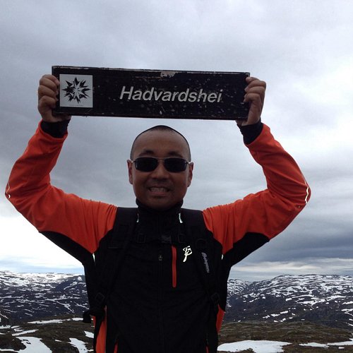
2. Hadvardshei Summit
Overall Ratings
5.0 based on 1 reviews
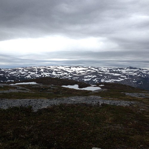
Starting point: park at the upper carpark at adneram ski lift located just off Bergetjodn. Description: from the carpark, follow the road/ski trail that runs down the mountain, at the first intersection turn right and follow the trail that runs south of the lake. At the end of the lake you will see three tracks, follow the middle one. On top of the hill, turn right and follow the trail to the top of the ski lift . Allow about 25 minutes to the top of the lifts. Cross under the lifts and continue northeasternly along the narrow path. In general you should follow the ridge of the mountain. After a short journey you will reach a small marsh, here turn right down a small glen, before again going up the mountain edge, first through a small birch wood, then across two small valleys. After approximately 15 minutes walk round the mountain, bearing north on the small mound from which you see Rubedalstjodna on the left handside, and Hassteinstjodn in the distance on the right. Go down the hill and cross the valleys that cross here, before you climb up the slightly steeper slopes in a northwesterly direction. When the path becomes less visible continue up the mountain ridge. Keep to the left and follow the stone cairns that will lead you back to a small tarn. Allow 25 minutes. At the tarn, turn west. You cross a stream that flows out of the tarn and pass similar small tarns. After a short anount of time you will cross the valley creek that runs east-west. Hadvardshei is now to your left, take the easiest road to the top where you can enjoy a 360 degree view over the mountain moors. For a detailed description including maps and information etc buy the guidebook 'Hiking in Sirdal' which includes Kjerag and Sirdals Seven Summits. Click here for Maps and GPS Coordinates Accommodation: Suleskard Fjellsenter Stavanger Turistforening Contact: Arild Rosnes +47 51 84 02 17
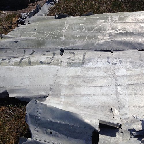
3. Flerehei
Overall Ratings
4.0 based on 1 reviews
Starting point: Turn off Highway 468 at Lunde church in the direction of oyne. Drive over the bridge and park at the first farm on the right. Description:The hike begins at a small farm in the oyes. From here follow the forest road to the summit allowing approximately an hour for the steep ascent. At the top, where the road travels down towards the Midtstolsvatnet, turn right and follow the red markers up Glovreknuten. Initially in a south-easterly direction over the flat areas, then up in a southerly direction. After about 15 minutes, cross a stream here the path runs east through the marsh area. At the end of the moor the trail continues up a small hill. During the climb, you will see a small lake on your left. Once at the top you will see the path again carrying on in a southerly direction throught the hillltops. On the flatter section you have to cross a bog and then you will come to a small lake on the left handside. Continue in the same direction until you reasch a small cavern now you have the top of Glovreknuten on your right. On top of the cavern you will see directly on Flerehei. Continue down the hilly landscape, you will pass a lake on the right handside, and shortly after you cross a stream between two lakes. Follow the stream on the left side of a small knoll, from which you walk on the left side of the lake before embarking on the final climb to Flerehei. First travel through a small valley with large stones, then zig zag up a small hill, before the last gentle climb over the bog and heath to the crash site. A memorial monument stands a short distance up from the aircraft remains. For a detailed description including maps and information etc buy the guidebook 'Hiking in Sirdal' which includes Kjerag and Sirdals Seven Summits.
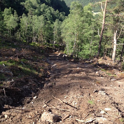
4. Hunnedalen to Tomannsbu
Starting point: The hike begins in the parking lot at the Tveidebrekka Hunnedalen. Description: Go over the bridge at Tverrani and continue on the marked path up to 800 m up Tveidebrekka. Allow approx 30 minutes to reach the top, where you come to a tarn that you will walk around until it is on your right-hand side. The terrain flattens out and continue walking in the same direction with the face of Mount Tveideknuten on your left. After approx 15 minutes you will pass between two tarns and a small cabin. At the end of both tarns there is a gentle ascent up to 845 meters where there are great views of the valley that cuts across in front of you. The path veers south-east under the summit at 917 m towards oydevatn lake. From oydevatn continue along the shore and up a gorge, before the terrain levels out and you come to a height from which you look down to Djupevatn lake. Walk down the valley in the direction of Djupevatn lake. At the small tarn the path curves round the mountain in a southwesterly direction to Tomannsbu Turisthytte. For a detailed description including maps and information etc buy the guidebook 'Hiking in Sirdal' which includes Kjerag and Sirdals Seven Summits.dstb
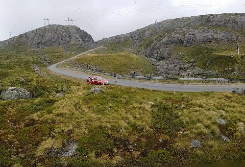
5. Haugen to Fidjeland
Starting point: Start on foot or take a taxi from Haugen Hytteutleie og Camping to the large rock by the barrier Honedalen (3.8 km). The trail begins just after the barrier. Description:The path starts at a large rock by the barrier in Honedalen valley where you head off in a northern direction. After a 5-10 minute walk you will reach Honetjodn where there is a lovely welcoming beach for hot summer days! Continue around the tarns turning north-east towards Honestol and then from here in a northernly direction up Urdalsskaret. Allow 30 minutes to the top, before you begin the descent to Finnstol (10 minutes). Continue north to Finnstoldalen, along the left side of the stream. The stream becomes livelier the further north you walk. Soon you will see the jagged mountains of Svartups mountain and Jogledalen valley on your right handside. At the holiday cabins at Smolasen, you come to a sheep fence with a gate enabling you to pass easily. Remember to close the gate behind you! After a few minutes you will come to a road that leads up to the cabins (Smolasen). Follow it until you reach a bridge where you can safely cross the Joglaelven river and walk up to Sirdal Hoyfjellshotell. Alternatively, you can continue straight ahead to Fidjeland Hytteutleige (cabin rental) You can see the Degdammen dam on the way down. It was built between 1968 and 1970 and is 90 metres high. The crown of the dam is 390 metres. The dam is a rock-fill dam where moraine has been used. The moraine comes from the housing development at Fidjeland. For a detailed description including maps and information etc buy the guidebook 'Hiking in Sirdal' which includes Kjerag.
6. Summit of Vardefjell
Starting Point: from Haughom head towards Ovedal travelling past oksendal through oksendalen, take the toll road to Listol, for approximately 1.5 km to the parking lot at the end of this road. Make sure you close all gates behind you as sheep graze in this area. Description: from the parking area at the foot of Vardefjell, travel on the wide path across the bridge that crosses the stream. Head towards the bog, you can cross using the boards that have been placed there for you. You will pass two small round tarns on the left hand, when you are parallel to the inner tarn you will leave the marked trail which runs in a south-westerly direction from power pylons on your right hand. Cross a small bog, and go up the small hill. Follow the path parallel to the pylons for a short distance, until you come to a round tarn on the left hand-side, where the path turns to the mast again. You pass a marsh on the left and cross under power lines which is at the beginning of the 100 meter ascent to the top. Follow the stone cairns up the mountainside. You have great views of Ovedal on the way up. At the top you will reach a small tarn on the right hand, and the great stone cairn is located next to the tarn. Allow about 30 minutes from the parking lot to the top. If you prefer another way for the descent, you can continue in a northwesterly direction until you get to a vantage point from which you travel down into the oksendalen valley travel around the mountains north side back to the masts and the way in which you are come up. For a detailed description including maps and information etc buy the guidebook 'Hiking in Sirdal' which includes Kjerag and Sirdals Seven Summits
7. Bergehei
Starting point: from the center of Tonstad head towards Josdal. Park in the parking lot at Josdalstippen, which is after the 'Indre Skjorbutjodn' on the right. Remember it is pay and display so don't forget your change. Route Description: from the carpark continue to walk across the narrow paved road. After about 10 minutes, the road splits, turn right on to the dirt road in a southerly direction. Follow the gravel road upto the cabin area, after an additional 10 minutes the road will end at a private parking space. Continue along the path upwards following the stream. After approximately 10 minutes of climbing on rocky terrain the terrain changes and alternates from marsh land to heather and then the ground splits so keep to the right. Cross the marsh at the north tip of the Magevatnet and walk along/parallel with the northernly Magevatnet which will be on the left handside. At the end of the northern lake turn east (to your left) and the route between the two lakes. Walk over a bridge, before turning south along the southern Magevatnet which will now be on your right handside. At the end of the lake another path crosses yours, here, go southeast along the creek down the left side. First on the rocks, then over the marsh. The trail not visible because of the marshlands but after about 7 minutes walk, turn left a short distance, until you see a cabin on your left handside. From here continue south east around a small hill until you come to two farm buildings. From the farms continue in the same direction up a small glen until you come to a swamp and the terrain flattens out. Turn north (left) along the narrow path travel up Budals rise. You will pass a small tarn on the right handside, and after about 20 minutes walking the path splits, here turn southeast (right) along the edge of the mountain. After about 10 minutes, leave the trail, try and find your own way up the mountain to the summit, which is about 20 minute walk in an easterly direction. You will walk for some distance on this beautiful pathway before the top, and from here you have 360 degree views of both the northern and southern Sirdal moors, Kvinesdal, as well as Lyngdal (south).
8. Hike from Tomannsbu to Stole
Starting Point: The hike begins at Tomannsbu Turisthytte. Description: From Tomannsbu follow the path south west along Djupevatnet, Kilen and Vassvollvatn lakes. The wakl here chis very challenging and you must pass smooth bare rocks that slope down towards the lake. At the south-west end of Vassvollvatn lake you cross a stream and the path ascends a gentle ravine running in a south-east direction, downwards and parallel with a regulated stream to a small tarn. Follow the tarn that is now on your left hand and cross the stream that runs from it. Cross a small ravine that is covered in scrub. Where the trail forks, turn right and walk down to a tarn just below Mount Blafjell. At the end of the tarn cross the stream that runs down to Ytra Skredavatn lake. You should now go on the east side of a small hill along Ytra Skredavatnet. Cross the stream coming down from a tarn in Blafjelldalen valley and walk up the ravine on the western side of Moestrond. There is a gentle ascent to 725 meters, before you then walk down a steeper ravine on the other side. Avoid the steep rocks on the descent. At the bottom of the U-shaped valley you will come to an intersection and the path then continues in a south-west direction through a narrow gorge. Although it looks impassable, there is an excellent old farm road throught the gorge. Once you have walked through the gorge you will see oyestoldalen. Stole cabin located at the end of this valley. For a detailed description including maps information etc buy the guidebook'Hiking in Sirdal' which includes Kjerag and Sirdals Seven Summits
9. Hike from Langavatn to Blafjellenden
Starting Point: The trip begins at Langavatn Turisthytte. Description: From Langavatn set off in a southwesterly direction along the stream. At the end of the lake cross two streams before you you begin a gentle ascent up to 945 meters. From here there is a gradual descent down to a tarn on your left-hand side. At the end of the tarn you pass a small reservoir. there is a great view of the beautiful and lush Blastoldalen. The trail follows the winding river all the way til Blastolen, 2 km further down the valley. By Blastol you pass the ruins of the old farm buildings which were in operation here until the beginning of the 1900s. (You must allow yourself at least 2 hours from Langavatn to Blastol). From Blastol continue down the valley, you have nice views of the lush 'Litle Fidjadalen' valley. At the next intersection continue straight ahead towards Blafjellenden. You come to a sheep fence, use the steps to climb over it. Soon you will see the cabins at Blafjellenden, and there is a suspension bridge over the Leitesana river to the cabins. For a detailed description including maps and information etc buy the guidebook 'Hiking in Sirdal' which includes Kjerag and Sirdals Seven Summits.
10. Hike from Grydalen to Grauthedlar
Starting Point: The walk starts at Lyseveien, park at the shepherd’s cabin in Grydalen valley where the path starts. Description: The start of the route is marked with a sign next to the shepherd's hut in Grydalen. Cross the river and go north up the valley behind the cabin. After about 20 minutes the terrain flattens out, continue along the stream north. Pass a rocky ravine before you begin the gentle climb to Kjeringstoldalen valley. In Kjeringstoldalen valley walk to the north-east, up another ravine. Near the top the terrain flattens out again turn left over a rock, that will take you around the oblong tarn east of Svartetjodn. Continue along the same valley and in the same direction as before, by Mount Salomonsknuten. At the top, under Mount Salomonsknuten there are magnificent views over the Sirdalsheiane.! You should now walk north-east across the plateau. The walking is easy here. After 20 minutes you will begin the moderately steep descent to Grauthedlar.Grauthedlarhytten is superbly located just off Grauthedlarvatnet. For a detailed description including maps and information etc buy the guidebook 'Hiking in Sirdal' which includes Kjerag and Sirdals Seven Summits