


Top Things to do in Sogn og Fjordane
Things to do in Sogn og Fjordane, Western Norway: The Best Hiking Trails
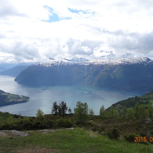
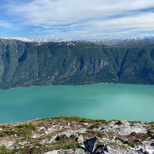
Rich in mountains, islands, glaciers, farmlands and fjords, Sogn og Fjordane is best known for Sognefjord, the longest in Norway and the second-longest in the world. One of its arms, Nærøyfjord, is a UNESCO World Heritage Site, as is the 12th-century Urnes Stave Church near Lustrafjorden, an excellent example of traditional Scandinavian wooden architecture. Jostedalsbreen, the largest glacier on mainland Europe, is home to a national park with several museums and visitor centers.
Restaurants in Sogn og Fjordane
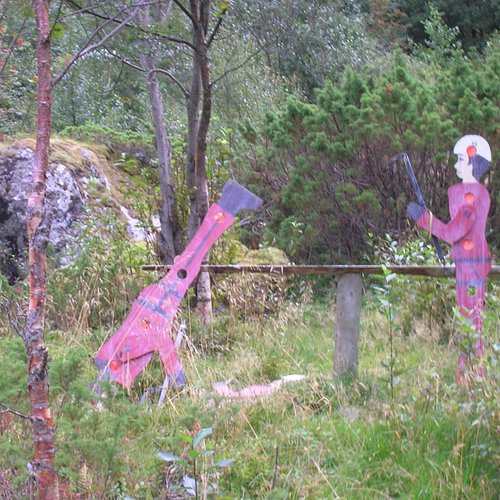
1. Alden the Norwegian Horse
Overall Ratings
5.0 based on 8 reviews

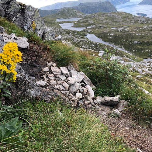
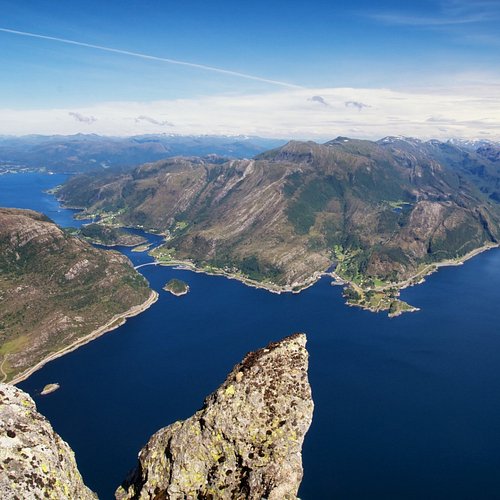
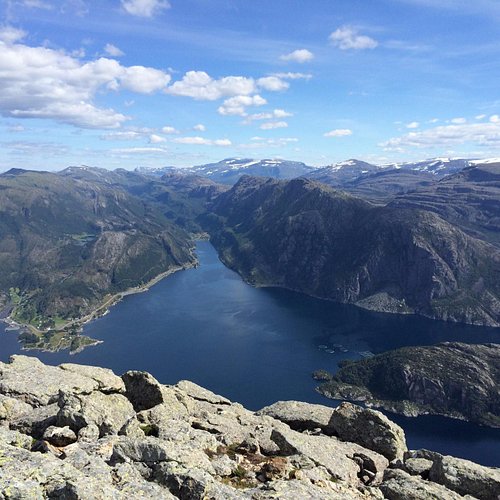
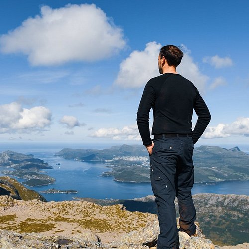
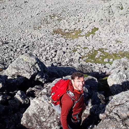
Visit the island Alden and hike up to the top also called «the Norwegian horse». This is one of the most spectacular hikes in Fjord Norway! The mountain rises straight out of the ocean 481 m above sea level. This is one of the most significant sailingmarks on the western coast of Norway and it is visible from more than a 100 km away. From the top you can enjoy a spectacular 360 degree view! How to get to there? You can easily travel to Askvoll by ekspressboat from Bergen or Selje.From Askvoll or Fure in Hyllestad you should go on the ferry to Vaerlandet. From Vaerlandet a private boat to Alden must be arranged through Vaerlandet Bat (tel: + 47 57 73 11 28) or M/B Setara (tel: +47 906 44 257). If you travel by your own boat please look at the sea maps for directions. There are several accomodation alternatives in Vaerlandet and Bulandet, great islands that should not be missed and a perfect startingpoint to reach Alden. Tourdescription: Start: Alden Duration: 1,5-2 hrs to the top , 1-1,5 hrs descending. Hight: 481 above sea level. From the pier you will walk up to the farm where signs towards the top. The trail is easy to find. The trail is steep in the beginning. The trail is quite narrow but very visible all the way to the top. At approximately 300m above sea level you will reach the platou, and the terrain gets more flat. Further east and up to «Instestova» it is easy to walk. From this point you will have a spectaluar 360 degree view! To get an even better view you should walk to the westernmost peak «Ystenova» wich will give you a breathless view. If you look west you will see the islands Vaerlandet and Bulandet, and perhaps some of the oil platforms in the north sea. In the east you will see outer Sognefjord and Sunnfjord, and you can see the majestic mountains Lihesten, Kvamshesten and Blegja. In the north you can see the westeernmost glaciers in Norway, «Gjengalunden» and «alfotbreen». The hike is quite steep in the very beginning of the trail, however further on the hike is graded as moderate for people who are used to walking in terrain. The duration of the hike is estimated to 3hrs. The trail is good and if you need a break you can have a seat and enjoy the amazing view. In the summer we recommend that you stay overnight on the island to enjoy the sunset and sunrise, nothing can compete with that view! We recommend not to hike when it is snow on the mountain.
2. Jostedalsbreen og Jotunheimen National Park
Overall Ratings
5.0 based on 8 reviews

Join a mountain hike in the mountain area between the Jostedalsbreen National Park and Jotunheimen National Park. There are fantastic views of both national parks as well as of the Sognefjord, down below. We offer walks that will suit everyone regardless of physical fitness.
3. Hiking in Bergefjell
Overall Ratings
5.0 based on 1 reviews
Take the road from Hoyanger village to Siplo skiing Centre, continue to the dam. You start by the dam. (600 m.a.s) The first leg to the first cairn is demanding, but after that it is a breeze.Dry, pleasant terrain and joggers are ideal for this hike. From the summit you can gaze down on the township of Hoyanger, the Hoyangerfjord and out over the Sognefjord. Marked trails lead further om from the summit across the mountain, in relatively light terrain. The trip is 7 km long with a hight difference of 278 m.
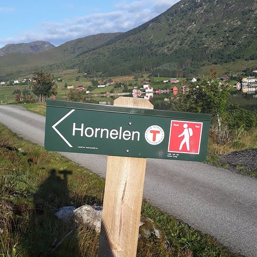
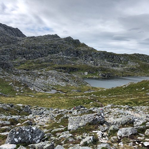
4. Hornelen
Overall Ratings
5.0 based on 21 reviews
Visit Bremanger and hike northern Europe's highest sea cliff! The hike will give you a spectacular hiking experience. The trail is quite challenging and steep, but gives you fantastic views all along the way to the top. On the top you can enjoy a breathtaking panoramic view! You will get a great overview of the varied and scenic landscape in FjordKysten - narrow deep fjords, majestic mountains and small islands far out at sea. If you dare to, you can lie down on the edge of the cliff and look straight down on the sea 860 meters below you. You will never forget this hike, it is one of a kind! The trail is steep and challenging and this hike is suitable for experienced hikers. You should be used to walking in the mountains and in the terrain. Hiking to Hornelen is a full day trip, but it is worth the effort you put in. The view is spectacular! Season: Spring, summer and early autumn. May - September. You should not hike to Hornelen if there is snow on the mountain. You should also plan your trip well to make sure you hike in daylight. Tour description There are several trail going to Hornelen, here you will find the description of two of them. You can either start from Hunskar or Berleneset. You will get the best view if you start from Hunskar and descend to Berleneset. The duration of the hike is approximately 8 -10 hrs. and is a full day trips. It is a challenging trip and hikers should be experienced. Start Hunskar: Duration: 7-8 hrs Altitude: 860 Above sea level Start at the end of the road at Hunskar. The trail is sign posted with red T’s and stones. Go in the same direction as the road, over the Ramarhammaren, then you make a turn towards southwest. The first part of the trail can be a bit moist, but after a while the trail will be dry. The trail up towards 500 meters above sea level is steep walking on grass and moors. You will have a great view to Skatestraumen, Rugsund and Maloy. Further up you will reach a lake where you might stop for a longer break and enjoy some of your lunch. Further there is a part of the trail which is characterized by more rocky terrain. The last part is as steep, a small hill and then steeper again before you reach the top. You will find water all along the way to the top. You will spend approximately 4 hrs hiking to the top. When you reach the top you can enjoy the most fantastic view, and it will be worth the effort. There is a small stone cabin at the top where you will find the Norwegian flag that you can set up if you want to. For a less steep descent with a slightly different view, you can descend to Berleneset. The descent to Berleneset starts off on the same trail as the one you came up, further down the trail divides in two and you should go southwest.. The trail ends at the eastern side of Berlepollen. Start: Berleneset: Duration: 8-10 hrs. This route is a bit longer than the one from Hunskar, however easier to hike. This is a trail that is suitable for a long hike for the entire familiy. However hiking experience is necessary. The hike will give you a fantastic nature experience with a great view! You start out from Lisete at Berleneset. The trail is quite steep in the beginning, but gets flatter after a while. The trail is in good condition and sign marked. On the last part of the trail you will meet the trail from Hunskar. Guiding Please contact Kalvag Tourist office for information if you have enquires regarding guiding to Hornelen. Keipen turlag offers trips to Hornelen from Hunskar.
5. Store Batalden
Overall Ratings
5.0 based on 1 reviews
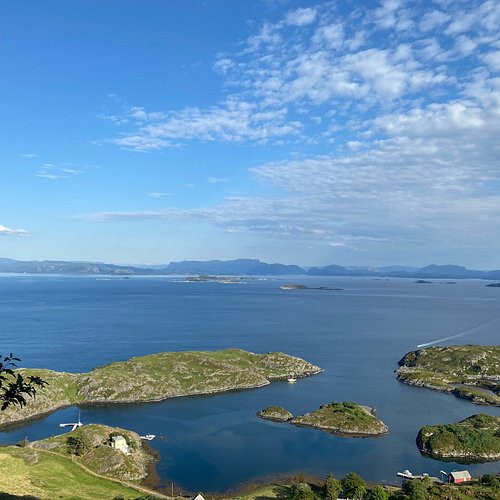
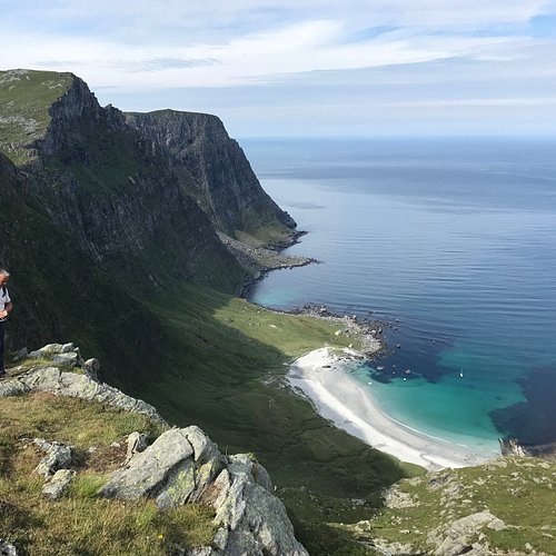
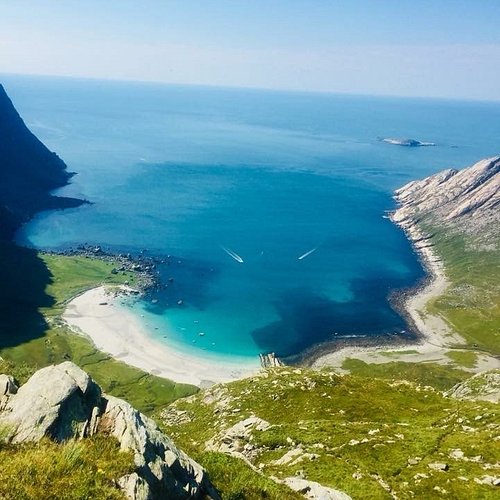
Hiking up this sea cliff outside Floro will give you an amazing view of the islands and the archipelago! Store Batalden rises 492 m straight out of the sea, and it is the highest peak on the islands surrounding Floro. Here you can enjoy the beautiful nature that makes this archipelago entirely unique! How to get there? Floro is easy accessible from both Oslo and Bergen by airplane. You can also take the Express boat from Bergen or Selje, which both stops in Floro. When you get to Floro you take a local boat to Store Batalden. By car from Bergen: Follow road E39 north towards alesund/Forde/Lavik. When you get to Oppedal you need to take the ferry to Lavik. From Lavik follow road E39 to Forde. From here on you follow road 5 (Naustdalsvegen) to Floro. Driving from Bergen to Floro takes approximately 3,5 hours. Tour description: Duration: 2,5hrs. Altitude: 492 meters above sea level. The trail starts at the dock on the island. You cross the beach and turn left by the houses. Walk on the left side when you get to the water. The first part of the trail is rather flat before it gets steeper until you are half way up. From here on to the top the terrain gets less steep. On the top you can enjoy the amazing view of the archipelago! The duration of the hike is estimated to 2,5hrs. Part of the trail is quite steep, but the hike is graded as moderate for people who are used to walking in terrain. If you want a easier hike you can go north from the dock, and walk on the eastern side of the island. You will then walk up to the top from a north-eastern direction. This trail is less steep, but takes a bit longer. During the hike you should look for eagles, which are often seen in the area. If you are lucky, you might even spot a deer! Sometimes they come swimming across the sea from the mainland, and they like to stay on the hillside of the islands where there is a lot of vegetation.
6. Tjuatoten
Overall Ratings
5.0 based on 4 reviews

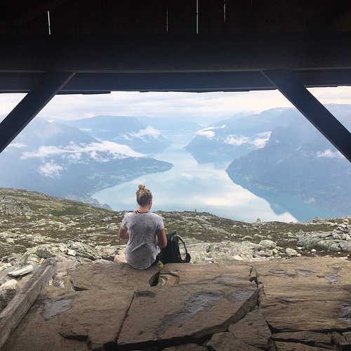
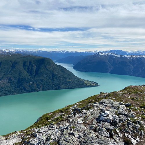
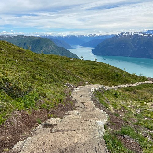
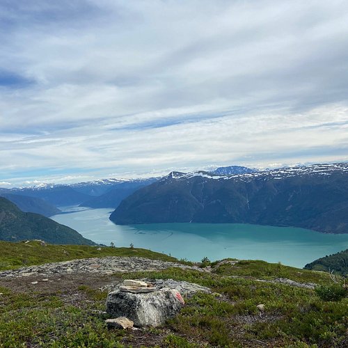
Tjuatoten (1098m) Tjuatoten is a mountain peak towering over Dragsvik and Balestrand. A hiking trail goes up the mountainside from Dragsvik to the top of Tjuatoten. This is a demanding hike. At the top you have fantastic views over the Sognefjord, including out towards Stolsheimen and in towards Fjaerland and Leikanger. Start: Turn off the main road at Dragsvik in the direction of the housing area and Haukaas enamel workshop. The starting point of the trail is signposted and there is a parking area beside the road. The first 400m of the trail follows the forest track. The rest of the trail goes through forest and mountain terrain. The trail passes the electricity pylons which are visible from Balestrand where you will get a wonderful view down to Balestrand and over Esefjord. The trail continues winding its way up, becoming steeper towards the top. When you reach the top you are rewarded with exceptional views over Sognefjord and the surrounding mountains. You will also see an old suncross on the ground. This is a demanding hike and takes approx 7 hours. Good advice: Get a hiking map from the tourist office. Be sure to take plenty of water as there is no drinking water on this route. Getting there: From Balestrand you can get to Dragsvik by car, bus or boat. (You can walk, though this will add an extra 9 km each way to the hike). To reach Balestrand you can take the express bus from Oslo, Trondheim or Bergen, or take the express boat from Bergen. If you come by car from Oslo take the E16 and route 55. From Bergen or Trondheim take the E39 and route 55.
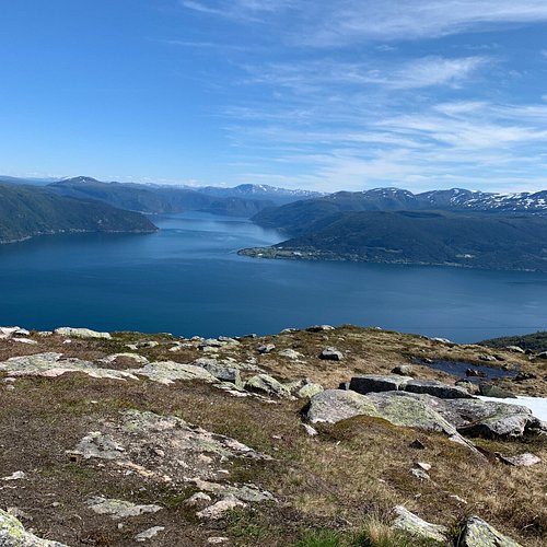
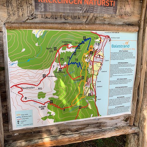
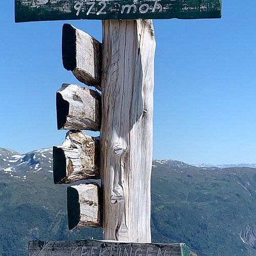
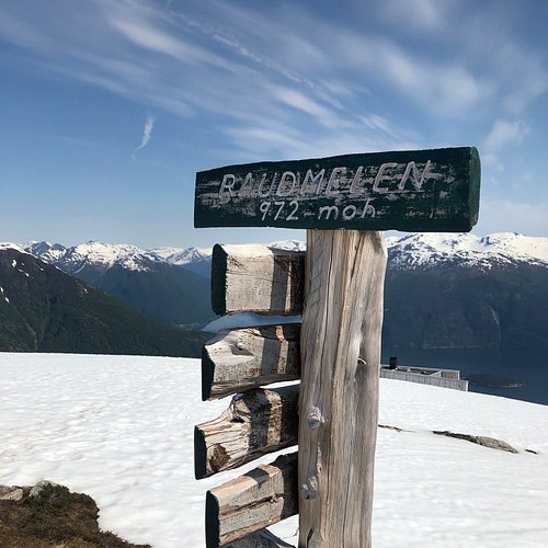
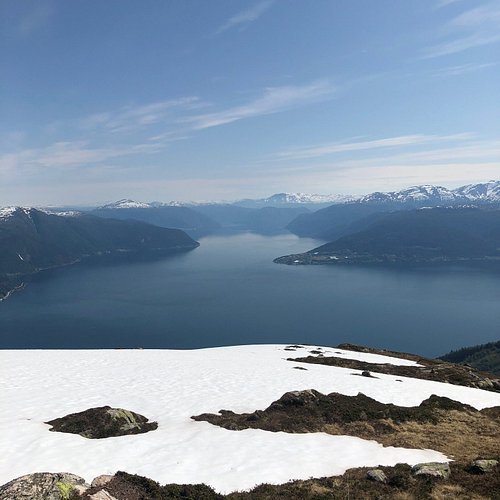
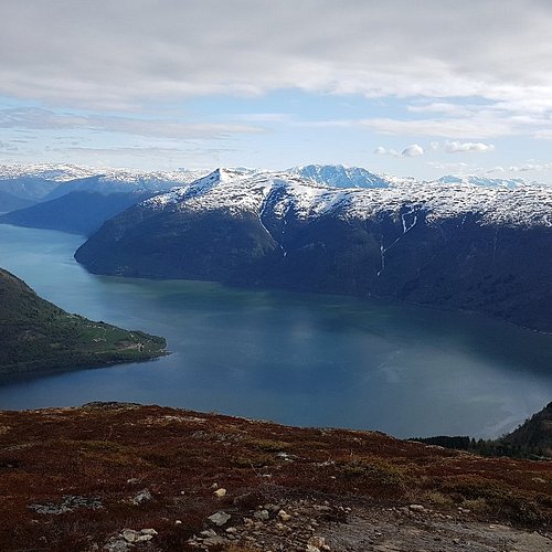
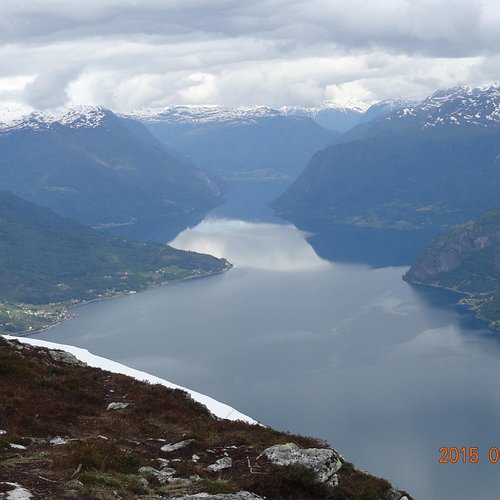
7. Raudmelen
Overall Ratings
5.0 based on 35 reviews
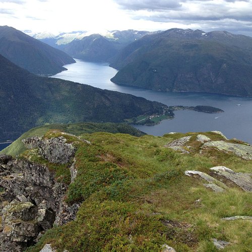
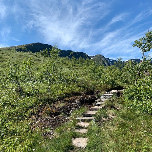
Raudmelen (972m) Raudmelen is a mountain which towers 972m over the centre of Balestrand. A hiking trail goes up the mountainside from Balestrand to the top of Raudmelen. This is a demanding hike. From the top you have fantastic views over the Sognefjord, both out towards Stolsheimen and in towards Fjaerland and Leikanger. Start: Start by Belehalli sports hall, at the same place as the starting point for the nature trail. Take the red route to Raudmelen. The first part goes along the marked nature trail, but soon turns off upwards. After following the relatively steep path up through the woods it is nice to take a break at Orrabenken (370m) where you get a wonderful view over Balestrand centre and the Sognefjord. From Orrabenken follow the path on upwards. The blue route turns off towards Balastolen and Fjaerestedstolen and the red route continues up towards Raudmelen. At Burasi (575m), another fine resting place, you get a marvellous view over Sognefjord and Esefjella. The path goes on up and along the ridge towards the top with wonderful views on both sides. On one side you see down over the green slopes to Balestrand and on the other dramatic rocky mountainsides towards Esedalen. At the top you are rewarded with fantastic views over the Sognefjord. This is a demanding hike and takes approx. 6 hours. Good advice: Get a map from the tourist office. Be sure to take plenty of water as there is no drinking water on this route. Getting there: From Balestrand quay/tourist office walk up Laerergata and on to Kreklingevegen until you get to Belehalli sports hall. The roads are signposted with white nature trail signs. To reach Balestrand take the express bus from Oslo, Bergen or Trondheim or express boat from Bergen. If you come by car from Oslo take the E16 and route 55. From Bergen or Trondheim take the E39 and route 55.
8. FjordSafari
Overall Ratings
5.0 based on 1,054 reviews

Experience the very best of nature, wildlife, history and local slowfood Fjord Norway has to offer! The RIB boat tour will show you the Unesco listed Nærøyfjord up close and personal. The hike goes from the fjord to the goatfarm Leim (360m amsl) with breathtaking views along the way. Enjoy a tasty local lunch based on goat produce and a tour of this traditional farm. Car back to Flam.
9. Molden
Overall Ratings
5.0 based on 54 reviews
Reviewed By Arcticozzie - Perth, Australia
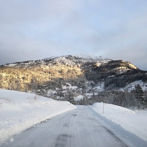
Although we didn’t climb Molden in January, we drove past it daily as we were staying on Mollandsmarki road. You might need chains on your car depending on weather...we wouldn’t of gotten up the road without them.
