


Top Things to do in Buskerud
The 10 Best Mountains in Buskerud, Eastern Norway
Discover the best top things to do in Buskerud, Norway including King's View, Tracks Bergsjo Area, Bjobergnose, Tekslehogget, Knabben, Reinsjoen, Nes Ostmark, Veslefjellrunden, Golsfjellet, Vassfartoppen, Storetoppen.
Restaurants in Buskerud
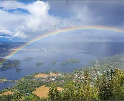
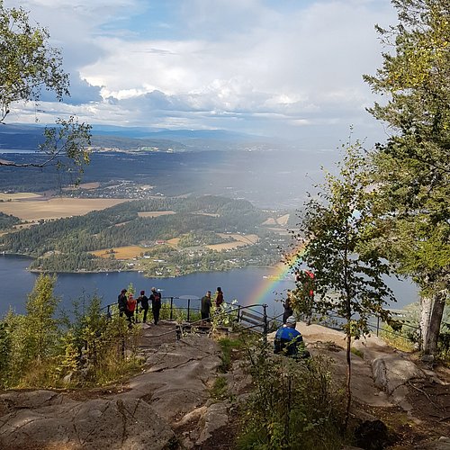
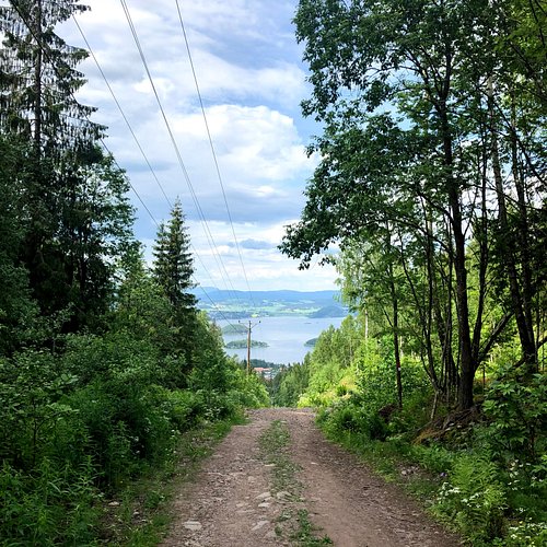
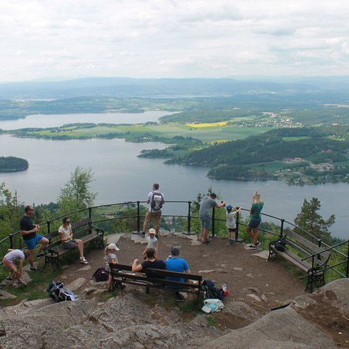
1. King's View
Overall Ratings
4.5 based on 21 reviews
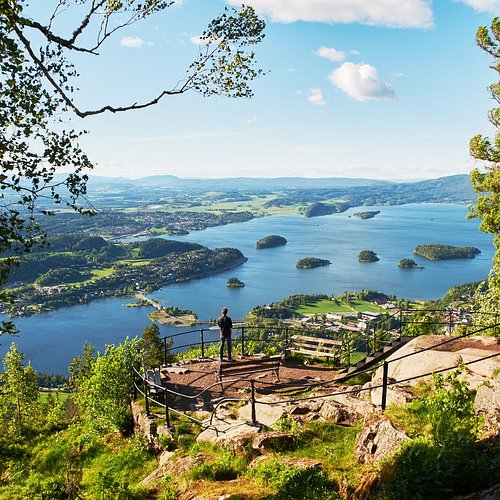
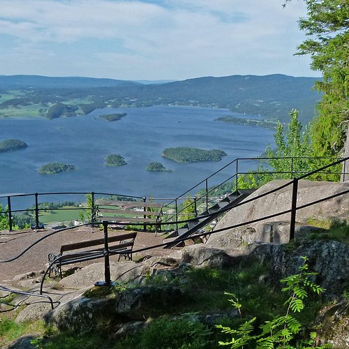
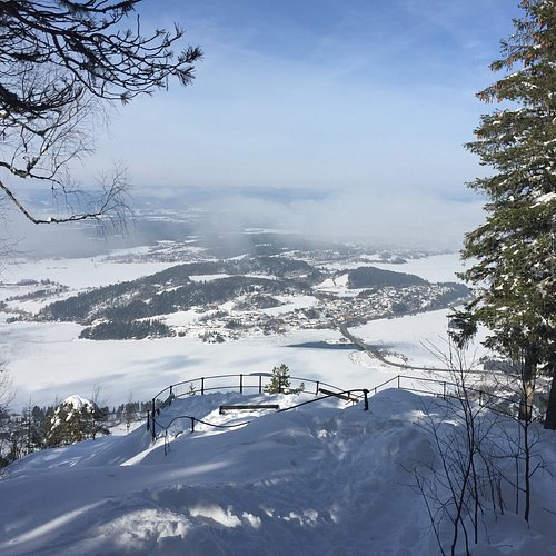
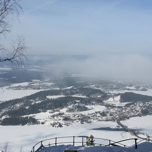
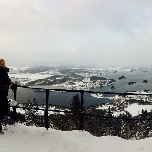
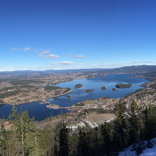
The view point Kongens Utsikt is 484 metres above the beautiful lakes of Tyrifjorden and Steinsfjorden, west of Kleivstua. Admire the fantastic vistas of large parts of Ringerike and Hole. King Karl Johan's visit in 1832 gave the view point its name: Kongens Utsikt means the King's view point. You can either start at Sundvolden and walk the 1,300 metres up to Kleivstua, or you can drive to Kleivstua. (Toll road, NOK 25) The path from Kleivstua to the view point is clearly signposted. The walk takes around 30 minutes each way. Have a good trip!
Reviewed By MargretEA - Vollen, Norway
We climbed up the forest paths from the parking lot at Kleivstua, making the ascent to the Viewing Platform in about 15 minutes. It was a very hot day so we were glad of water bottles and a snack when we reached the top. On that July day when most were at the sea, we met people with lots of photography equipment, tourists, joggers and even a couple of families with small children. This is a trip for everyone - you can just adjust your pace. The views are simply amazing - the lakes beautiful and you can see as far as to Gaustatoppen - the highest mountain in southern Norway.
2. Tracks Bergsjo Area
Overall Ratings
4.0 based on 3 reviews
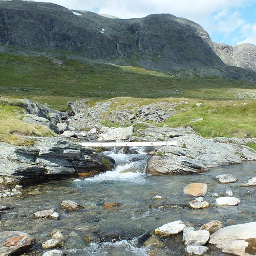
Treat yourself to fantastic experiences in one of Norways most beautiful mountain areas. Climbing Reineskarvet might be hard but the view from the top will take your breath away. The terrain is slightly hilly. On very windy days, your are advised to ski in the forest rather than the mountains. Indeed, some of the forest routes are known as ‘bad weather tracks”. There is a network of tracks from Bergsjo to Hevjanasen and al ski centre, Votndalsasen and Liatoppen ski centre and Torpo-Oppheimsasen. The route from Myrland via Bergsjo to Votndalsasen and on to Torpoasen is known as the northern Hallingdal route. The kiosk at Reine i open every day from winter holiday and until after Easter. It is toll road on the mountain road to Nysetlia. For more information regarding payment, you find this by the toll road. There is often a parking fee on the parking spots in the mountain during winter season. Maps: Reineskarvet 1:50 000 Skarvheimen 1:50 000
3. Bjobergnose
Overall Ratings
4.0 based on 1 reviews
4. Tekslehogget

5. Knabben

6. Reinsjoen
Overall Ratings
2.0 based on 1 reviews

High mountain, 930-1192 m.a.s.l. Park by the gravel deposit at the summer farm Buvassli seter, Follow the road about. 100 meters and get on the trail by the old shed. Follow the trail and keep to the left when it forks (some marshland) up Buvasslia 1 km. Keep going over some rocky flats overlooking the lake Rantetjern, before the incline to the outlet of the lake Svarleintjern. Follow the trail upwards until you can see the lake Reinsjoen, app. 1 km. In the late summer there is a good chance that you’ll encounter reindeer herds. Just sit down quietly and watch the animals. Follow the same route back. Alternative route back: follow the heights from the lake Svarleintjern to the outlet of the lake oyvatn, and keep going down the trail on the north side of the lake Sondre Rantetjern and down to the summer farm Gorbu seter. Follow the road and then the trail back to the summer farm Buvassli seter. Start point: Buvassli. Parking space at gravel deposit. Road decription: Drive rv. 7 from Nesbyen to Bromma, get on the road to Eggedal. After app. 7 km, get on the farm road towards Myte/Imle (toll bar). After the car parking at Myte, go left on the road in to Buvassli. Drive almost to the end of the road. Length in km: 6 x 2. App. time/normal pace: app. 3 hrs. Signs: none. Interesting stops: All the large and small lakes. Fishing license for Nes Sormark. Separate fishing license for Bortnes/oygarden Sameie in the Vesle Reinsjoen (Bromma YX Hydro Texaco). Boulder at bonfire area by Reinsjoen. Hiking maps can be bought at the tourist information, bookstore and at tourist businesses. GPS: 0503795o - 6697409N
7. Nes Ostmark
Nes ostmark offers beautiful mountain areas that stretch towards Vassfaret. A great area to explore with a little less skiers than Nes Nordmark and Southmark. Nes ostmark North (950-1199 masl.) There are tracks running from Buvatn (east) to Vardefjell and some smaller track loops. All crossings are sign-posted. The tracks are made with track machines. App. 30 km in total. The tracks is prepared every weekend from February 1st (Friday night or Saturday morning) and when needed in the winter holiday (week 8) and Easter. Nes ostmark South (850-950 masl.) Tracks are prepared from late November/Early December in weekends throughout the season. The tracks run through mostly level forest terrain over snow-covered marshes and frozen lakes. The tracks connect with Nes ostmark North and the Valdres tracks. Recommended routes (all these routes connect through short tracks or by crossing): 1. The Skarstjern Route on Langevassasen. (10 km). 2. The Vangen Route. (13,5 km). Start off at Buvatn - Grunntjern - Trytehol - Vangen - Bergatjern - Buvatn. The tracks connect with the Valdres tracks at Vangen. 3. The Alketjern Route. (11 km). Buvatn - Svartetjern - Trytehol - Bergatjern - Alketjern - Buvatn. Just after Svartetjern, the track connects to Loken / Vassfaret. It connects with the Valdres tracks at Alketjern. 4. The Buvass Route. (6,5 km). Loop around Buvatn, ski along the shores around parts of the lake. Thoenmarka and Liemarka. The main tracks, like from the car park at Langevatn, continue from Fisketjern to Ormevatn and are marked with blue sticks. The main track in its entirety runs from Vardefjell to Ormevatn. These tracks are prepared on weekends from February 1st and every day in the winter holiday and Easter. For information about the Krakehaugen (Vassfartoppen) are, contact Kjell and Bjorg Gullingsrud Tel. +47 32 07 21 53, mob. +47 952 88 355. The tracks are made by Egil Skailand and Sverre Gullingsrud. Krakehaugen café is open during weekends in the late winter and Easter.
8. Veslefjellrunden, Golsfjellet
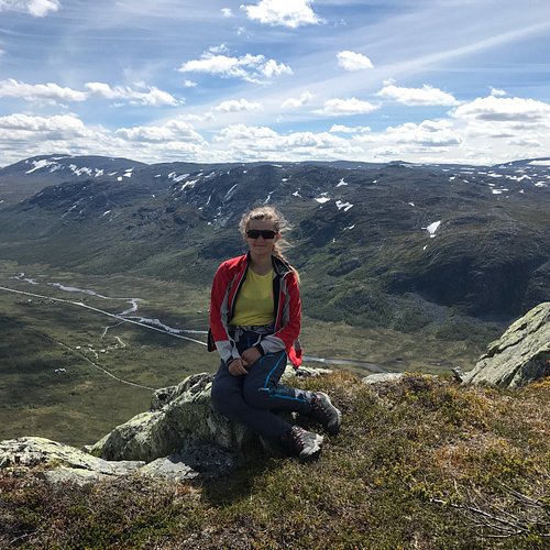
Do you enjoy hiking in the mountains with views of mountains on the plateau Golsfjellet place for you. The beautiful mountainous area has a large network of trails and roads in the family-friendly terrain. Directions to the starting point: From Gol take the road 51 direction Fagernes. After 13 km turn off the main road to the left and follow the road for 4 km to Storefjell Resort Hotel. Remember to include tolls NOK 30 Parking is located at the rear of the hotel. Stay like at Storefjell Resort Hotel, a full service hotel in the mountains that give you the good life - whether you come alone, with family or in a group. There is room in several price ranges, and the restaurant offers delicious and rich meal for breakfast, lunch and dinner. There are also cabins for rent for 6-8 persons, self catering accommodation in the area. All paths are signposted with avstandssmerker with GPS kooridinater in each corner. Along the trail at Veslefjell is a barbecue house that is open all year, then attach and barbecue in the bag. The peaks have mailbox with guestbook, free map of participating card on the map. Storefjell - Veslefjell - Storefjelltoppen - Storefjell Round around Veslefjell and over Storefjelltoppen is an easy walk suitable for everyone. The tour is in mountainous terrain, 1001-1149 m and is 6 km long. The trip will take between one to two hours Start your trip by Storefjell-lift. Follow signs for 421, 422, 423, 428, 427, 426 past the Gullknapp and walk along the Veslefjell-lake, to the top of Veslefjell. Take a break on the barbecue hut on the way to Storefjelltoppen. Follow the signposts 453, 454, 427. From Storefjelltoppen followed a tracks down here is a bit steep the last 1.1 kilometers down to the plate 458 and you are well reappear where the tour started at the sign 421 and Storefjell-lift.

10. Storetoppen
Forrest, road and good trail. From 170 m.a.s.l. The ski jumps at Storetoppen have been disused since the turn of the millennium, and the hills are getting covered with brush in spite of volunteer efforts. The first ski jump was built here in 1927. There was much activity here before the war, hosting national events with 60 jumpers and 600 spectators. In 1984 a modern center with two 50 and 75 meter jumps, floodlights and lifts was opened. Storetoppen saved the training season for many jumpers in East Norway in the 90s, when there were several winters with little snow, and Norway’s new major talent, Anders Jacobsen, won his first real competition here. Description: The hike starts on the parking lot by Hallingdal Museum. Follow the road and trail along the museum area and further upwards. Cross Rukkedalsvegen and go up to the flats by the ski jumps. The hike poster is placed by the foot of the scaffolding. To get there, walk the stairs straight up along the side of the hill below the ski jump, or follow the tractor road and trail to the right, which pass a few small mounds up to the ski jump and scaffolding. By the road to Rukkedalen. Parking lot by Hallingdal Museum Distance in km: 2 km GPS: 6713941 North 504857 East (UTM zone 32)