


Top Things to do in Nesbyen Municipality
10 Outdoor Activities in Nesbyen Municipality That You Shouldn't Miss
Discover the best top things to do in Nesbyen Municipality, Norway including Bygdeborgen, Trommenatten, Nesbyen Alpisenter, Trytetjern, Roundtrip Nesbyen, Biking in Nesbyen, The Cattle Trail in Nesbyen, Timmermannsstolen, Nystolkroken Ski, Qvisten Outdoor Bath.
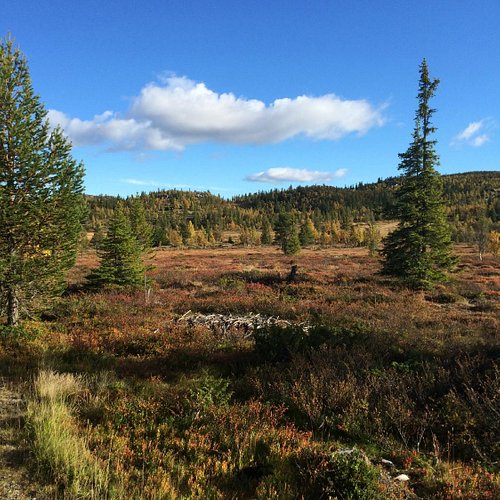
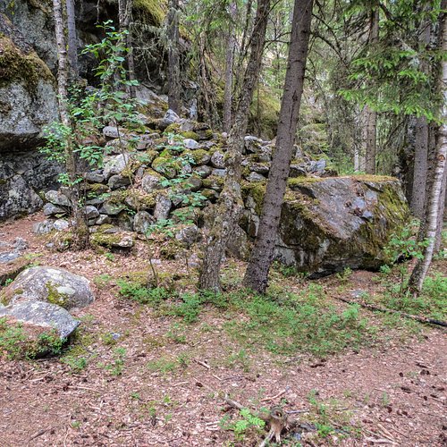
1. Bygdeborgen
Overall Ratings
5.0 based on 1 reviews
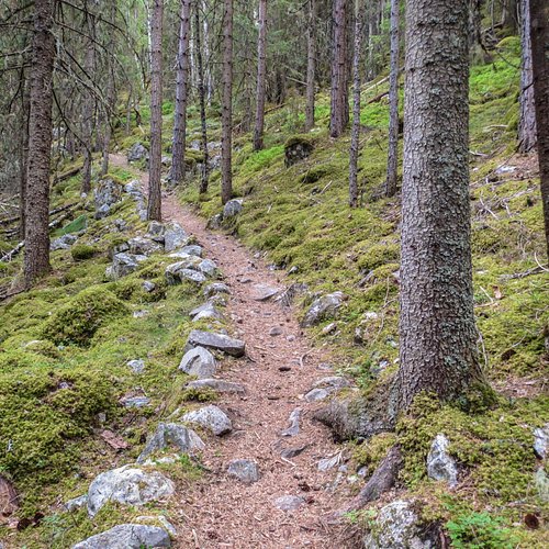
Good trail. From 170 m.a.s.l. In the dense forest in the hills north of Rukkedola River, not far from residences in Nesbyen, are some peculiar stone walls. They have been there a long time, but who put them there, and why? The conventional theory has been that they were trapping fences, forcing animals off the steep cliffs above the river. Now some say they might be the ruins of a town fortress. The theory is strengthened by the fact that there is a spring there, providing constant fresh water. Either way, this is still a special memory of the earliest inhabitants of Nesbyen. Route description: The hike starts at the parking lot by Hallingdal Museum. Cross the pedestrian bridge over Rukkedola and go steeply up to the left and onto the easily seen trail that climbs uphill. After app. 250 meters, a new trail goes downwards to the left. Follow this. After a while, the trail cuts steeply up through the hills going down towards the river. The town fortress sits on a flat shelf between two steep hills. If you go back the same way, you’ll get a hike of 1.5 km, but we definitely recommend you follow the old path further, and see how well-made it is, and how it follows the terrain. When you enter the road upwards to Bringenatten, follow it about 100 meters upwards before you turn right, onto one of the old trails that used to connect the old small farms in the area. The trail will bring you back towards Nes, just a little higher up on the hillside. The hike is 2.5km long as a round trip. Location: By Rukkedola Starting point: Parking lot, Hallingdal Museum Distance: 2.5 km as round trip GPS: 6714104 N, 504639 E
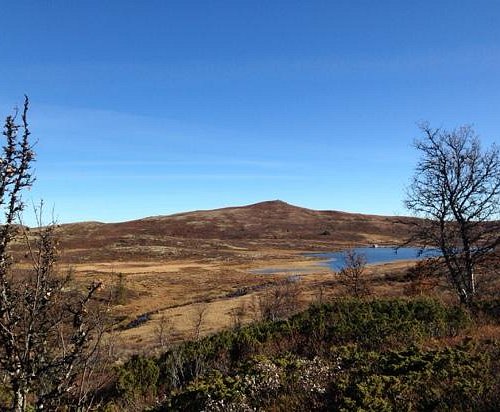
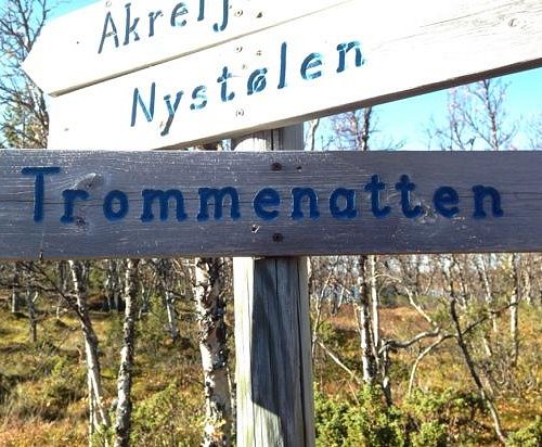
2. Trommenatten
Overall Ratings
5.0 based on 3 reviews
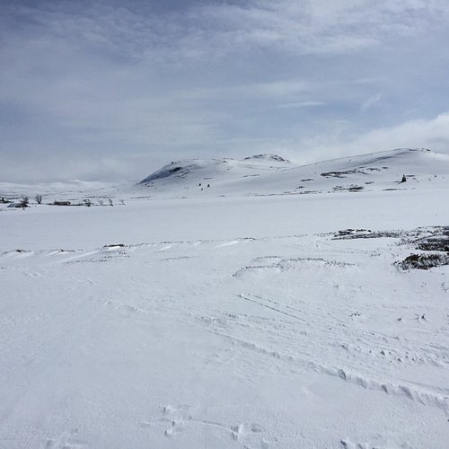
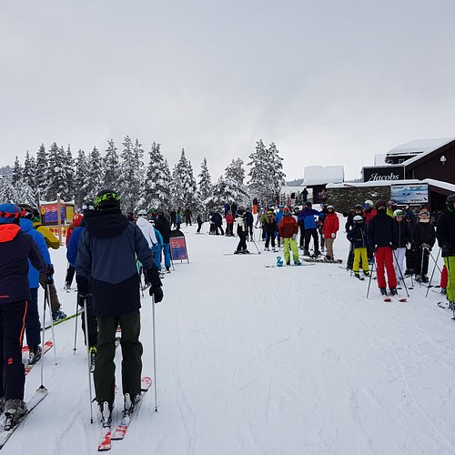
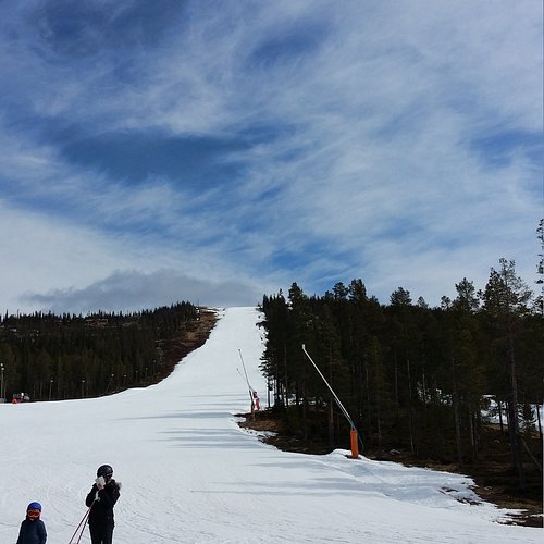
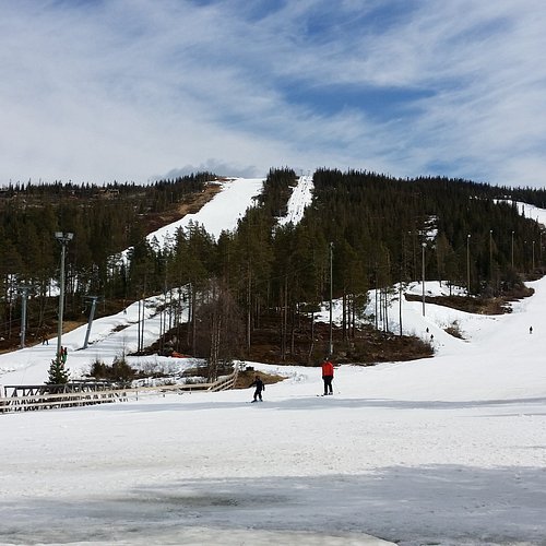
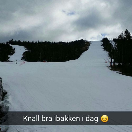
3. Nesbyen Alpisenter
Overall Ratings
4.5 based on 12 reviews
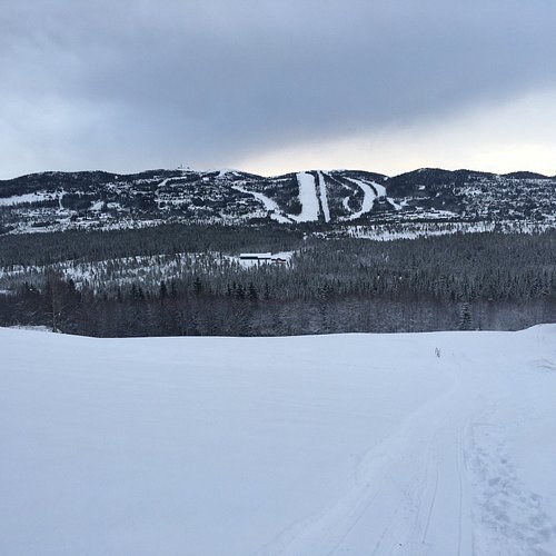
Natten Most think of this area as a paradise for downhill skiing, but there is also a selection of cross country tracks. The steepest hills can be avoided, just use the ski lift! Nesbyen Alpine Centre (760 - 1315 masl.) Tracks are generally prepared every day during Christmas, one week during the winter holiday and during Easter. Otherwise the tracks are prepared on Saturdays and on Sundays when needed (+ 5 cm fresh snow). The tracks are normally supposed to be done by 11:00. Plenty of parking at Nesbyen Alpine Centre, and Skistua café and restaurant is open every day. Nesbyen Alpine Centre is responsible for preparing the tracks. Tel. +47 32 06 74 00. Trip suggestion: Natten - The Children’s Trip - (app. 6km) The Natten area is also ideal for cross country skiing. If you have young children, ride the ski lift to the top and follow the tracks towards Trommenatten over Lake alsvatnet and down through Tverrlia to the golf course. This is an easy trip, suitable for children. This trip can easily be extended towards Bogaset and Nystolen. Starting point: Nesbyen Alpine Centre. For ski rental, see the alpine Centre. Slope preparation General agreement on the preparation each day as needed during Christmas, winter holiday week and Easter. Outside of holiday periods the slope is preparated every Saturday, and Sundays as needed (+ 5 cm fresh snow)
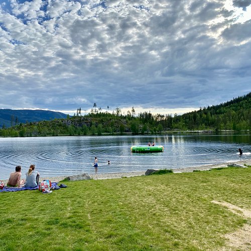
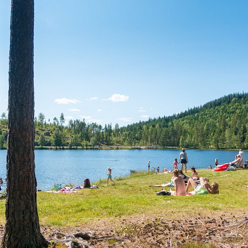
4. Trytetjern
Overall Ratings
4.5 based on 3 reviews
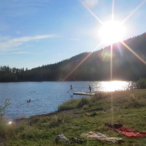
Gravel road and good trail. Approx. 400 m.a.s.l. The Trytetjern area is a popular leisure area in Nes. The area has both a shooting range and a great swimming spot. The high water temperatures in Trytetjern are well-known from the radio reports. Route: Drive Hedalsveien up the valley side from the east side of Nesbyen. Park on the large parking lot on the left of the road after app. 5 km. Walk the gravel road to the swimming spot and onwards on the trail around the water. Follow the car road the last part back. Locals often use the hills up from the town center for exercise. East side of the valley Starting point: Parking lot by bath lake Trytetjern Distance in km: 1,7 GPS: 6715349 North 508580 East (UTM zone 32)
5. Roundtrip Nesbyen
Overall Ratings
4.5 based on 3 reviews
Tarmac and gravel roads. Approx. 160 m.a.s.l. After the waterfalls by the museum, the Rukkedola River runs calmly through Nesbyen town center and into Hallingdalselva. There is a hiking path along one of the riverbanks. The hiking path crosses the river by the museum and near the market place just before the outlet. . Route: The starting point of the hike is Nesbyen town center. Follow Alfarvegen and cross Rukkedola. Pass Thoen Hotell and turn right, down Steinmogutu. After 300 meters, the hiking path takes off to the right. Follow this along the river and around the market place, before you walk through a residential area back to the starting point. The hike poster is placed by the pedestrian bridge where you cross the river. Location: Nesbyen town center Starting point: The parking lot by Kiwi Distance: 2,2 km as round trip Paths: Tarmac and gravel roads GPS: 6715245 North 505743 East (UTM zone 32) Hiking map can be bought at the tourist information, bookstore, and tourist businesses.
6. Biking in Nesbyen
Overall Ratings
4.0 based on 1 reviews

Nesbyen is a great place for bicycling along quiet gravel roads and roads with little traffic. Some of the rides are somewhat challenging due to steep hills, while a few others are easy. Two of the bike routes are also marked for pole hiking. HALLINGDALSRUTA Nesbyen is part of Hallingdalsruta (The Hallingdal Route), a sign-posted bicycle route from Geilo to Nesbyen. Leave your car in Nesbyen, go to Geilo by train or bus and cycle back to Nesbyen in one day. This ride will suit most cyclists as you'll be gradually descending from Geilo at 650 masl. to Nesbyen at 168 masl. Read more about the Hallingdal Route. If you wish to rent a bicycle in Nesbyen, we recommend ordering in advance from Tretterud Sport. Marked bike trails in Nesbyen: 1. THE SaTEFJELL ROUTE Marked as black / Very difficult. The Satefjell Route is 40 km long and runs from Myking and over the mountain to Tunhovd. You'll be in the high mountains with great views and several fishing waters and swimming spots. You'll be cycling on mountain roads, off-road on trails and on roads with more traffic. The route runs on a narrow and rocky trail between Gronhovd and Hakatjon in Tunhovd. You'll have to carry your bike for 1-2 km, estimate some extra time on account of the brush. When you get to Hakatjon, follow the road to Tunhovd and back to Myking. This route is for enthusiasts who are ready for a challenge. Route facts, map, information and gpx coordinates. 2. KULUSETRUNDEN Bicycle and Pole hiking / Marked as green. Kulusetrunden is app. 5 km long and runs past Kulusetberget and Kuluset nature trail. The route is recommended for families and runs on gravel roads between old summer farm and through cabin areas. Take a little detour to Kulusetberget and see the panoramic view of Hallingskarvet and the Hemsedal mountains. There’s a board at the top showing the names of the mountain tops and the directions. We recommend starting at Nystolkroken Café. 3. THE SOLLI ROUTE The Solli Route is 10 km long. You'll be riding through a beautiful cultural landscape over Sollia. We recommend stopping at Nystolkroken Café of the café at the GolfAlpin golf course. The route is marked as red because of a very steep hill at Bogaset. Gradient red (green). 12 km. Cycling 1,5-2 hours city 2-3 hours. Terrain: forest, seats and cabin area Altitude: 720-975 Starting point: Nesbyen Golf Resort. Parking: P-space. Directions: Drive from Nesbyen against Nesbyen Alpine. Nesbyen Golf Resort is located just to the right of Alpin Center. Route facts, map, information and gpx coordinates. 4. THE NESBYEN ROUTE Marked as green. The Nesbyen Route is 15 km long. Start off in the town centre, where you can park at Coop Marked groceries. Cycle up to the museum and down Mollevegen and through Old Nes. Follow the road Alfarvegen towards Gol to Smedsgarden Hotell. Just after Smedsgarden, you’ll have to cross Rv. 7 three times to get to Tyribakkbrua Bridge. Cross the bridge and ride along the east side along the railroad tracks back to the town centre. 5. THE TRYTETJERN ROUTE Bicycle / Marked as red. The Trytetjern Route starts off in the town centre and continues through Todalen past the popular swimming water Trytetjern. you can extend the trip by making a detour to Liodden, where you can stop at Liodden Cultural Landscape Area. The Trytetjern Route is marked as red because of the hill at the start and finish, and if you take the detour to Liodden, you’ll be cycling along Rv. 7 for about 5 km. Route facts, map, information and gpx coordinates. 6. THE GARNaS ROUTE Bicycle / Marked as black. The Garnas Route is 57 km long. Follow the same route as The Trytetjern Route towards Gol. Cross the bridge at Svenkerud and continue towards Gol on the west side. Pass Gol railway station and the motor centre. Follow the roads upwards until you turn off to Ridalen at Torpo. Follow the road through Fladalen and through the crater. Go down the road Garnasveien to the highway and follow the route back to Nesbyen town centre. This route is marked as black and is suitable for those who want a proper exercise trip, possibly with a night in a tent in the mountains. Route facts, map, information and gpx coordinates.
7. The Cattle Trail in Nesbyen
Overall Ratings
3.0 based on 1 reviews

This is a small part of an old cattle road that went from Aurland in Sogn and crossed Hallingdal just below Sundre. The road then turned towards Nesningsfjella, Skalsrudstolen, Rukke and further up to Jordeslia, where there was a rest stop on one of the summer farms. ”Our” road starts just above Jordeslia and follows Driftevassbekken creek upwards. Just 200 m from the starting point, the historical society has built a small bridge over the creek. There's an info sign here. About 3 km further on, the road passes a giant pine tree. Jorgen Holm has named it Kvilningsfuro, The Rest Pine. An examination of the growth rings revealed that the tree is about 550 years old a living organism from medieval times. A visit to the pine is worth the hike in itself. There's an info board and 2 good benches by the tree. About 1 km further, you'll arrive at Kvilningsberget, The Rest Rock. There are benches here as well and a great view towards the Hemsedal mountains and Reineskarvet. You can also see Hallingskarvet in the distance, and several idyllic fishing waters. The cattle road (not cleared) continues into the mountains, passing Brynhildstjern, Hallingnatten and Reinsjoen on its way towards Norefjell. The old cattle road went all the way to Branes/Drammen and the Kongsberg area. Our part of the cattle road was cleared by Nes historical society between 2001 and 2003 and marked with marker sticks. There's a good info board at the starting point in Jordeslivegen. 4 info boards in all. Slight incline. Beautiful hiking terrain (900-1000 masl.) Some marshland at the top after app. 4 km. 5.3 km in total, 1 hour with normal walking speed.
8. Timmermannsstolen
Small car roads in farm and cabin area. 950-1030 m.a.s.l Take the road to Kuluset from Nystolen. It’s possible to hike to Kulusetberget from the summer farm at Kuluset (see Kulusetberget nature trail). The road continues through a right turn and forks after app. 600 m. Small parking/turning space. Here there is a marked trail to Bogaset to the left, but the route continues to the right at this crossroad and follows the road app. 500 m. A bit up a steep hill there is a small road to the left leading to Timmermannsstolen (road barred with chains) Right after Timmermannsstolen you’ll find the road that leads to Trommenatten (oyvassrunden). Follow the oyvassrunden back to the starting point. Be sure to follow the wooden sign at the last crossroad (not the bicycle sign), the bike route is a little longer. Starting point: Trondrudmarka. Parking: Nystolkroken Kafe or Storhalle. Directions: From Nesbyen town center, Rukkedalsvegen 8 km towards Tunhovd. Go left over the river towards Nystolen 3km. Go right towards Nystolen 5 km. Km: 3,5. Normal pace: 1 hr. Signs: Signed and marked with blue color. Bicycle signs and wooden signs. Recommended stop: Kulusetberget. Hiking map can be bought at the tourist information, bookstore and tourist businesses.
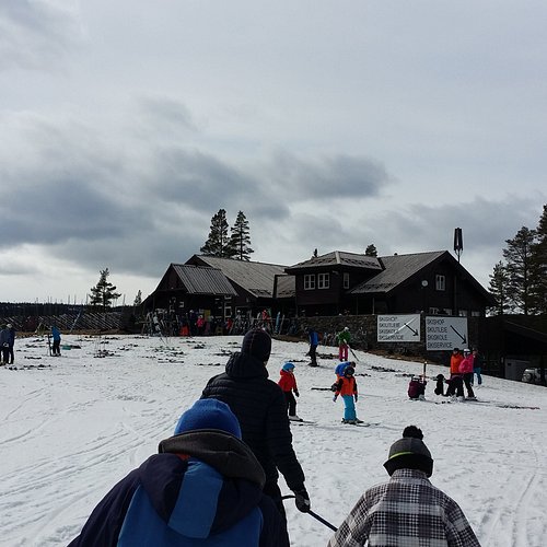
9. Nystolkroken Ski
A great little slalom piste and half pipe, 200 meters long. The sledding piste is right next to the café and offers a great view of the area. The sunny terrace facing southwest is a great place to enjoy your lunch. Café and warming room licensed for beer and wine. Mini market. Organized activities such as horse-drawn sleds, ski racing and dog sledding. Ski rental, see the example for daily rates. Skis and skiing equipment for sale in the ski shop. Large selection. Explanation, ski rental: V/A = adults, B/C = children.
10. Qvisten Outdoor Bath
Outdoor bath centrally located in Nesbyen. Swimming pool with international measurements and diving board. Water heated to 25 degrees. Large green area and relaxation area by the pool. Service facilities with showers and bathrooms. Guests at Qvisten Ferieleiligheter have free entrance to the bath. The apartments are located right by the bath. Accommodation booked through Nesbyen tourist information. The Outdoor Bath is located adjacent to a kiosk, restaurant with good meals, Rimi grocery store and Shell gas station with NAF Centre. Entrance behind the centre.