


Top Things to do in Southern Norway
Top Hotels in Southern Norway
10 Hiking Trails in Southern Norway That You Shouldn't Miss
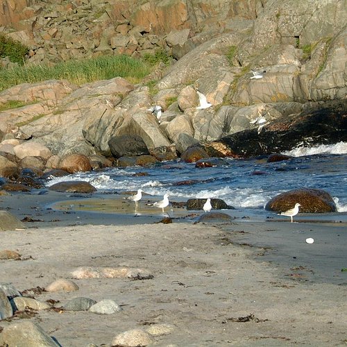
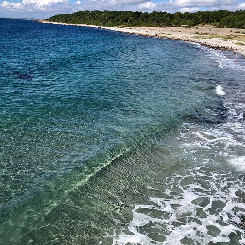
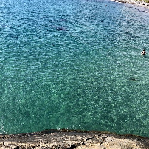
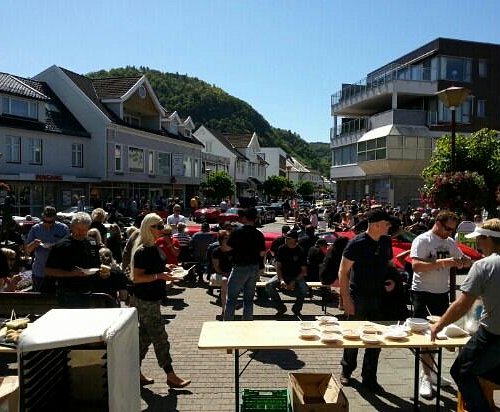
Called Sørlandet, Norway's South Coast is known for its rocky coastline, its whitewashed houses and its idyllic archipelago. This warmest area in the country draws many resdents for a summer holiday. Kristiansand, the biggest city here and fifth-largest in all of Norway, has many lovely beaches, a very good zoo (Norway's most visited attraction) and a number of historic buildings. These date from the period of the city's 17th-century founding and are located in Posebyen, the old town area.
Restaurants in Southern Norway
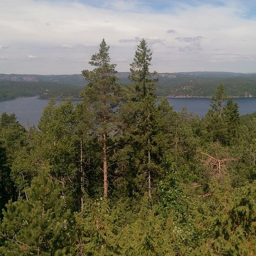
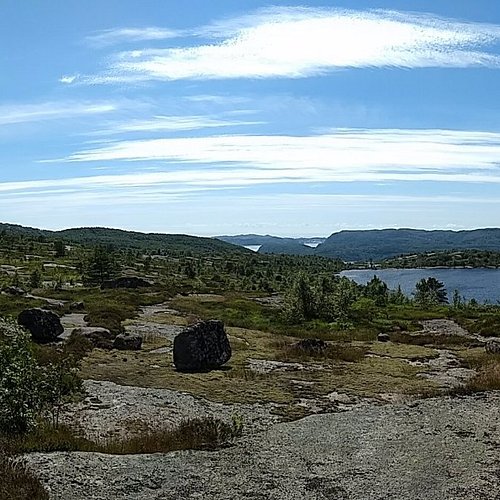
1. Kollen at Fjaereheia
Overall Ratings
5.0 based on 4 reviews
Follow the recommended route to Dommesmoen. Continue along the floodlit trail for 100 metres, then turn right and follow the trail towards Deidalen. Some wet areas. At the first crossroads, turn left and then left again by a small lake. By the sign “Kollen, 2.6 km”, turn right. Then turn right and follow the old railway line for 200-300 metres. Climb the steep Orrekeiv to the left and follow the tractor tracks to Kollen, 1.9 km. At the top, you can enjoy the tranquillity and views towards the mountains and lake Rore. The route is marked with red triangles/red paint. As you return to the railway line, turn right and follow the road along the lake. After 1 km, you’ll reach the floodlit trail. Turn left and continue to the car park by Dommesmoen. Duration: Approx. 1 hour is required for the 4.2km walk from Dommesmoen to Kollen. For the 10km roundtrip, some 2 hours is needed. Terrain: Varied, exciting countryside. Some wet areas. Sturdy shoes and a reasonable level of fitness required. Level of difficulty: Medium Suitable for: The area is not suitable for wheelchair/pram.
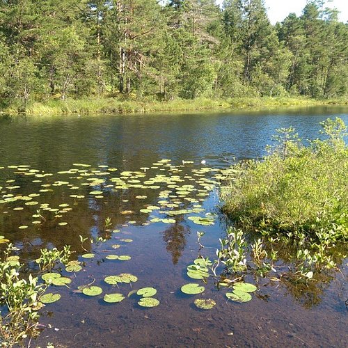
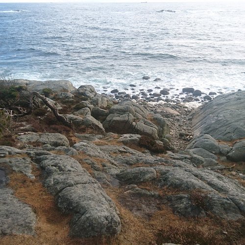
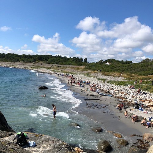
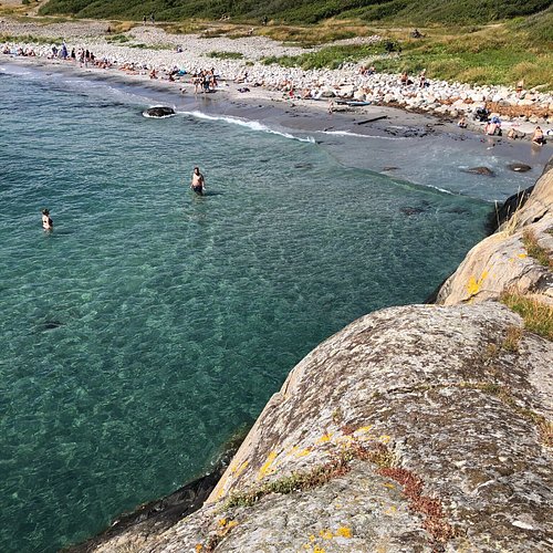
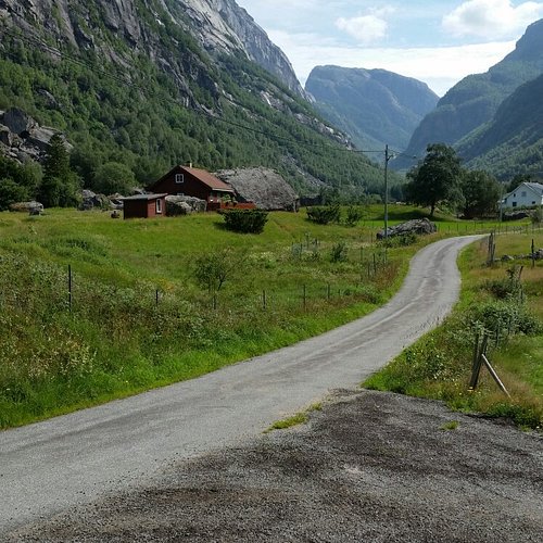
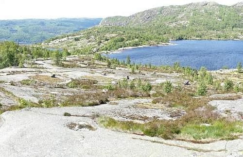
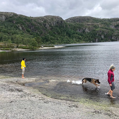
2. Hove and Spornes
Overall Ratings
5.0 based on 80 reviews
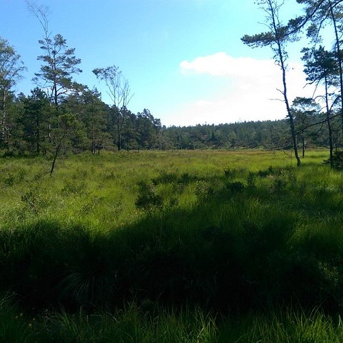
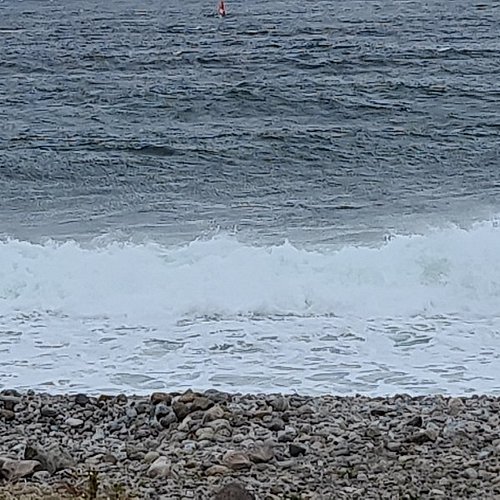
On the southern part of the island of Tromoy, only 10 minutes from Arendal town by car, bus or boat, there is a beautiful area called Hove. This recreation area is part of a protected moraine that lies along the southern coast. The whole area has been adapted for walks with resting places along the shore. There is a beach and kiosk at Hove camping during the summer season, and several kilometres of smooth rocks. Sundays between September and May, there is a lunch buffet at Hovestua in Hove camp from 12 to 18. The paths are many and stretches from Hove to Alve, along Spornes beach, consisting of boulders and rocks, and sand when the sea permits. The area is used for hiking both summer and winter, and is suitable for everyone, children and adults. The trip from Hove camping to Alve and back is about 12 kms, and the network of paths allows both short and long trails. Maps for sale at Arendal tourist office, Hove camp, and Bjellandstrand Gard. Parking for instance at Hove camping and Hove camp. Bus no 3 to Tromoy ost leaves Arendal every hour during the day, Monday-Saturday.
Reviewed By Samadhi33 - Arendal, Norway
Hove and Spornes has it all... The beautiful forest to hike in with sunlight pouring in between the trees; the sandy beach for sunning, swimming and picnics on warm summer days; and the "rullesteinstrand" (rolling stones beach) for communing with nature, with the wide ocean horizon spread out in front of you and the sound of the waves crashing over the stones. Here you can find real relaxation any time of the year, a break from an otherwise busy life. Plenty of activities also for families with children. They'll love it as much as you will. If you're in the Arendal area you definitely don't want to miss the old Viking ground Hove and the beaches of Spornes.
3. Royknes Kiledalen
Overall Ratings
5.0 based on 2 reviews
There are small differences in level along this section of the route. From Royknes Cycle Route no. 3 follows the path of the old Setesdalsbanen railway to Nomeland power station. When the Nomeland power station and Nomeland dam were built in 1920, the railway was rerouted. You cycle up the hill to the new route, which you then follow through the Nomeland tunnel and upwards along the west side of the fjord. The old railway lies at the bottom of the fjord. As you are cycling along an old railway section you don't have so many tough uphill slopes. There are 7 tunnels along this section of the route. Two of these are lit. After approx. 6 km you pass Iveland power station. From here the road heads inwards towards the centre of Iveland. On the section between Iveland and Kile there are several large log driving walls and other reminders from the time when enormous piles of logs were driven down through the water system. You cycle through several tunnels, the longest of which are illuminated. There are no cars between Gasefla and Kile. From Kile and up to Kiledalen you have to cycle along Highway 9 Recommended map: National cycle route no. 3
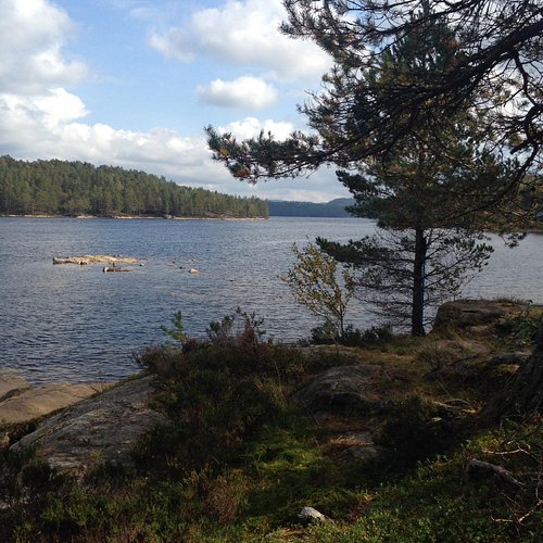
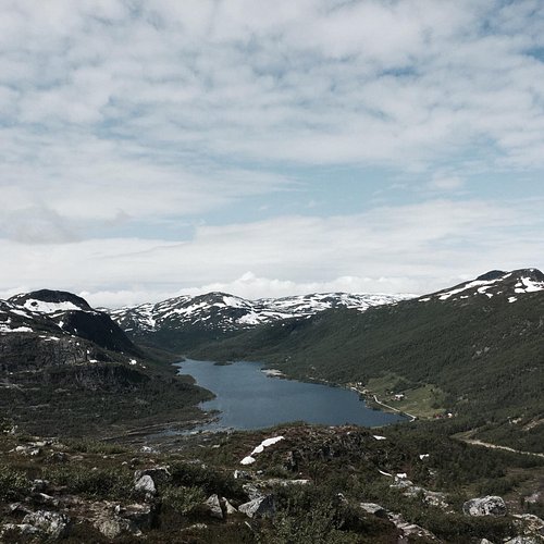
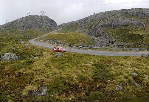
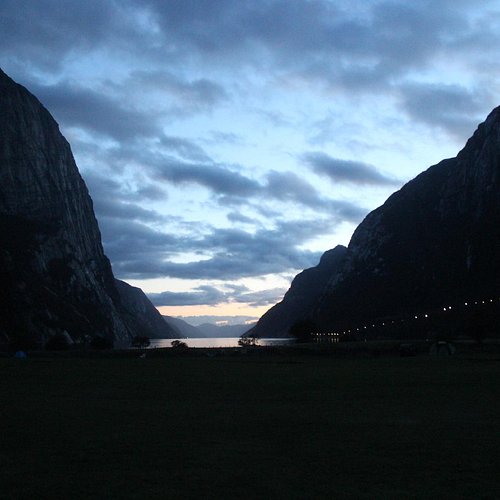
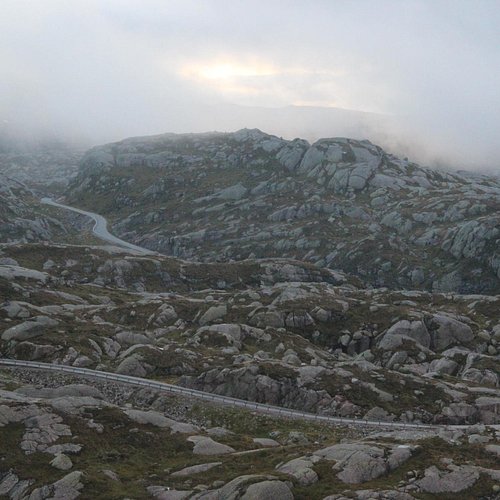
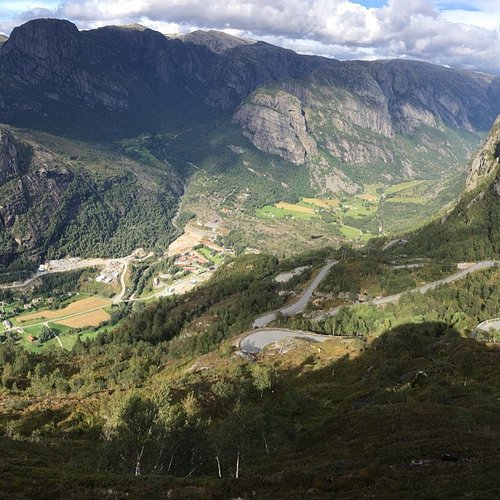
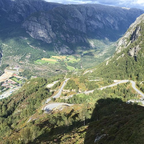
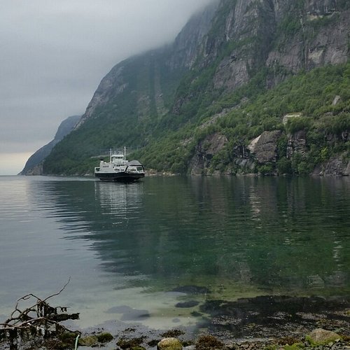
4. Lyseveien to Lysebotn
Overall Ratings
5.0 based on 22 reviews
Starting Point:The walk starts on Lyseveien between Sirdal and Lysebotn, about 1 km west of Grydalen. You can park on Borsteinshyttens carpark, located on the opposite side of the road in relation to the trail. Description: Start walking in a north-west direction. After approx 5 minutes cross the stream descending from Matupstjodne tarn and follow the left side of the stream gently upwards. The path here runs along a small hillock on the south side of the tarn. Gradually climb up towards the paths highest point. At 970 meters there is a magnificent view across the Lyseheiane. From here start the descent towards Andersvatnet lake. You must first zig-zag your way down ¾ of a steep ravine and then follow the rock face of Vardekleivane on the right. After approx 100 metres cross the stream that runs from Andersvatnet lake. (Carefully follow the markings and your GPS if you have one).The path continues to the west and the terrain becomes gradually hillier and it may be difficult to find your bearings. You will pass several lakes before coming to a ravine that takes you down to Pollen (tarn). The path zig-zags down this ravine but you get a great view of the waterfall cascading down from Mount Toknuten. At the bottom of the ravine you cross the stream running from Andersvatnet lake. From here, the path gradually ascends on bare rock before you come to a valley to follow. Towards the top of the valley you can see the high mountains of the Lysedalen valley on your right and you get an idea of what awaits you later on on the walk. Lysedalen valley is one of the region's wildest valleys, with their 800/900 metre steep mountainsides that plunge into almost impassable terrain. At the end of the valley you climb over a boulderfield before continuing down the ravine to a green sheltered spot with fresh mountain water. This is a perfect spot for a break! Follow the stream down to where it winds 90 degrees around the mountains down towards Lysedalen valley. You can't fail to be impressed! The magnificent mountains that make up Lysedalen valley greet you in all their splendour. This is not the place for those who may have fear of heights! Like the stream you must also change direction (northwards). Allow yourself approx 1.5 hour to get down the steep mountainside. Carefuly zig-zag your way down. You will copme to a birch forest at approx 420 metres. It may be difficult to find the path here, as it also zig-zags through the dense forest. Look for stone cairns and red marks on the trees in the forest. When you get to a prominent overhang, the path turns 90 degrees towards the innermost farms you can see far below in Lysebotn. At 85 metres turn right, towards the spot where you must cross the river by climbing over some large rocks. There is a wire rope attached to one of the rocks, which makes crossing easy. Follow the right side of the river westwards. You then come to a grazing area for sheep, and pass through a gate that takes you onto the land of the innermost farm in Lysebotn. Remember to close the gate behind you. Cross the grazing land and use the steps that have been erected for you to cross the fence at the other end. After 100 metres you come to another fence that will lead you through a little gate into the parking area at the farm. For a detailed description including maps and information etc buy the guidebook 'Hiking in Sirdal' which includes Kjerag and Sirdals Seven Summits.
Reviewed By mihaella19 - Haugesund, Norway
Have only one thing to say : it's worth every second to spend there both on the road /Lyseveien or at the fjord down at Lysebotn .Every piece of nature is mesmerizing .
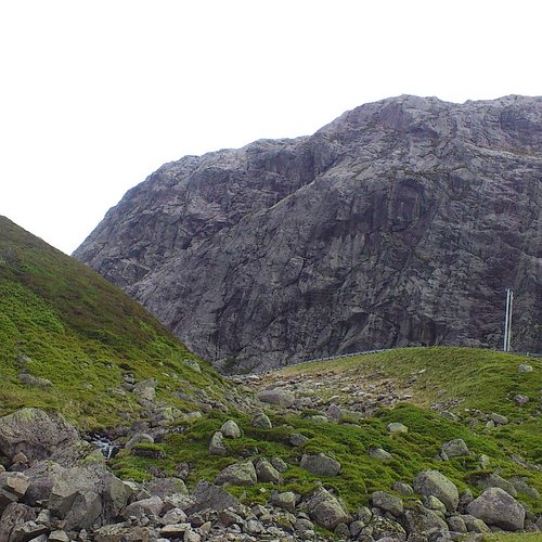
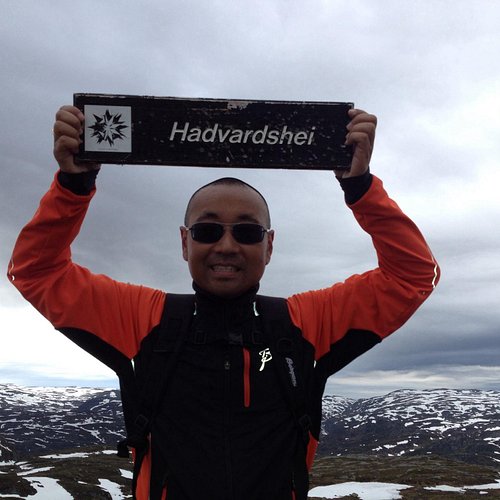
5. Hadvardshei Summit
Overall Ratings
5.0 based on 1 reviews
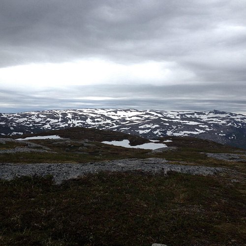
Starting point: park at the upper carpark at adneram ski lift located just off Bergetjodn. Description: from the carpark, follow the road/ski trail that runs down the mountain, at the first intersection turn right and follow the trail that runs south of the lake. At the end of the lake you will see three tracks, follow the middle one. On top of the hill, turn right and follow the trail to the top of the ski lift . Allow about 25 minutes to the top of the lifts. Cross under the lifts and continue northeasternly along the narrow path. In general you should follow the ridge of the mountain. After a short journey you will reach a small marsh, here turn right down a small glen, before again going up the mountain edge, first through a small birch wood, then across two small valleys. After approximately 15 minutes walk round the mountain, bearing north on the small mound from which you see Rubedalstjodna on the left handside, and Hassteinstjodn in the distance on the right. Go down the hill and cross the valleys that cross here, before you climb up the slightly steeper slopes in a northwesterly direction. When the path becomes less visible continue up the mountain ridge. Keep to the left and follow the stone cairns that will lead you back to a small tarn. Allow 25 minutes. At the tarn, turn west. You cross a stream that flows out of the tarn and pass similar small tarns. After a short anount of time you will cross the valley creek that runs east-west. Hadvardshei is now to your left, take the easiest road to the top where you can enjoy a 360 degree view over the mountain moors. For a detailed description including maps and information etc buy the guidebook 'Hiking in Sirdal' which includes Kjerag and Sirdals Seven Summits. Click here for Maps and GPS Coordinates Accommodation: Suleskard Fjellsenter Stavanger Turistforening Contact: Arild Rosnes +47 51 84 02 17
6. Hike to Skrelia
Overall Ratings
5.0 based on 27 reviews
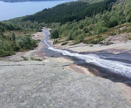
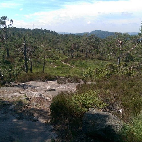
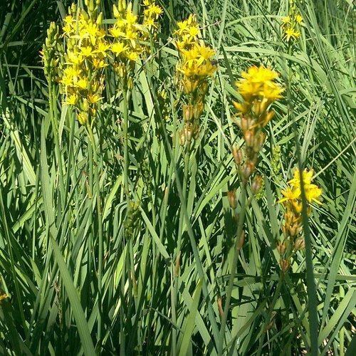
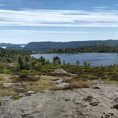
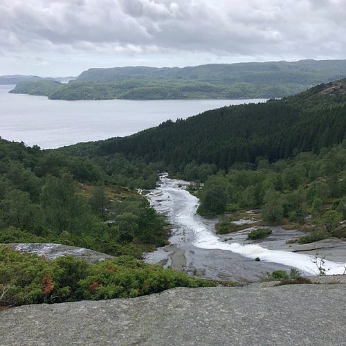
Skrelia is the most recommended area for hiking in Lyngdal. The mountain is only 350 meters high but the terrain can easily be associated with the highlands. The wonderful view combined with the view of the waterfall running down the polished mountain, makes a remarkable view. This is an easy terrain for hiking. There are many inviting small lakes for hikers who need to cool down. There are many marked trails in this open terrain, and they are of various lengths. There are trails for most people and most are on polished mountains. Some places you may need to cross brooks and areas of marsh and heather. Heather is Norway’s national flower. The shortest trail starts at the parking lot and goes straight to the waterfall. The hike takes about 10 minutes. You may use this trail as the starting point to the other marked trails in the area. Expect to spend 2-3 hours through Rassveda, around Sandvann and Homso. Here you will find an exceptional viewpoint. At this location you may see the ruins of an old fortress dating back to 500 A.D. It is also possible to walk down the mountain alongside the waterfall all the way to the fjord. On the way you will notice remnants of earlier mills and sawmills. Direction: From the town centre of Lyngdal follow the road to apta. Drive 3 km to you see the sign “Skrelia”. From here it is 9 km on a curvy gravel road to the parking lot. You cannot miss it! From the parking lot walk 50 meters to the gate that marks the beginning of the trails to Skrelia. The trails are marked with red/ yellow paint directly on the mountain. Hiking to Skrelia is reviewed in the book ”Oppdag Lister” from 2009.
7. Hill Hike in Grimstad
Overall Ratings
5.0 based on 1 reviews
By the tourist office, cross the road at the traffic lights. Turn left, and continue along Pharos Vei. At the very end of Hoyvardeveien is the first hilltop: Vardeheia, 41 m a.s.l. Stunning views, and within an easy 10 min. walk from town centre. Enter Vestregate and then follow Storgaten until you reach Frivoldveien. The next hilltop is Floyheia, 63.5 m a.s.l., with beautiful views to the sea, town and countryside. This trail has been created based on Knut Hamsun’s work, “On Overgrown Paths”, and you’ll find quotes from the book along the way. Some steep sections, but Hamsun was 88 years old when he did this walk. Mollerheia, 41.9 m a.s.l., is the hilltop prior to the descent down to Kirkegaten. Cross over to Kirkeheia, 27 m a.s.l., with its beautiful park and the wooden Grimstad Church - Norway’s second largest of its kind. Binabben, 58.5 m a.s.l. and the last of the hilltops, offers an excellent “forest walk on wellkept paths to the vantage point. Spectacular 360° view towards countryside, town, harbour, archipelago and sea. At the top is a panorama disc with distances and details on what’s what in every direction. Duration: approx. 1 ½ hours. Terrain: Varied, some hilly areas, exciting countryside. Sturdy shoes and a reasonable level of fitness are required. Level of difficulty: Medium Suitable for: Both Vardeheia and Kirkeheia are suitable for wheelchairs/prams.
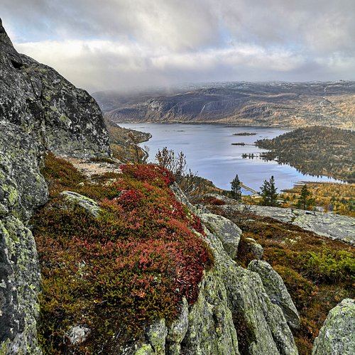
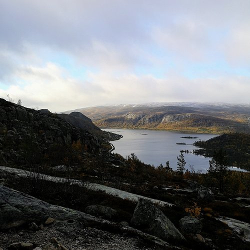
8. Hovdenuten
9. Fransasenloype
Overall Ratings
4.5 based on 4 reviews
12 km long hike starts from Risor centre. Follow the blue marked trail through uneven terrain. Fantastic view from the top Fransasen, about 4 to 5 hours hike.
10. Postveien from Kristiansand to Brennasen
Overall Ratings
4.5 based on 3 reviews
Postveien (The Postal Route) is part of the National Cycle Route No. 1 and is a 9 km scenic road, preserved as it was built in the 1790s, between Stavanger and Oslo. The road Kristiansand / Songdalen passes Groheia and along Kvislevann from the Krossen in Kristiansand to Farvannet in Songdalen. Access from Highway 9 by Krossen-Suldal and from E-39 by Farvannet. Recommended maps: