


Top Things to do in Whiteshell Provincial Park
What to do and see in Whiteshell Provincial Park, Whiteshell Provincial Park: The Best Hiking Trails
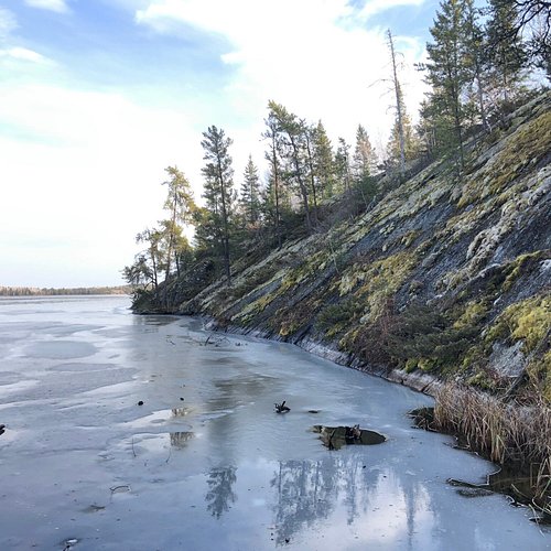
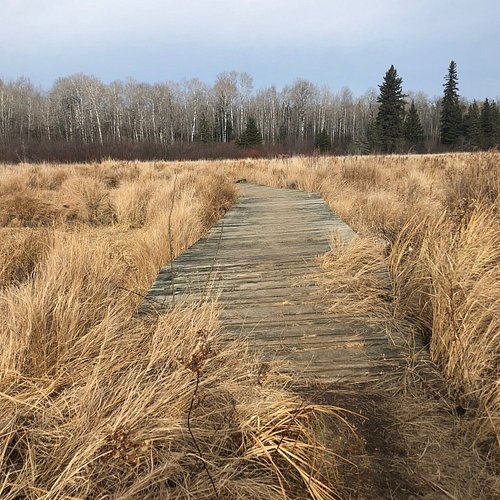
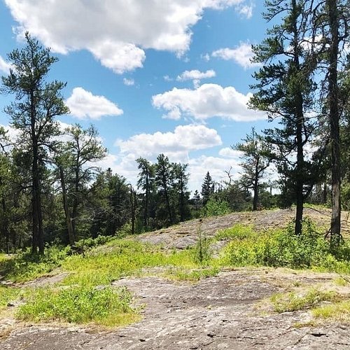
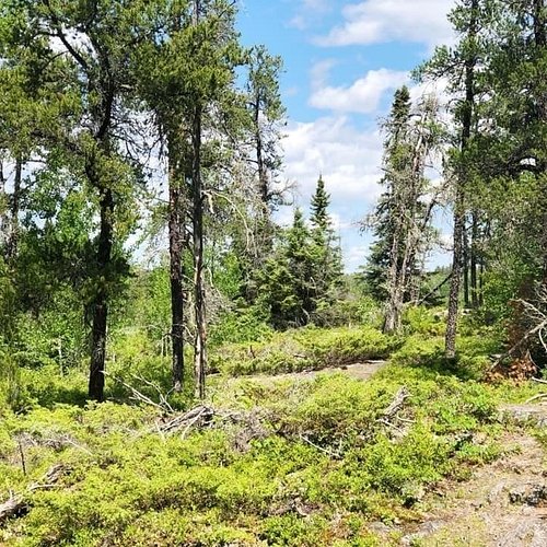
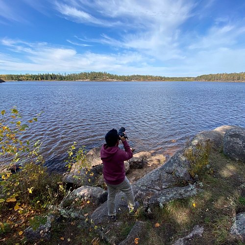
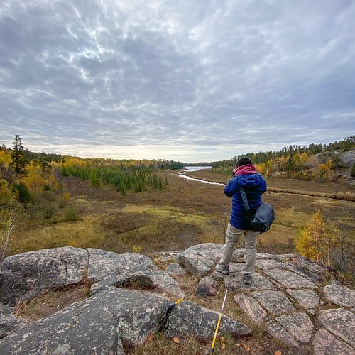
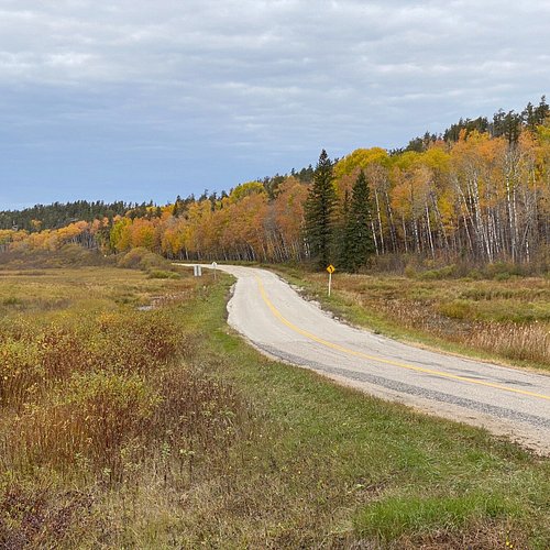
Discover the best top things to do in Whiteshell Provincial Park, Manitoba including Pine Point Trail, Bear Lake Hiking Trail, Hunt Lake Hiking Trail, Whiteshell Provincial Park, Top of the World Trail, Falcon Creek Self-Guiding Trail, Amisk Hiking Trail, McGillivray Falls Self-guiding Trail, Mantario Trail.
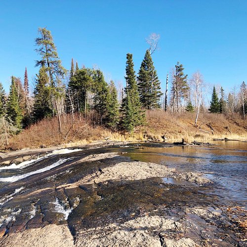
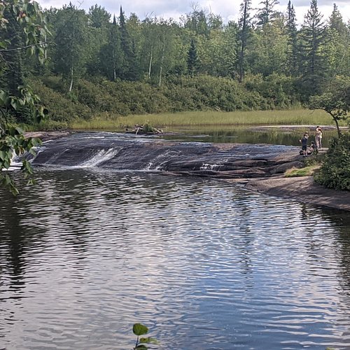
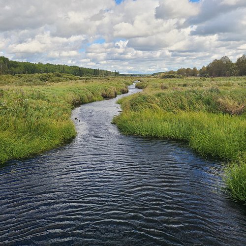
1. Pine Point Trail
Overall Ratings
5.0 based on 12 reviews
Reviewed By BrittanyMExplores - Winnipeg, Canada
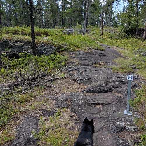
I completed this hike on the morning of June 20 2020. I arrived at 7:30 AM and was the first one there and enjoyed having the entire trail to myself for most of the hike (just passed a few groups on the way back). When I returned to the parking lot at 10:30, it was starting to fill up but the trail didn't feel busy at all on my way back. The hike begins on a wide path through the forest and arrives at a junction. I always take the trail to the right (the self-guiding 2.7 km one), as it's more scenic and interesting in the terrain. The other path is a wide, straight trail through the forest that also arrives to the first rapids and there is no elevation on that one. The scenic trail travels through a mix of forest and climbs over the rocky face of the Shield. There is a short, offshoot trail leading to a lookout point along the way, where there were beautiful views of the forest! There were quite a few muddy sections of the trail as you get closer to the first rapids... Make sure to bring extra socks and wear waterproof footwear! At the first rapids, there is a small warming hut with a wood stove. It's a nice place to enjoy a snack! There's also picnic tables on the rocks. The rapids were beautiful! The second loop is 2.8 km and is lesser traveled than the first section of trail and it's my favourite portion of the hike as it is very scenic! This section is slightly more challenging with more ups and downs over the rocks. It leads to Acorn Falls first and then Viburnum Falls. Both are gorgeous and offer pretty views! There were some fallen trees across the trail at various points, but they were easy to navigate. The mosquitoes were absolutely HORRENDOUS when I hiked here. I had to wear my bug head net to escape their attacks. Would highly recommend lots of bug spray and a bug net if you have. It was definitely helpful. There is an outhouse at the beginning of the trail and at the first rapids. I hiked the full 9 km loop and it took me roughly 3 hours to complete with some photo/snack stops along the way. Pine Point is one of my favourite hikes in the Whiteshell and I love the variety of terrain and landscapes and pretty views along the way. The natural beauty is amazing.
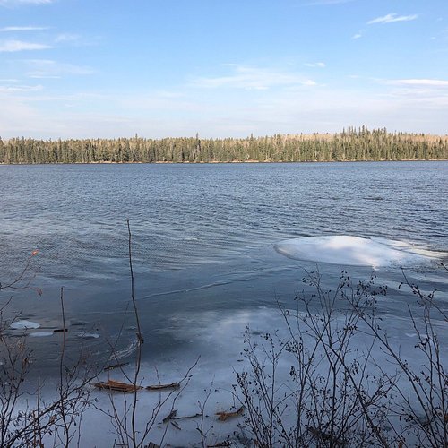
2. Bear Lake Hiking Trail
Overall Ratings
5.0 based on 3 reviews
Reviewed By BrittanyMExplores - Winnipeg, Canada
I snowshoed the Bear Lake Trail on a guided trek with Manitoba Parks this winter and it was amazing and beautiful! The 6 km out and back trail starts out by entering the forest briefly before crossing a set of train tracks and an open meadow and then re-entering the woods where it continues to follow through for the rest of the hike. There were lots of ups and downs as the trail crossed the Canadian Shield and a steep descent before arriving at the lake. While standing on top of the rock before the descent to the lake, there were beautiful views of the surrounding landscape. At the lake, we sat on a large fallen tree and enjoyed a snack with views of the sea of undisturbed fresh snow covering the lake. The atmosphere was so peaceful and calm. There was thick frost on the trees which created such gorgeous scenery. Every once and awhile, my nose caught the amazing smell of junipers which was so nice. It was a wonderful day to spend appreciating nature. There is a small parking lot and outhouse bathroom at the trailhead. The trail had been packed down by other snowshoers but it was still fluffy snow and plenty deep enough for snowshoeing. It was well marked with flagging tape on the trees and frequent blue arrow signs posted on the trees as well. The trail was not groomed or maintained so there were tree branches in the face sometimes and a few fallen trees to watch out for. Overall, I really loved this trail and it was great for snowshoeing! I would rate this trail as moderately challenging, due to the frequent inclines and declines (some steep) over the rocks. Bring hiking poles, as they were helpful on the steep descent to the lake. The Parks Interpreter told us that the trail is often a swamp in the summer and fall, so winter is the best time to enjoy this trail. Take advantage during this season! I would absolutely return here again and it was a fantastic trail for snowshoeing.
3. Hunt Lake Hiking Trail
Overall Ratings
4.5 based on 21 reviews

Reviewed By TnJAdvents
Absolute amazing hike. Very challenging hike with lots of elevation changes, rock climbing, mud jumping, etc. Very scenic views along some parts of the trail. Took us 5 hours to complete with frequent photo taking and beverage stops. Highly recommend.
4. Whiteshell Provincial Park
Overall Ratings
4.5 based on 12 reviews

Reviewed By BrittanyMExplores - Winnipeg, Canada
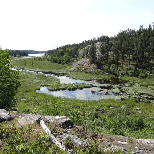
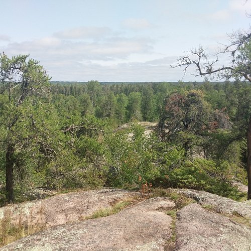
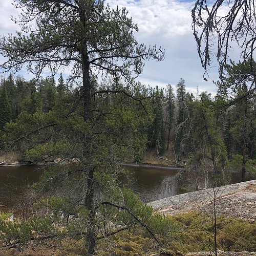
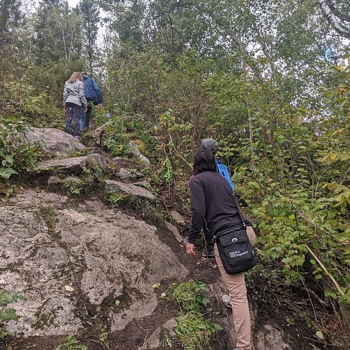
I hiked a portion of the Mantario Trail from the south trailhead to Caribou Lake West as an introduction to this trail. This was my first backcountry hike/camping experience with a few friends who had a lot of combined experience on this trail. We hiked approximately 20 km round trip (10 km to Caribou Lake and back) and camped in the west campground at Caribou Lake. The hike was challenging (especially while carrying the weight of extra gear for camping), but very rewarding. There were lots of ups and downs over the granite rock face, including some steep climbs and descents. The trail led through forest (including burned sections from past fires), along the granite rock face in the Canadian Shield, across a river and a couple of creeks, and over two sets of train tracks. There were some very muddy sections in the lower forest areas, more so in the first section near the beginning of the trailhead, which were sometimes tricky to maneuver and required hopping across logs. Lots of roots and rocks, so definitely watch your footing to avoid tripping. Hiking poles helped tremendously! There were beautiful views along the hike while on top of the granite rock of the surrounding forest, Caddy Lake and Whiteshell River. The trail was pretty well marked and easy to follow with arrows posted on trees and bright flagging tape. I was expecting the bugs to be much worse than they actually were. There were definitely some mosquitoes, flies and ticks but they were not horrendous. I ended up having a total of six ticks by the end of the weekend (regular ticks, no deer ticks). At the Caribou junction, the sign was down but still visible laying in front of an old airfield tower foundation in the burned section of forest. The trail to the right (marked with flagging tape), leads 5 km to the Caribou Lake east campground and the trail to the left leads 2.5 km to the west campground. If you are hiking the entire trail, then you would camp in the east campground, as this is where the trail continues from. The west campground is suited for those doing an overnight on the trail. We headed to the west campground and the trail continued along a wider grassy path through forest and over rocks. This section of the hike to Caribou Lake was less intense and it was fairly flat, with not too many ups and downs. Closer to the campground, there was a fork in the trail with an arrow pointing right and left. The right trail look lesser traveled so we took the left trail to arrive at the campground (still not sure where the other trail leads). Before arriving at the campground, we passed three bear boxes and the outdoor privy (toilet) was on the left side of the trail just before arriving to camp. Bring your own toilet paper and hand sanitizer for the toilet. Caribou Lake was absolutely gorgeous! The campground was situated on a small peninsula jutting out into the lake, among tall pine trees to provide shade. There were lots of flat spaces to pitch a tent. This was a very peaceful area, deep in the wilderness, with amazing views of the lake and so much natural, rugged beauty! There was a picnic table and fire pit at the campground as well. On the first day, it took us approximately 5.5 hours to hike the 10 km from the south trailhead to Caribou Lake, with some breaks along the way and moving at a leisurely pace. On the hike back to the trailhead, we completed the same distance in about 4.5 hours and were moving at a steadier pace with less breaks. Come prepared if you plan to hike this trail. Wear sturdy and comfortable hiking boots/shoes, bring lots of water and a water filter and extra food. There is limited cell service along most of the hike. Overall, I would absolutely recommend this hike to experienced hikers with a good fitness level looking for a challenging and rewarding experience! I definitely felt pretty strong and empowered after completing a portion of this trail. Can’t wait to eventually hike the entire 63 km.
5. Top of the World Trail
Overall Ratings
4.5 based on 4 reviews

Reviewed By BrittanyMExplores - Winnipeg, Canada
The Top of the World trail is a short (approx. 3-4 km loop) but rewarding hike and has fantastic views. The beginning of the trail starts from the parking lot of the Falcon Trails Resort, across from the main office building, about a 15-20 minute drive from the Falcon Lake townsite. You have to follow the High Lake Trail and signs for the High Lake Eco Cabins and it eventually meets up with the Top of the World loop, where there is a sign indicating this trail. It was a little difficult to find and confusing at times and the signage could definitely be better. The loop was along the rocky and forested landscape typical of the Whiteshell. The viewpoint overlooking Falcon Lake and the surrounding forest was gorgeous and there was a nice bench for sitting and admiring the views there. This was definitely the highlight of the trail. It was a short and scenic trail that was moderately challenging. This trail is also frequently used by mountain bikers and trail runners, so be aware of your surroundings. Would definitely recommend this hike!
6. Falcon Creek Self-Guiding Trail
Overall Ratings
4.5 based on 4 reviews

Reviewed By BrittanyMExplores - Winnipeg, Canada
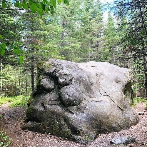
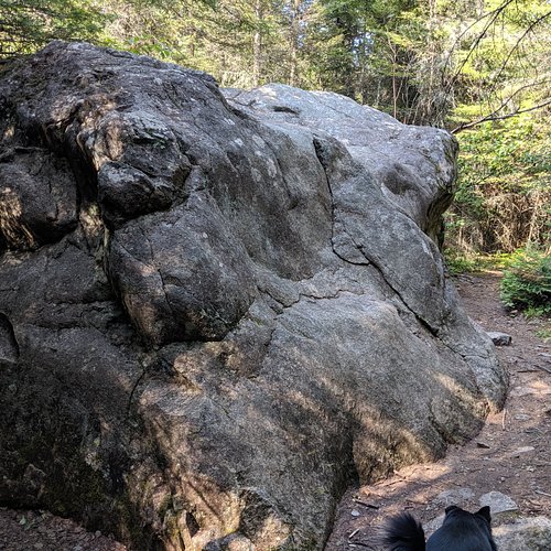
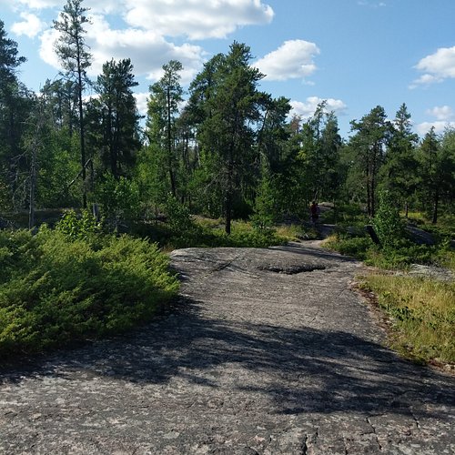
The Falcon Creek Self-Guiding Trail is a short 2.2 km loop trail, just a short drive from Falcon Lake townsite off the Trans Canada Highway, next to the Falcon Beach Ranch. The trail follows over the rocky landscape and through forested areas. There was one very large rock positioned along the trail that was deposited there by glaciers back in the day, from the receding ice, which was interesting to see. You can also spot lots of quartz veins in the rocks along the trail. The trail had some ups and downs along the rocks, but overall, was an easy hike. The trail was well-marked. This trail was scenic and had great views and beautiful nature along the way. Would recommend!
7. Amisk Hiking Trail
Overall Ratings
4.0 based on 7 reviews

Hiking trail through Whiteshell Provincial Park's beautiful woodlands.
Reviewed By heatherontherun - Saskatoon, Canada
I am fortunate to be able to holiday at my husband’s family cabin at Brereton Lake every year. And the Amisk Trail is a short walk from the cottage. Fabulous to run it...hopping over rocks and roots...that’s fun!! And then you get up on the large Canadian Shield rocks and do some stretching and yoga...and ?meditation?? SO BEAUTIFUL!!!! So safe to run on your own as well. Pick some blueberries and wild raspberries along the way!! A must do if you are in the area. Will take you under an hour to run. ENJOY!!!!!
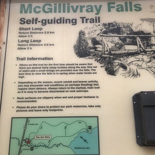
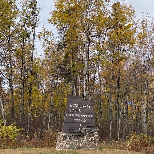
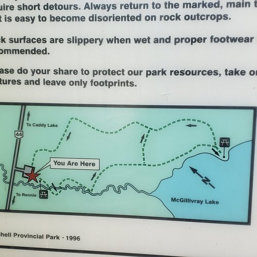
8. McGillivray Falls Self-guiding Trail
Overall Ratings
4.0 based on 21 reviews
Reviewed By TnJAdvents
One of many nice hiking trails in the Whiteshell. Some elevation changes and a variety of changes from climbing rock to bush to lakefront trails. Perfect trail for its moderate difficulty and distance. Later in the season so the ‘falls’ were a little underwhelming but still a great time. We did the hike backwards so to get a lead-up to the falls. Recommend you do it that way. Take the trail to the left of the sign board to do in reverse.
9. Mantario Trail
Overall Ratings
5.0 based on 2 reviews
Reviewed By BrittanyMExplores - Winnipeg, Canada
I hiked a portion of the Mantario Trail from the south trailhead to Caribou Lake West as an introduction to this trail. This was my first backcountry hike/camping experience with a few friends who had a lot of combined experience on this trail. We hiked approximately 20 km round trip (10 km to Caribou Lake and back) and camped in the west campground at Caribou Lake. The hike was challenging (especially while carrying the weight of extra gear for camping), but very rewarding. There were lots of ups and downs over the granite rock face, including some steep climbs and descents. The trail led through forest (including burned sections from past fires), along the granite rock face in the Canadian Shield, across a river and a couple of creeks, and over two sets of train tracks. There were some very muddy sections in the lower forest areas, more so in the first section near the beginning of the trailhead, which were sometimes tricky to maneuver and required hopping across logs. Lots of roots and rocks, so definitely watch your footing to avoid tripping. Hiking poles helped tremendously! There were beautiful views along the hike while on top of the granite rock of the surrounding forest, Caddy Lake and Whiteshell River. The trail was pretty well marked and easy to follow with arrows posted on trees and bright flagging tape. I was expecting the bugs to be much worse than they actually were. There were definitely some mosquitoes, flies and ticks but they were not horrendous. I ended up having a total of six ticks by the end of the weekend (regular ticks, no deer ticks). At the Caribou junction, the sign was down but still visible laying in front of an old airfield tower foundation in the burned section of forest. The trail to the right (marked with flagging tape), leads 5 km to the Caribou Lake east campground and the trail to the left leads 2.5 km to the west campground. If you are hiking the entire trail, then you would camp in the east campground, as this is where the trail continues from. The west campground is suited for those doing an overnight on the trail. We headed to the west campground and the trail continued along a wider grassy path through forest and over rocks. This section of the hike to Caribou Lake was less intense and it was fairly flat, with not too many ups and downs. Closer to the campground, there was a fork in the trail with an arrow pointing right and left. The right trail look lesser traveled so we took the left trail to arrive at the campground (still not sure where the other trail leads). Before arriving at the campground, we passed three bear boxes and the outdoor privy (toilet) was on the left side of the trail just before arriving to camp. Bring your own toilet paper and hand sanitizer for the toilet. Caribou Lake was absolutely gorgeous! The campground was situated on a small peninsula jutting out into the lake, among tall pine trees to provide shade. There were lots of flat spaces to pitch a tent. This was a very peaceful area, deep in the wilderness, with amazing views of the lake and so much natural, rugged beauty! There was a picnic table and fire pit at the campground as well. On the first day, it took us approximately 5.5 hours to hike the 10 km from the south trailhead to Caribou Lake, with some breaks along the way and moving at a leisurely pace. On the hike back to the trailhead, we completed the same distance in about 4.5 hours and were moving at a steadier pace with less breaks. Come prepared if you plan to hike this trail. Wear sturdy and comfortable hiking boots/shoes, bring lots of water and a water filter and extra food. There is limited cell service along most of the hike. Overall, I would absolutely recommend this hike to experienced hikers with a good fitness level looking for a challenging and rewarding experience! I definitely felt pretty strong and empowered after completing a portion of this trail. Can’t wait to eventually hike the entire 63 km.
TAGS