


Top Things to do in Valdres
What to do and see in Valdres, Eastern Norway: The Best Hiking Trails
Discover the best top things to do in Valdres, Norway including Bjorgovarden, Mugnetinden, Bitihorn, Smadalen Route, Stoelsrunden circuit, Gilafjellet, Elvevandring, Kongevegbedrifter Filefjell SA.
Restaurants in Valdres
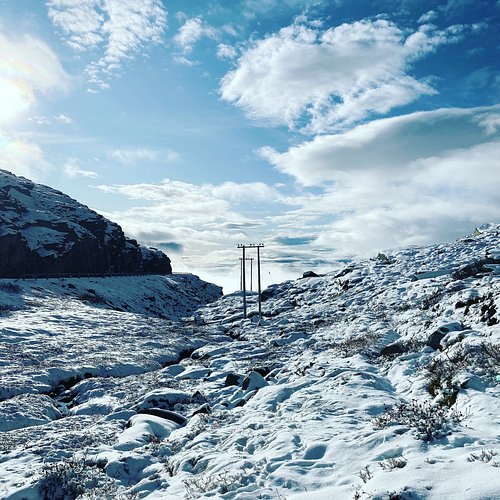
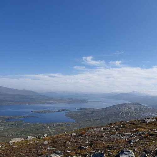
1. Bjorgovarden
Overall Ratings
5.0 based on 3 reviews
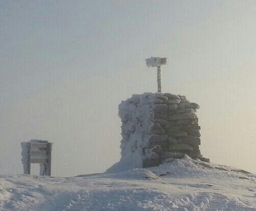
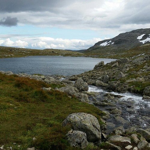
Easy walking (no climbing or scrambling) ascent. Nice and wide view. Tour description Length: ca. 7 km one way Duration: ca. 1,5 hrs up Hight difference: ca. 160 meters Suitable for children: recommended from ca. 8 yrs. This walk is very easy but maybe a bit boring for smaller children. Well suited for child carriers. From the old ski slope, a path leads up to Lake Fraeningen (picnic area and bathing place) and further on to the right towards Storstolsknatten 1124 m, first along the lake, later up and down into the birch forest. From Storstolsknatten the path continues southeastwards past Kringlestolen to the top of Bjorgovarden. Nice views in all directions. The return first leads west-, then northwestwards around Lake Langevatnet back to Kringlestolen and from here it follows the same way back. Alternatively follow the path to the left towards Storstolstjernet and the gravel road back to Danebu Markings Clear path and blue markings on rock. Equipment Standard clothing for light mountain walks: light hiking shoes, wind- and waterproof outer layer. No special equipment required.
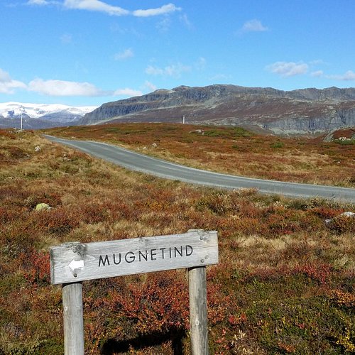
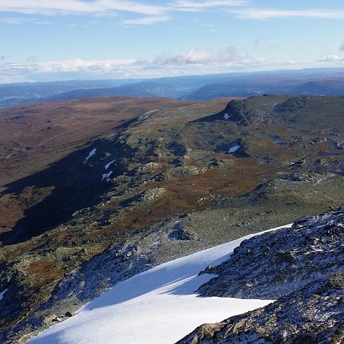
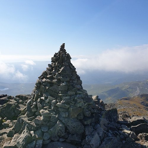
2. Mugnetinden
Overall Ratings
5.0 based on 4 reviews
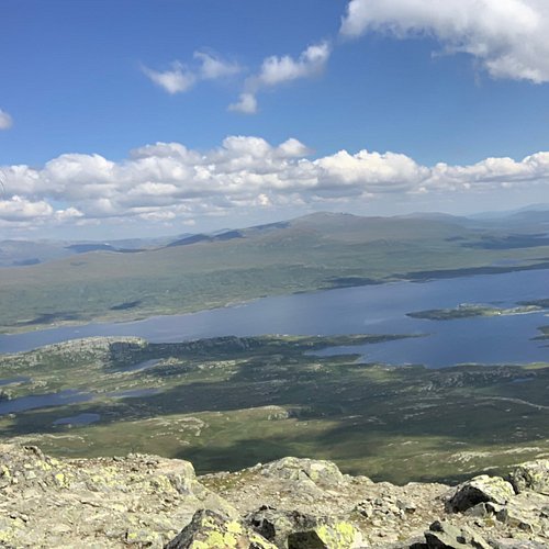
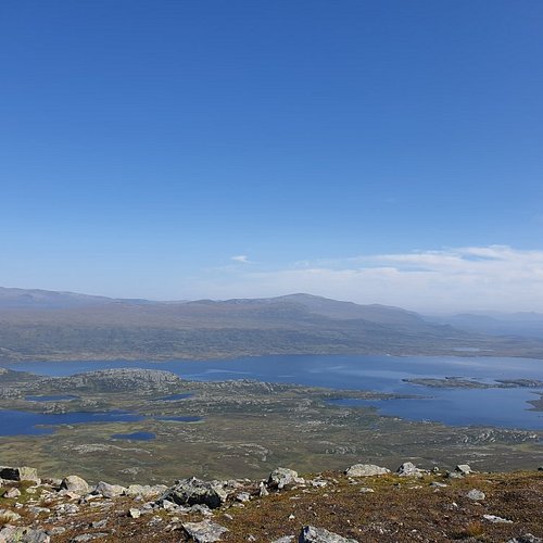
Moderately demanding walking (no climbing or scrambling) ascent. Highly rewarding view from the summit towards Jotunheimen and Valdres. Tour description Length: approx. 6 km one way Duration: approx. 2.5–3 hrs. up Altitude difference: ca. 750 meters Suitable for children: from 8 yrs. From Beitostolen, drive to Beito and follow the signs towards Slettefjellvegen. Drive past the toll station (NOK 50 in 2010), continue past Fleinsendin and turn left at the intersection. Parking area on the left side of the road, near Mugnestolen, approx. 3.5 km from the toll station. The path starts on the opposite side of the road and is marked with cairns and white V’s. It leads gently uphill to Mugnebottjernet (pond) and then climbs steeper up into a col. From here you have two options. The steeper and more demanding route (recommended uphill only) turns right, while the main route, which is still steep but less demanding, continues straight ahead for another 300 meters and then turns to the right and uphill, too. The last bit leads through rocky terrain to the summit with a stunning, highly rewarding view towards Jotunheimen and Valdres. Equipment Standard clothing for high mountain walks: solid hiking boots, wind- and waterproof outer layer, warm sweater, hat, mittens, daypack. No special equipment required. Tip: Stay overnight at Gronolen Fjellgard and take a bike to the trail head. This way you get a varied full day tour.
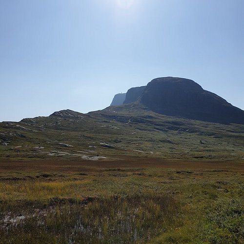
3. Bitihorn
Overall Ratings
4.5 based on 33 reviews
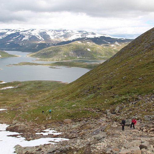
Moderately demanding walking (no climbing or scrambling) ascent. Highly rewarding view from the summit towards Jotunheimen and Valdres. Length: approx. 4 km one way Duration: approx. 2 hrs up Altitude difference: ca. 550 meters Suitable for children: from 6-7 yrs. Follow road 51 North from Beitostolen in the direction of Bygdin. After approx. 10 km, you will see a parking lot on the left side of the road, opposite the Lappish Camp. From there, follow the T-marked path for about 1 km. After passing through a reindeer fence, the route up to the summit of Bitihorn turns left and uphill. (The T-marked path continues straight ahead to Yksendalsbu). The route to Bitihorn is clearly marked and not very challenging. However, it does get a little steeper near the top. Enjoy the panoramic view towards Bygdin, Jotunheimen, and most of the northern region of Valdres. Markings Cairnes and red markings on stones. Equipment Standard clothing for high mountain walks: Solid hiking boots, wind- and waterproof outer layer, warm sweater, hat, mittens, daypack. No special equipment required.
4. Smadalen Route
Overall Ratings
4.0 based on 1 reviews
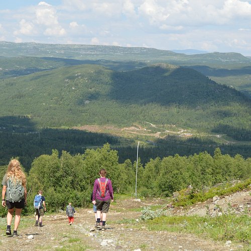
TYPE: Easy-Moderate 2 km of climbing, but the rest is easy. DESCRIPTION: This is a nice family route, althoug the first two km from the foot of Stettefjellveien is a challenging climb from 700 - 900 meters. Turn rigth towards oygardsstolen and continue on a flat mountain road for 4 km. There are several opportunities for hiking in this area, and at the end of the road you will find an information board. If you only wish to cycle, you may turn around and follow the same road back to where you started. An alternative route is to turn right after 3 km at Torpegardstolane and follow the mountain road down until you meet the main road. However, be aware that this road is quite steep and you have to keep a slow speed when you reach the intersection.
5. Stoelsrunden circuit
LEVEL: Moderate (Some difficult areas where you need to carry your bike). DESCRIPTION: This route passes by Norways larges summerfarm area with a stunning view in all directions. If you cycle at you own pase, most people will be able to compete the tour. However, we don’t recommend bringing small children. From Vestre Slidre and Vaset, you will enter the spectacular area of Vang, with its poweful mountains and beautiful lakes. There are a few narrow trails and wet areas where you will need to walk or carry your bike, but the majority of the tour is on nice and dry mountain roads.
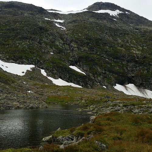
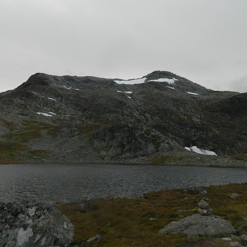
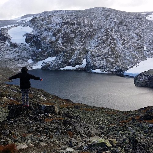
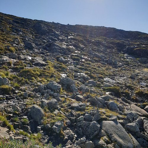
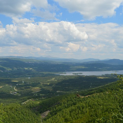
6. Gilafjellet
Moderately demanding walking (no climbing or scrambling) ascent. Fine view over lakes and mountains. Botanical Conservation Area. In poor sight it is difficult to find the route on the mountain plateau. Tour description Length: ca. 4–5 km one way Duration: ca. 1,5–2 hrs up, 3–4 hrs in total Altitude difference: 600 meters Suitable for children: suitable for children from 6–7 yrs The Midtre Syndin Lake is a great spot for swimming, so we recommend that you bring a towel. The route to Kruk is unmarked, apart from a few wooden signs reading “turmal” and some cairns in the summit area. It starts as a cart track and soon turns into a clear path. Along the route you may spot some rare botanical flowers, which become visible as soon as the snow has melted, normally from the middle of June to the beginning of July. (This is a Botanical Conservation Area). After having passed Nonskampen, a sign reading “turmal” points to the left, directly to the summit, but this route is very poorly marked and difficult to find. We therefore recommend continuing on the same path and through the col, from where the top is visible. Once you reach the top, sign the log book and enjoy the view! Instead of going straight to the summit of Kruk, you can also take a short detour to the viewpoint Krukknappen, 1557 m.s.l. on the other side of the massif. On the way there, you will pass by an animal burial site which is a part of a larger capture area for reindeer. We only recommend this hike in clear weather. Equipment Standard clothing for high mountain walks: solid hiking boots, wind- and waterproof outer layer, warm sweater, hat, mittens, daypack. No special equipment required. GPS recommended in poor sight. Markings Unmarked. Some wooden signs towards „turmal“ (destination) and few cairns in the summit area. Directions Follow road E16 North from Fagernes. If you are arriving from Bergen/Tyinkrysset, take the E16 South towards Fagernes. Exit when you see the sign to “Riste bro” (Riste Bridge). Keep to the right after the bridge and follow the signs towards M. Syndin (automatic toll road, NOK 60 in 2010). Drive past Syndinstogo (tourist cabin), and continue over the bridge by Pyttingen to the area of Norre Gile. Marked parking area to the right. It’s also possible to park down by the small beach.
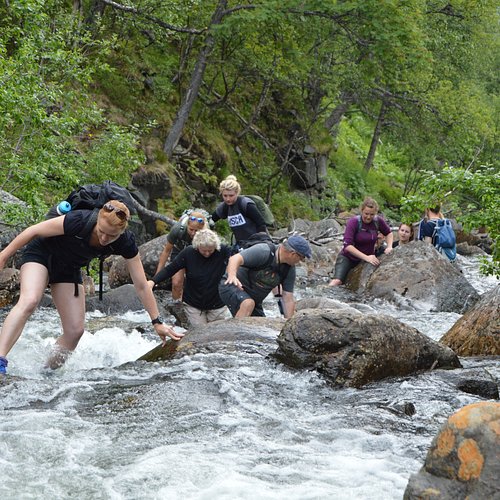
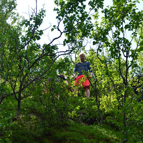
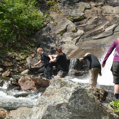
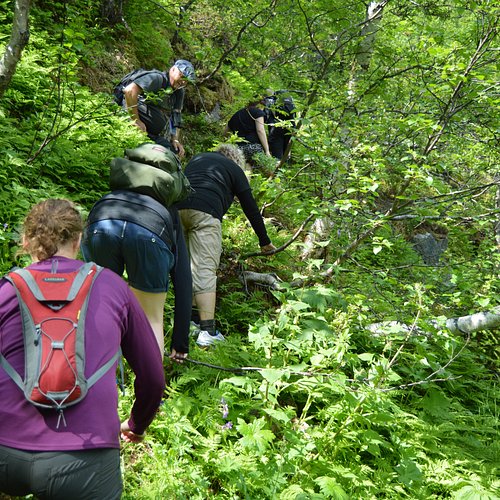
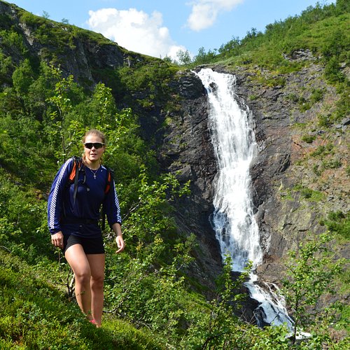
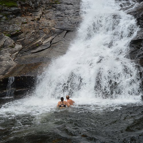
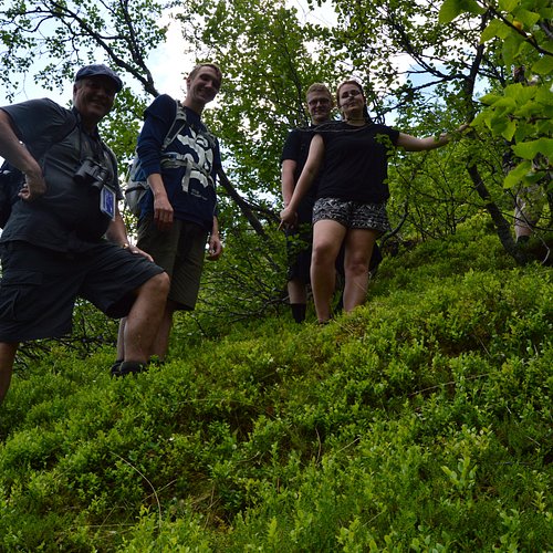
7. Elvevandring
8. Kongevegbedrifter Filefjell SA
Overall Ratings
4.5 based on 3 reviews
