


Location: Grimstad
Top Things to do in Grimstad
Top 6 Hiking Trails in Grimstad, Southern Norway
Grimstad ( listen (help·info)) is a municipality in Aust-Agder county, Norway. It belongs to the geographical region of Sørlandet. The administrative center of the municipality is the town of Grimstad. Some of the villages in Grimstad include Eide, Espenes, Fevik, Fjære, Håbbestad, Hesnes, Homborsund, Jortveit, Kroken, Landvik, Nygrenda, Prestegårdskogen, Reddal, Roresand, Rønnes, Skiftenes, Tjore, Vik, and Østerhus.
Restaurants in Grimstad
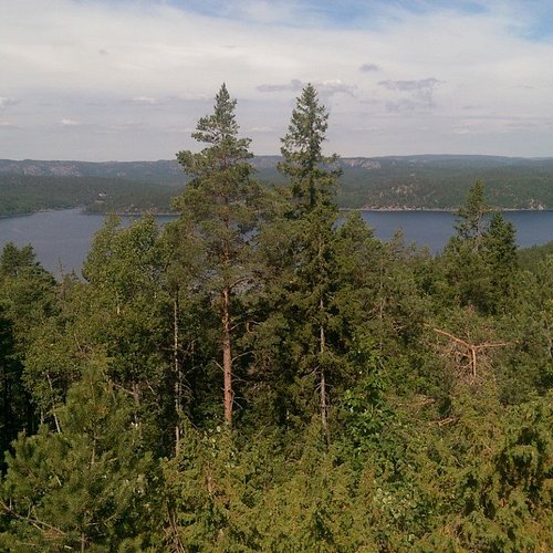
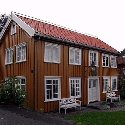
1. Kollen at Fjaereheia
Overall Ratings
5.0 based on 4 reviews
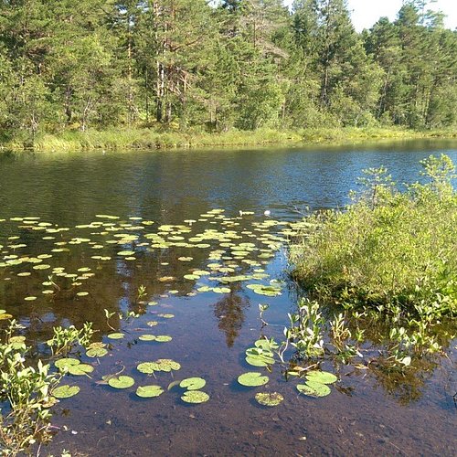
Follow the recommended route to Dommesmoen. Continue along the floodlit trail for 100 metres, then turn right and follow the trail towards Deidalen. Some wet areas. At the first crossroads, turn left and then left again by a small lake. By the sign “Kollen, 2.6 km”, turn right. Then turn right and follow the old railway line for 200-300 metres. Climb the steep Orrekeiv to the left and follow the tractor tracks to Kollen, 1.9 km. At the top, you can enjoy the tranquillity and views towards the mountains and lake Rore. The route is marked with red triangles/red paint. As you return to the railway line, turn right and follow the road along the lake. After 1 km, you’ll reach the floodlit trail. Turn left and continue to the car park by Dommesmoen. Duration: Approx. 1 hour is required for the 4.2km walk from Dommesmoen to Kollen. For the 10km roundtrip, some 2 hours is needed. Terrain: Varied, exciting countryside. Some wet areas. Sturdy shoes and a reasonable level of fitness required. Level of difficulty: Medium Suitable for: The area is not suitable for wheelchair/pram.
2. Hill Hike in Grimstad
Overall Ratings
5.0 based on 1 reviews
By the tourist office, cross the road at the traffic lights. Turn left, and continue along Pharos Vei. At the very end of Hoyvardeveien is the first hilltop: Vardeheia, 41 m a.s.l. Stunning views, and within an easy 10 min. walk from town centre. Enter Vestregate and then follow Storgaten until you reach Frivoldveien. The next hilltop is Floyheia, 63.5 m a.s.l., with beautiful views to the sea, town and countryside. This trail has been created based on Knut Hamsun’s work, “On Overgrown Paths”, and you’ll find quotes from the book along the way. Some steep sections, but Hamsun was 88 years old when he did this walk. Mollerheia, 41.9 m a.s.l., is the hilltop prior to the descent down to Kirkegaten. Cross over to Kirkeheia, 27 m a.s.l., with its beautiful park and the wooden Grimstad Church - Norway’s second largest of its kind. Binabben, 58.5 m a.s.l. and the last of the hilltops, offers an excellent “forest walk on wellkept paths to the vantage point. Spectacular 360° view towards countryside, town, harbour, archipelago and sea. At the top is a panorama disc with distances and details on what’s what in every direction. Duration: approx. 1 ½ hours. Terrain: Varied, some hilly areas, exciting countryside. Sturdy shoes and a reasonable level of fitness are required. Level of difficulty: Medium Suitable for: Both Vardeheia and Kirkeheia are suitable for wheelchairs/prams.
3. Fevik via Hasseltangen
Overall Ratings
4.5 based on 10 reviews
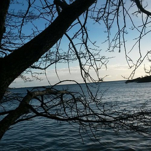
From the tourist office, followSmith Petersens Gate towards Arendal. Continue past Grimstad Church and Grimstad Town Hall on the left, and follow the foot and cycle path across Biesletta. Cross the road by the Bieheia turn-off, and continue along the foot and cycle path on the right hand side until you reach Vikkilen. Follow the signs for Fevik. At the Vik junction, turn right and follow the foot and cycle path along route 420 towards Fevik. When you reach the 40 km/h zone, cross the road and continue along the foot and cycle path on the left hand side. After a few kilometres, where you have open views to the sea, you can see the idyllic Strand Hotel Fevik. At the very tip of the headland is Sandodden Fort. Cross over to the right hand side and follow the pavement to Fevik. Turn right at Feviktoppen, and then take the second right. Feviktoppen has a small shopping centre. Continue past Fevik Park on your left and Fevik Church Community Centre on your right. Follow the signs for Som/Haugenes. Somsveien towards Hasseltangen does not have a foot and cycle path. An alternative route is marked in blue. Please see recommended trip below. After the Haugenes junction, continue straight ahead until your reach Hasseltangen. To get to the outermost part of Hassel-tangen, follow the gravel road to the left at the very end of the car park. On your return, turn right towards Birketveit at the first junction. At the route 420 junction, turn left towards Fevik. When you have passed a riding school on your left, cross the road and follow the signs for Lunde. At the end of the road is a T-junction where you turn left towards Lia. Continue straight ahead until you reach the foot and cycle path, and follow this towards Vik/Grimstad. Just before the Vik junction, use the pedestrian crossing to get over to the right hand side and then follow the foot and cycle path underneath route 420. From here, follow the foot and cycle path back to Grimstad. Opt. 1: Turn right towards Storesand, and continue past Randvika. In the upper part of the car park, bear left and follow the main road until you reach Haugenes junction. Then turn right towards Hasseltangen. Comments: Mainly flat and gentle terrain, but parts of the trip do not follow foot and cycle paths. Some gravel roads.
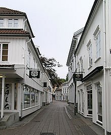
4. Heritage Walk
Overall Ratings
4.0 based on 2 reviews
By the tourist office, cross the road at the traffic lights. Enter Storgaten (pedestrian precinct), and then turn left by Nedre Tverstredet. Walk past Reimannsgarden, Grimstad Art Society. Continue up Vestregate, cross Nygaten and follow Markveien past the Technical College. Turn left into Torsgate, then cross Tonnevoldsgate where you’ll see Grom, the oldest farm in Grimstad, directly ahead. Continue on to Berge Gard, one of Grimstad’s former manor farms. Today, it is used as a nursing home, and the gardens can be enjoyed by everyone. At the end of Bergekleiva is Grimstad’s old tannery. This was where Otto Andersen, in 1869, found all he needed to open his workshop clean water and oak bark. As you enter Frivoldveien, you can see Fuhr's old production facilities. This impressive brick building/wine cellar was used to produce wine and juice until 1989. On your left is the old Grimstad Vinegar Brewery dating back to 1941-43. Continue along Frivoldveien and up the hill to old Grimstad Hospital with its two large, old wooden buildings. The green unit was where the author Knut Hamsun was detained after the war. Follow the foot and cycle path up the hill and down to Levermyr Idrettspark (sports centre w/ swimming pool). Then turn left and continue down Kirkegaten. As you approach the lower part of town, turn left towards the harbour into Henrik Ibsens Gate with the Ibsen Museum. Turn right and follow the quays until you reach the tourist office. Duration: approx. 45 min Terrain: Flat and on tarmac. Level of difficulty: Easy
5. Syndle Roundtrip
From the tourist office: ride west along the quays, continue past Odden Shopping Centre and follow Bark Silas Vei until you reach a roundabout. As you follow route 420, cross Grooseveien and continue past the Ericsson building. By Statoil, cross the E18 by using the underpass. Continue past Hageland and the turn-off to Prestegardsskogen, and then on to Landvik School. Ride past the school, turn right at the junction and follow route 404 towards Herefoss. From this point onwards, the terrain is slightly hilly. Ride past Skiftenes village and Gurebo farm, and embark on the uphill climb. Halfway up the hill, follow the signs for Birkeland. This section is on gravel. Follow the signs for Risdal. After a while you will be back on tarmac. The final 2.5 km leading down towards the Reddal village and lake are steep. By Landvik Church, follow the sign for Risdal. Continue straight on until you reach Bergemoen. From here several routes lead back to town centre, and one option is to follow the signs for Rv. 420 directly to Grimstad. Comments: Spectacular ride, but some hilly and challenging terrain. Please be careful down the hill towards Reddal as this is a dirt road and may have uneven surface. Idyllic scenery with numerous picturesque lakes along the way.
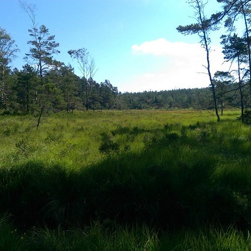
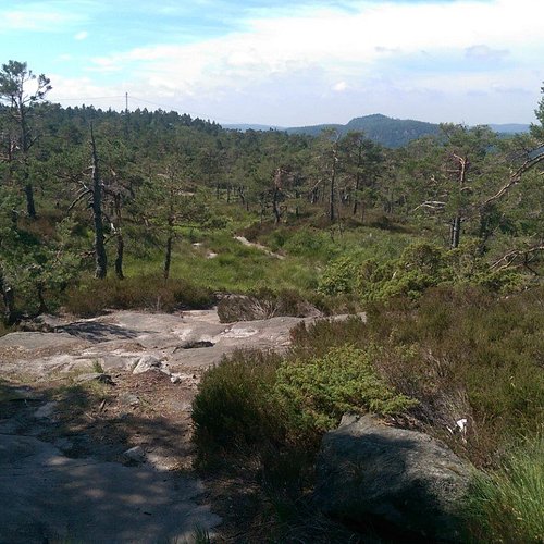
6. Lysloypen pa Fevik
Overall Ratings
5.0 based on 1 reviews