


Top Things to do in North Island
Top Hotels in North Island
The 10 Best Geologic Formations in North Island, New Zealand
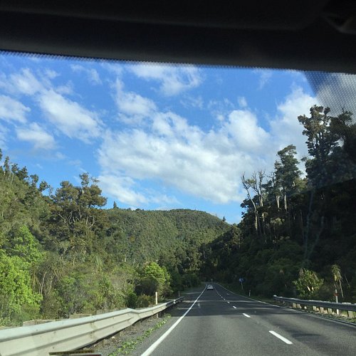
Discover the best top things to do in North Island, New Zealand including Mahia Peninsula, Waimangu Volcanic Valley, Hawkes Bay, Red Rocks Reserve, Wairere Boulders, Spa Thermal Park and Riverbank Recreational and Scenic Reserve, Rere Rockslide, Mangapohue Natural Bridge Walk, Pinnacles Track, Te Paki Sand Dunes.
Restaurants in North Island
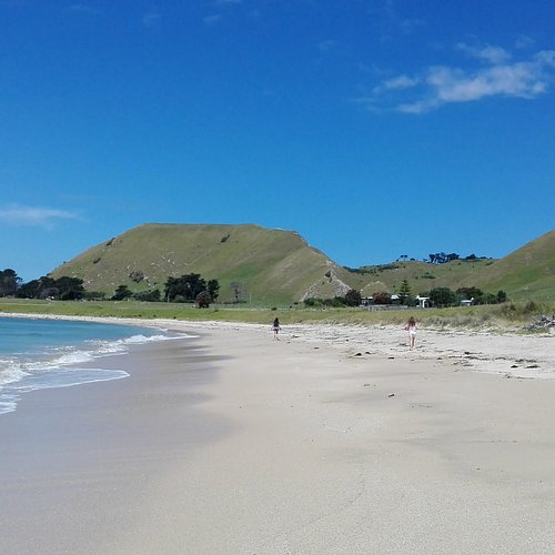
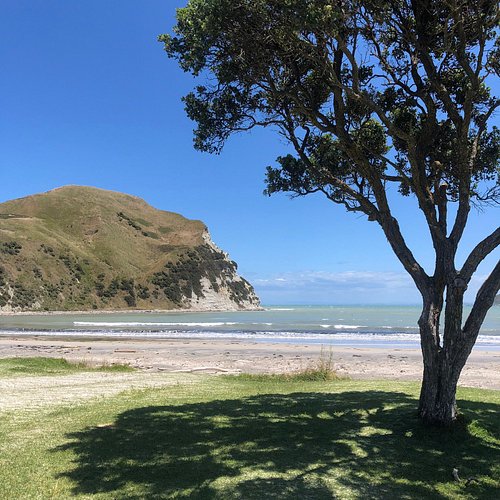
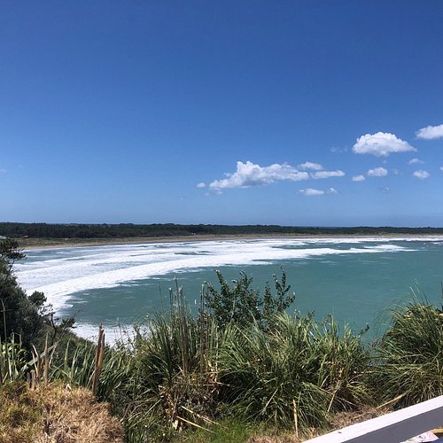
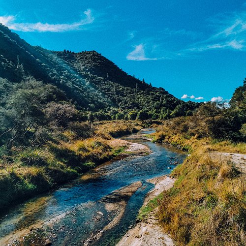
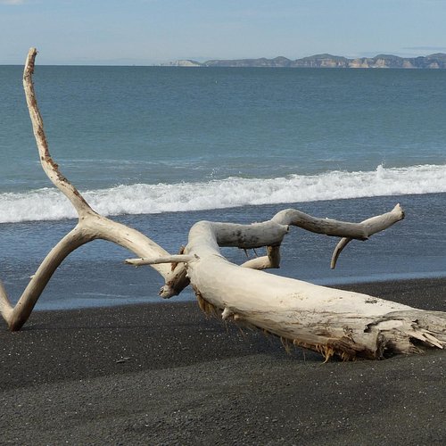
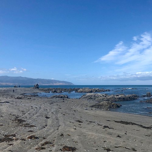
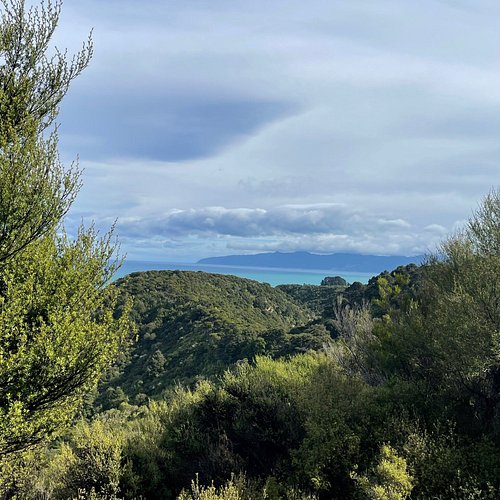
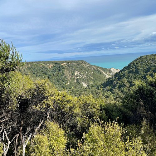
1. Mahia Peninsula
Overall Ratings
5.0 based on 14 reviews
Reviewed By KBNZ666 - Perth, Australia
This was one of my favourite places to visit while growing up. My family would go swimming and fishing here, for walks around the rock pools, shell collecting at Mahunga beach, and fish n chips at Mahia Beach. I love seeing the bach's with their characteristics.
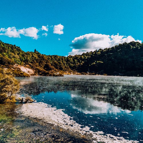
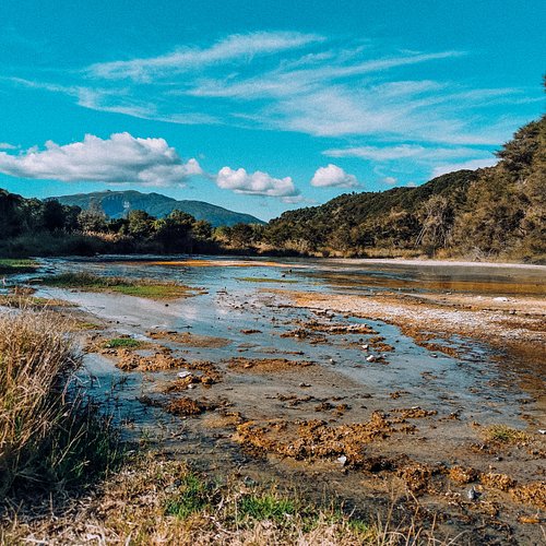
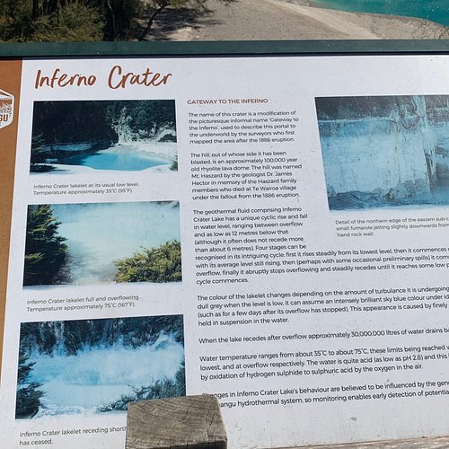
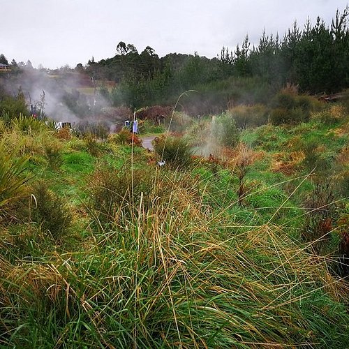
2. Waimangu Volcanic Valley
Overall Ratings
4.5 based on 1,697 reviews
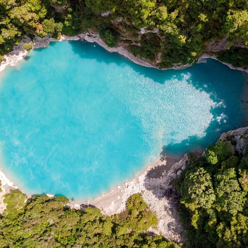
Explore spectacular activity in the world’s youngest geothermal system on a self-guided walking tour at Waimangu Volcanic Valley. We offer a range of options for all abilities and ambitions varying in length from our short 1.5km highlights walk to a 4.5km hike including an invigorating climb over Mount Haszard for astonishing panoramic views. Discover Frying Pan Lake, one of the largest hot water springs in the World and mysterious, beautiful Inferno Crater Lake which rises and falls as it heats and cools. See rare and unusual plants that have adapted to grow in the warm geothermal landscape and enjoy the abundance of native birdlife around Lake Rotomahana. Opt for an additional 45 minute cruise around the tranquil waters of Lake Rotomahana to see nature, birdlife and geothermal activity not accessible by foot. Relax and listen to the full historical commentary throughout cruise. Enjoy a much needed rest and take advantage of the shuttle bus at the end of your tour.
Reviewed By R0gerV - Leuven, Belgium
This site offers a nice hiking experience for all levels of fitness. Starting at the visitors center you can hike all the way down the valley passing places like Frying Pan Lake, Cathedral Rocks, Inferno Crater, Birds Nest Terrace, Rift Valley, Waimangu Stream and many more, leading you to the jetty at Lake Rotomahana. Here you can even make a boat trip of about 45 minutes on the lake. You are walking all the way in a stunning landscape with geothermal and volcanic elements. Depending on your hiking abilities you can start walking and if necessary take the internal bus further down to the lake or return, after a breathtaking walk all the way down, back to the visitors center. This is an experience you should not miss when you are in the neighborhood of Rotorua.
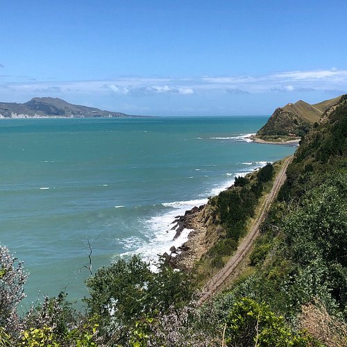
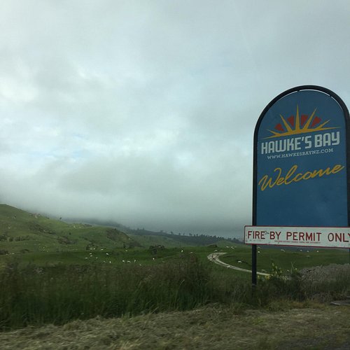
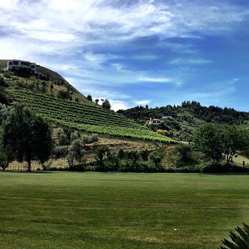
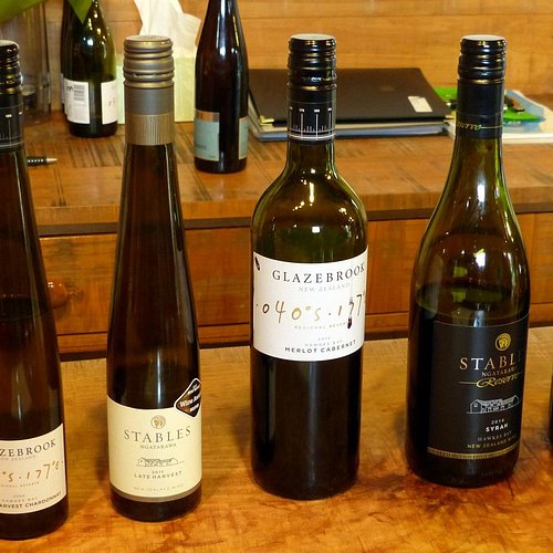
3. Hawkes Bay
Overall Ratings
4.5 based on 16 reviews
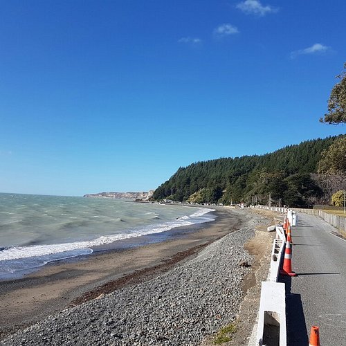
Popular wine making region of New Zealand.
Reviewed By ergiros
Wonderful area with great wineries and beaches. Tour the wineries - small boutique or renowned as Te Mata Estate, Black Barn and Craggy Range - all with offering food and tastings before heading to Ocean beach.
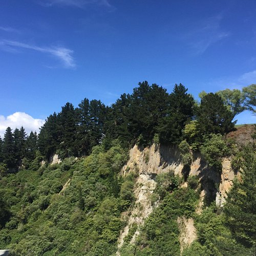
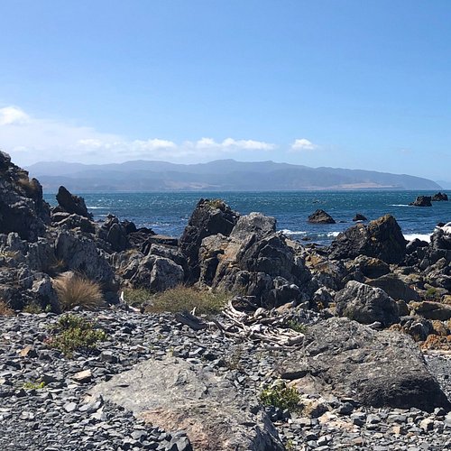
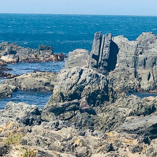
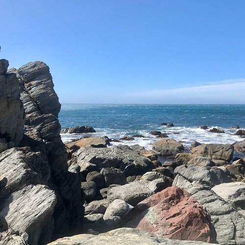
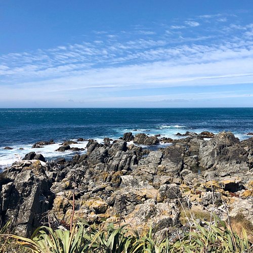
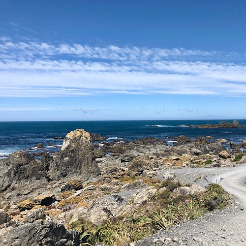
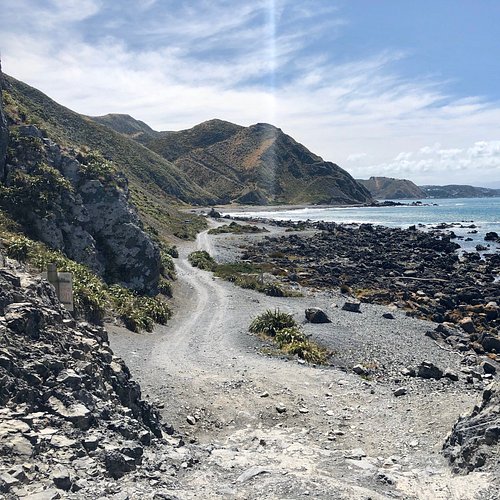
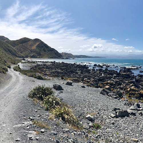
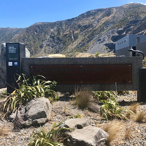
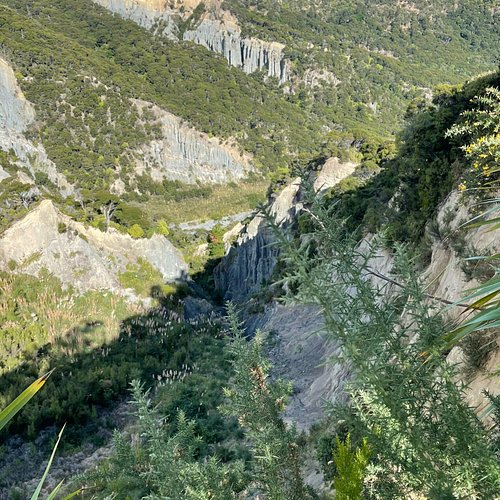
4. Red Rocks Reserve
Overall Ratings
4.5 based on 174 reviews
Reviewed By CarolDM1900 - Montpelier, United States
There's a World War II forward observation post with huts and bunkers atop Sinclair Head, the high promontory that looms over Devil's Gate and the seal colony just beyond. It's an impressive site to visit, redolent of history and offering some of the best views over Cook Strait. On a fine summer day, the sky above is magnificent. If you're hardy and adventurous, with good footwear and sturdy long pants, you can get there via a loop of trails that will take you through some of the more remote interior sections of the reserve, where you are less likely to encounter other hikers and can enjoy the sound of silence over the hills and through the deep valleys. I found this to be one of the most challenging, but enjoyable, hikes I've done in Wellington, and I've done many of them, at least 8 in this particular reserve. Here's how to put together the loop. Start from the main trail head, a bit inland from the Coastal Track (road) as it nears Devil's Gate. Between a couple of "baches" (beach shacks), you'll see a big sign at the bottom of rising hills showing the different tracks on a map. You will start by rock-hopping across a shallow stream that flows by to the right of the sign, then follow the steep, winding trail straight ahead. A sign will eventually identify it as the Pari-Whero (Red Rocks) Re-Route. NOTE: When you begin, DO NOT turn right BEFORE the stream to follow the steep uphill gravel road with a barrier across it. That is the part of the Red Rocks track route that is now closed. The re-route rises steeply, has a couple of stream crossings, and eventually, about halfway up the hills, brings you to a hard-to-miss sign that points you to the connector for the Radome Track and the Bunker Track. You'll also traverse some of the Waipapa Loop Track. From the connector sign, it is still a long way to the WW II headland bunkers, with some very steep slopes to navigate both up and down, as you will essentially be crossing over several big hills and the valleys between them to get to the historic site. This being the dry season, small rocks and pebbles are loose and tend to slide in the dust when foot pressure is applied on the slope, so take great care on the downhills in particular. I slid a couple of times, despite wearing trail runners with aggressive treads. Some sections of the track wind through very prickly bushes that nearly obscure the pathway. You can't always detour around them, so don't even think about coming this way in shorts and short-sleeved shirts. These bushes are nettlesome and can raise welts. All this may have you wondering if you really want to take this loop. But I assure you, once you are up high enough to see the observation post in the distance, you will be strongly motivated to get there, even if you are tired and a bit scratched up. And besides, it a long, difficult way back retracing your steps. Better to press on. Once you get to the site, you'll discover that there is some graffiti on the buildings, but it does not much detract from the experience of seeing the old installations, especially the bunkers with the grass growing on the roofs in an effort to hide them from sight. If you are historically-minded, as I am, you will have a deep feeling about what went on here, being able to picture it "live" in the empty structures that remain today. It is a moment in time in the dramatic shadow of history. Get out as close to the edge as you cautiously think appropriate and walk around: the views up and down Cook Strait from this spot are glorious. Alas, there is no historical interpretation, but I think what you see is enough to make you feel the history and the impact of the place. So take your time, take it all in, and enjoy it. To complete the loop and return to the place you began, you should begin to descend the trail you used to get up to the buildings. Focus intently on the right side as you start to go down, and you will see a small, somewhat overgrown track that has no sign but is distinguishable because of its narrow tramped pathway of dried grass that clearly begins to move toward a descent in the distance. Once you start to follow the tramped down grassy pathway, you will see occasional metal posts, some with yellow plastic caps on top. There are sections that may require some trial and error to keep on the track. Sometimes you may have to dive under big bushes to find and follow the trail. Parts of it are so overgrown that the trail just seems to disappear. It does help to know that you're definitely going down, in a fairly narrow valley, and that this last part of the loop is relatively short. You will get there. The last section of the track is the most difficult because its runs right on top of a steep, stony creek. You will be stepping over rocks with moss and water trickling down them. It is slow going, but not far from the beach. You will exit the trail right by a local "bach" that has a jolly roger flag on the roof of a rough shed. From there, it is just steps back to where you began, and in any case you will see the Coastal Track (road) right ahead of you. If you'd rather not do this whole loop track, you can do a there-and-back on the shorter, more direct route used to descend on the last part of the loop. To find the beginning, start at the main trailhead sign and map, then walk to the left. You'll cross a little bridge and then find the track between two baches, nearest the one with the jolly roger flag above it. Stroll up what seems to be a private driveway toward the bach's outdoor shed, and you will see on your right a rough, hand-painted sign with the word "track" on a bright red arrow pointing the way. I would personally not like to take that shorter, more direct track uphill, given the difficult climb over the descending stream with the water and the moss. Plus, it misses the peaceful charm of the trails in the quiet interior hills and valleys. But if your time is limited, and you 're willing to scramble a bit to see the WWII observation post site, then by all means give it a try. The loop trail took me about 3 hours to do, but I did not hurry. I also spent time on top taking photographs and just enjoying the scenery. Having made a significant effort to get there, I wanted to savor the experience of being there. If you elect the shorter, more direct there-and-back route, you can probably cut the time in half, depending on your strength and agility. This is a great place, the more so, I think, because of the invigorating hike and the dramatic scene changes you experience while getting there via the longer loop. You miss that on the shorter, there-and-back trail. But whichever way you go, I think you will enjoy your visit. Highly Recommended.
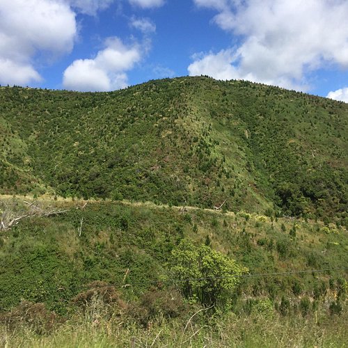
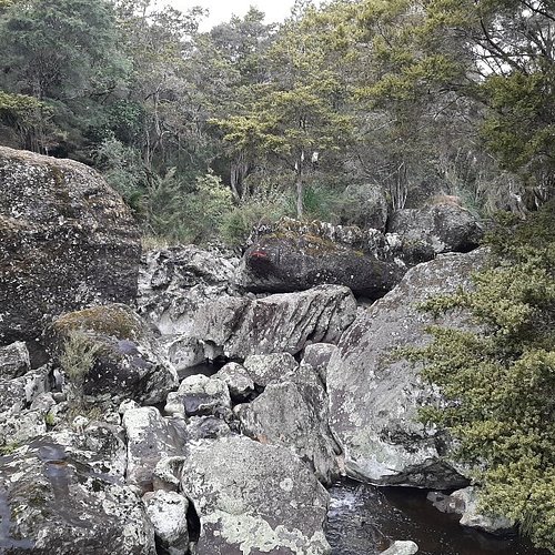
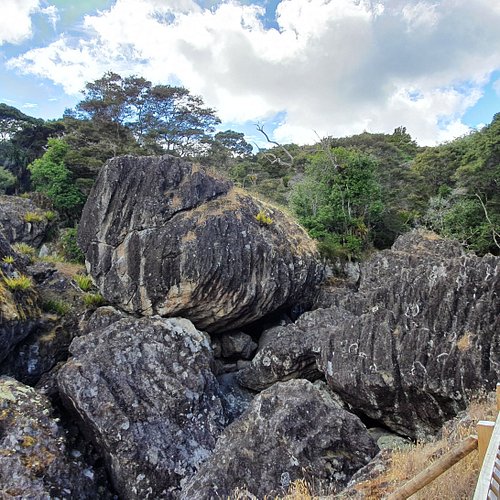
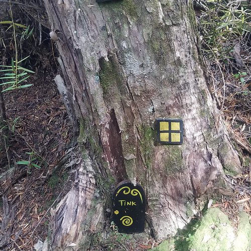
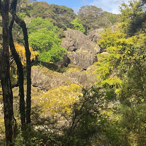
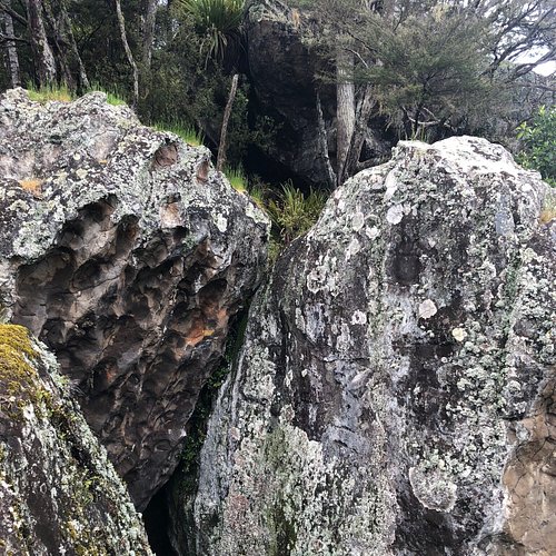
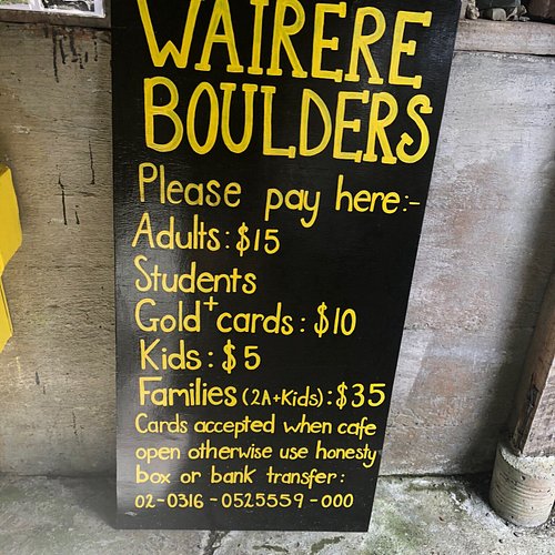
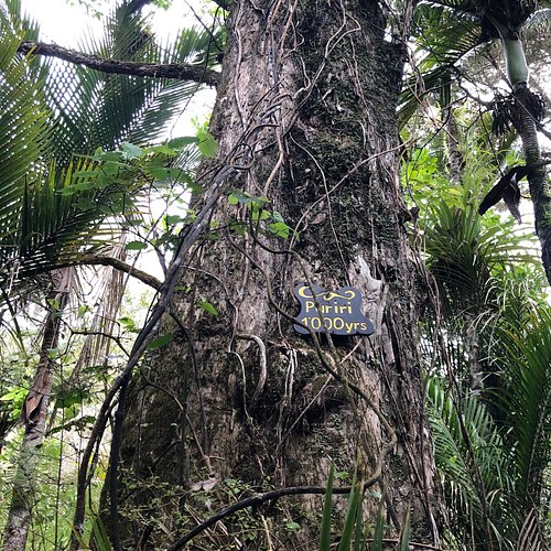
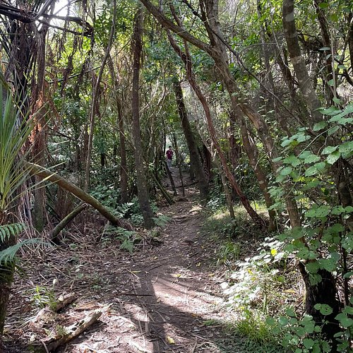
5. Wairere Boulders
Overall Ratings
4.5 based on 188 reviews
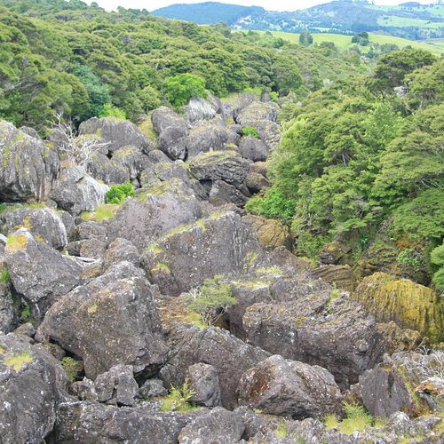
Walks from 30 min to 3 hrs, take you through beautiful subtropical rainforest, under, over and around the boulders. Bring the kids and hunt for rock animals, fairy houses and enjoy the native flora and fauna. You can hire kayaks and paddle down the boulder river all the way to the Hokianga harbour. Our low key campsite offers visitors a chance to stay in our beautiful, secret corner of New Zealand. Our B&B at the Boulder Bach sleeps 3 and includes fresh homemade sourdough bread. Whilst you are here book a night walk and see glow worms, cave wetas and maybe even a kiwi.
Reviewed By TrionaD15
Love this spectacular walk, such a magical place. Have done the boulder loop walk several times, great track and board walk, incredible views. Read the story of the area, is fascinating. Highly recommend :)
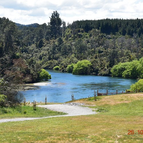
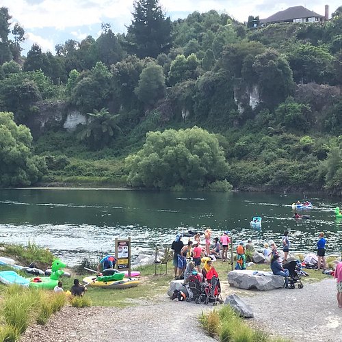
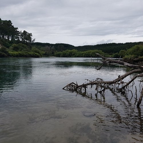
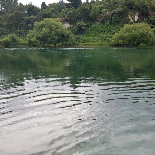
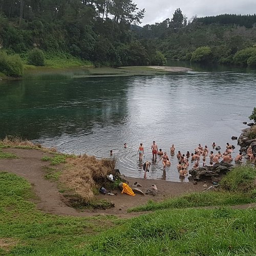
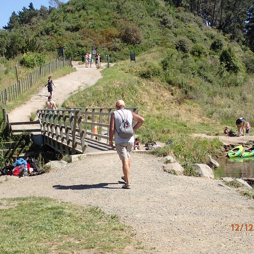
6. Spa Thermal Park and Riverbank Recreational and Scenic Reserve
Overall Ratings
4.5 based on 376 reviews
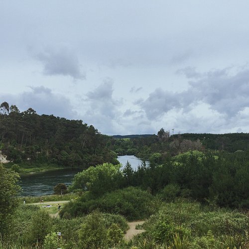
Reviewed By batchhen2017 - Timaru, New Zealand
This is so close into town, its very available and easy to find. What a delightful thermal river and hot pools (man made little pools in rocks ) at the side of the larger pool. I was pleasantly surprised how modern the facilities are, changing rooms and toilets very clean. Someone told me its had an upgrade. This is a beautifully made attraction and its free to use, how about that in NZ? It was only 2d when I went, but the fog lifted and I had a lovely soak. I was expecting it to be hotter like 35 to 39d but it was prob about 3od. However, I thoroughly enjoyed my visit and stunning scenery around the river.
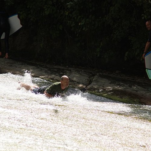
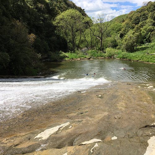
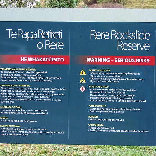
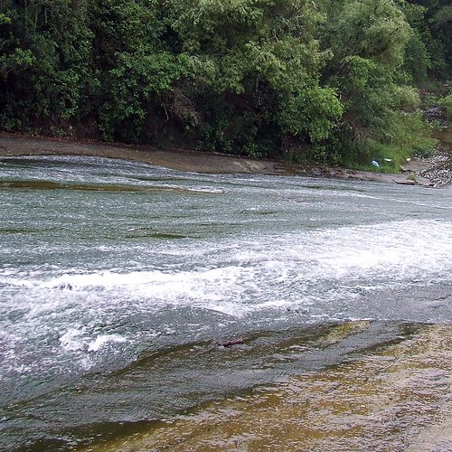
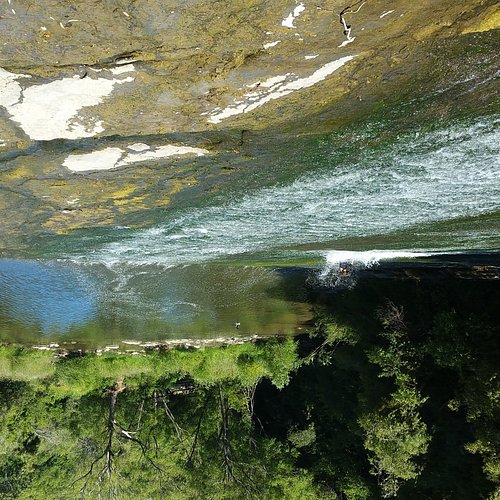
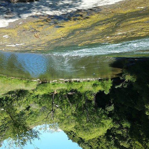
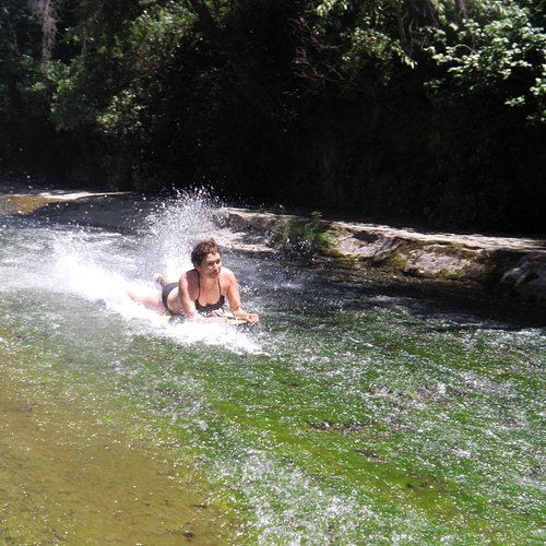
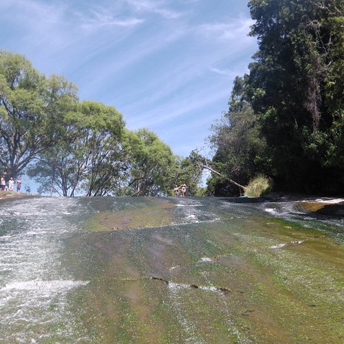
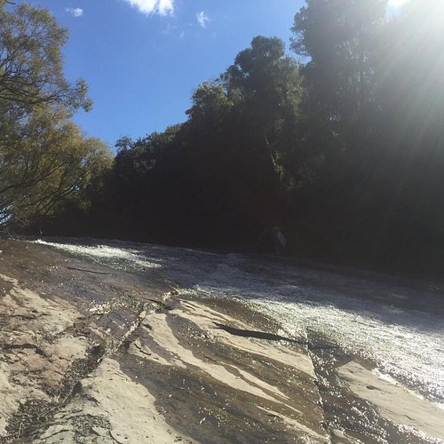
7. Rere Rockslide
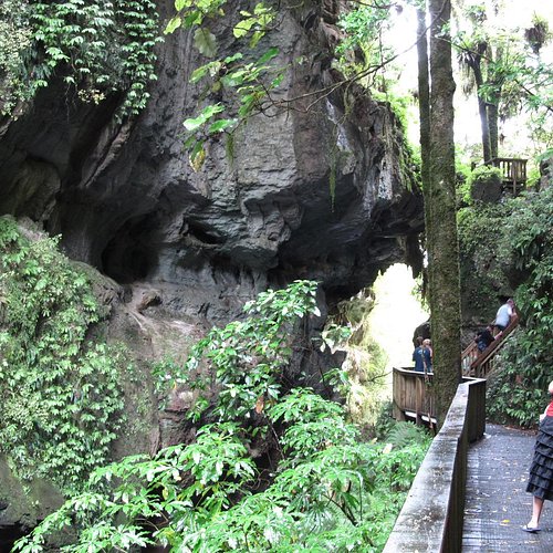
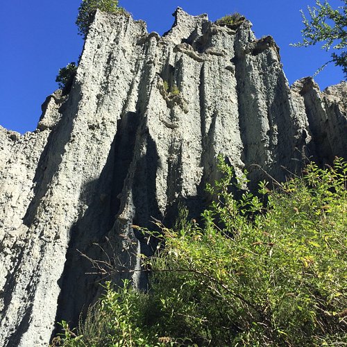
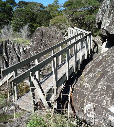
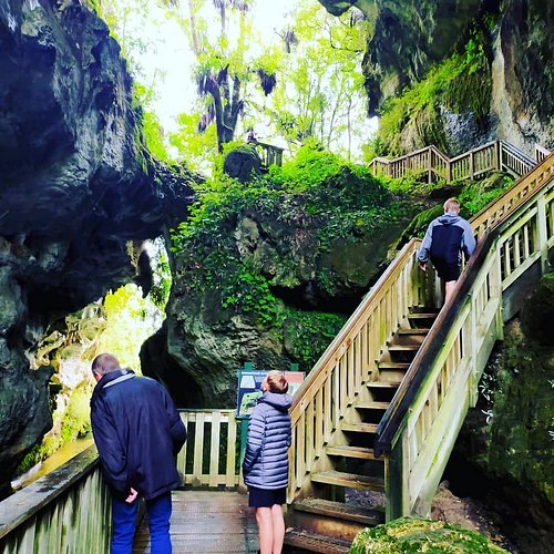
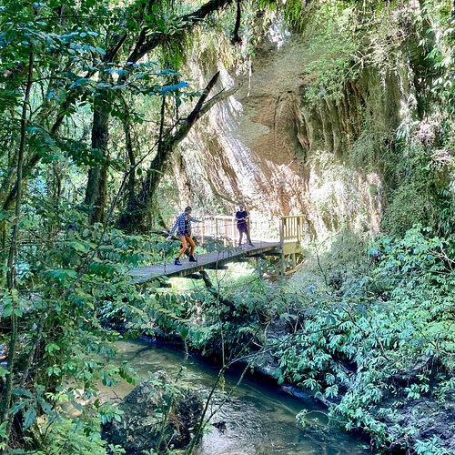
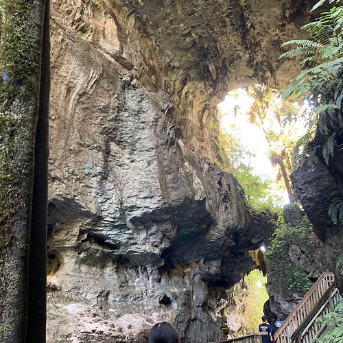
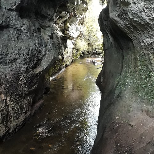
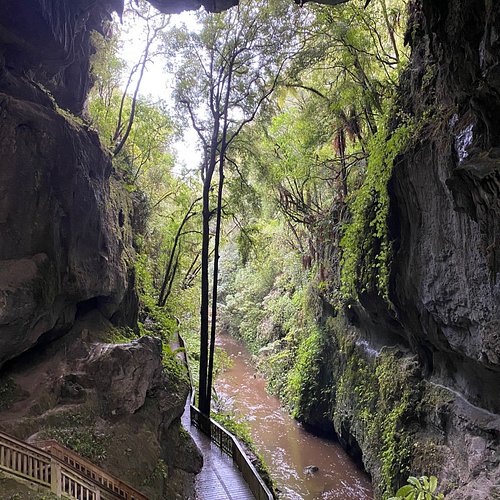
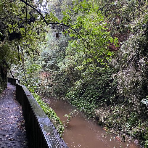
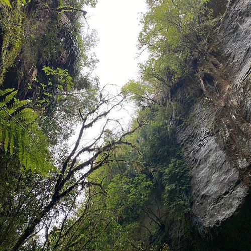
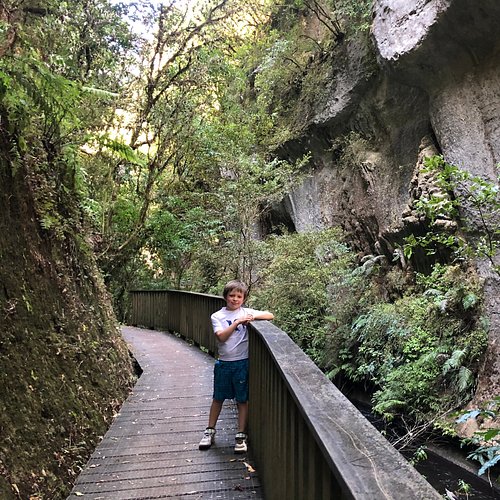
8. Mangapohue Natural Bridge Walk
Overall Ratings
4.5 based on 345 reviews
Always check the website for changes that might affect your trip.
Reviewed By 6-world-travelers
If you're in the Waitomo area, this is a 35 minute drive from Waitomo village, and 5 minutes from the spectacular Marakopa waterfall. Coming from the village, parking is on the right hand side of the road; be careful turning in as it's on a curve and there might be traffic to cross. Easy walk through a gorge to the main attraction; crosses a bridge where you'll have to hold onto your kids' hands (lest they fall over the edge) and you're under the limestone arch in about 5-10 minutes. It's 57ft of wow, and hard to capture on camera. If you carry on through, you'll climb a couple of stiles, go through farmland (watch the cow pats) and up and around. Loop takes maybe 20 minutes, tops.
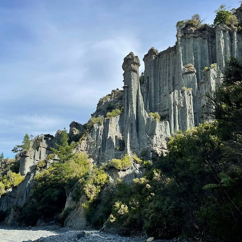
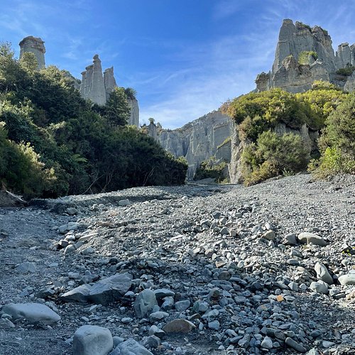
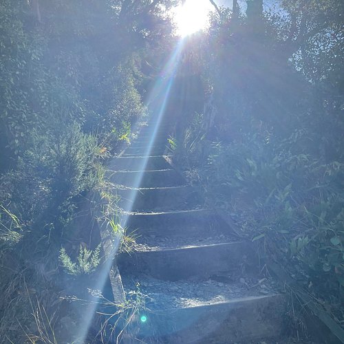
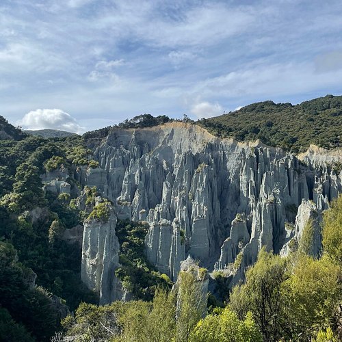
9. Pinnacles Track
Overall Ratings
4.5 based on 174 reviews
Always check the website for changes that might affect your trip.
Reviewed By familyoffiveonhols - New Zealand, null
The DOC suggest this is as an easy trek, but it is tricky uneven walking which requires some fitness. The ground especially on the stream bed is very uneven and unstable which I suggest wearing sturdy boots to tackle. The trek both up to the top and down in the stream bed are totally worth it. The Pinnacles are incredible to see from both areas.
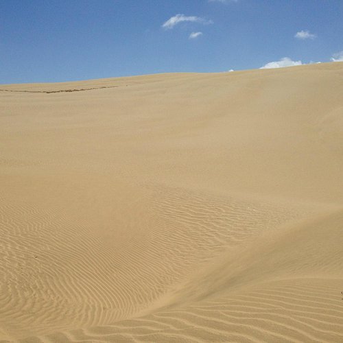
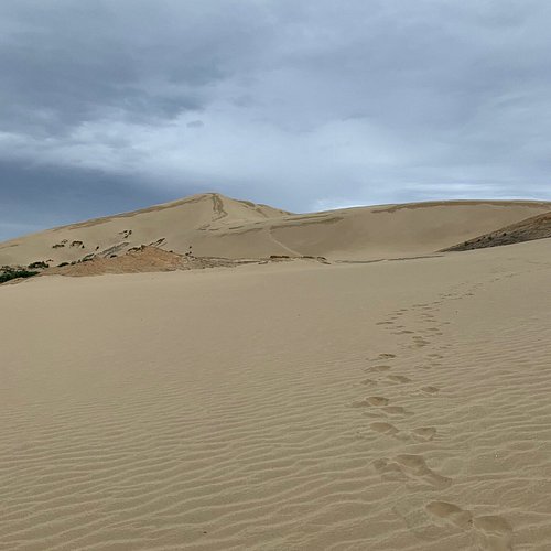
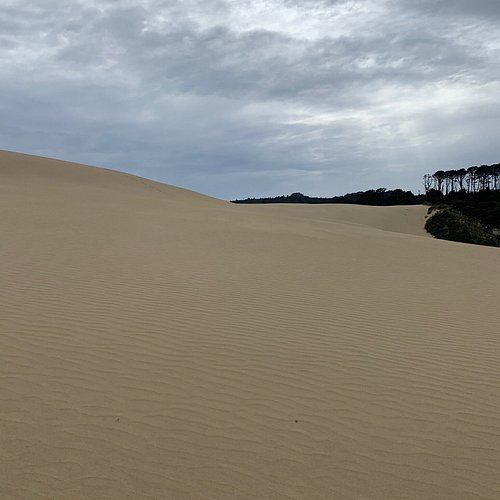
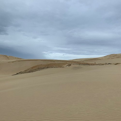
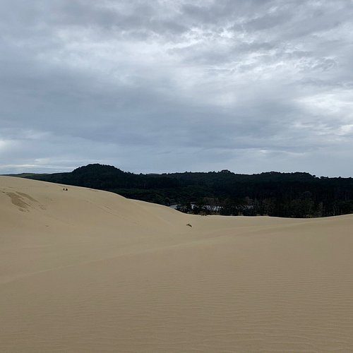
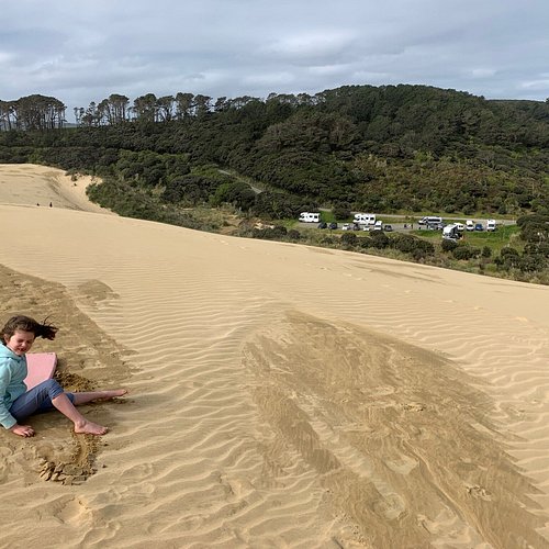
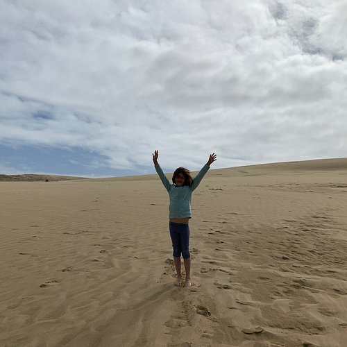
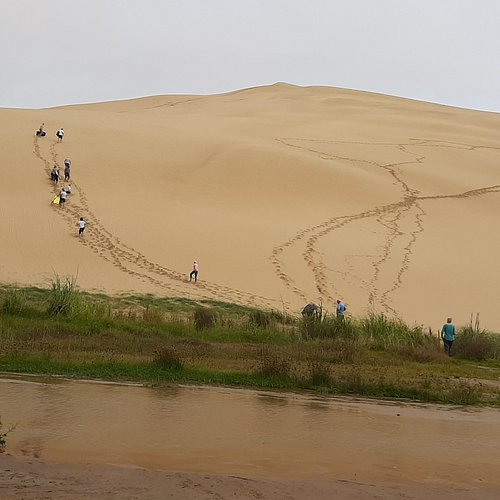
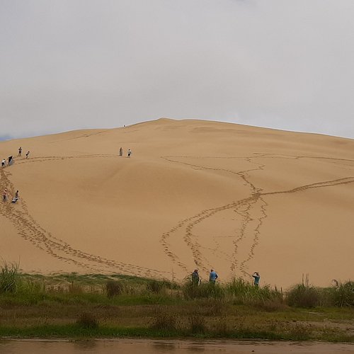
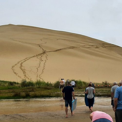
10. Te Paki Sand Dunes
Overall Ratings
4.5 based on 219 reviews
Reviewed By NatashaB2803 - Auckland, New Zealand
Great fun, plenty of parking great to break up the driving to or from cape Reinga. Boards available for day hire before arriving at $10 or pay $15 on site or take your own boogie board but you might not go as fast.