


Top Things to do in Westland Tai Poutini National Park
Top Hotels in Westland Tai Poutini National Park
6 Scenic Walking Areas in Westland Tai Poutini National Park That You Shouldn't Miss
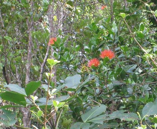
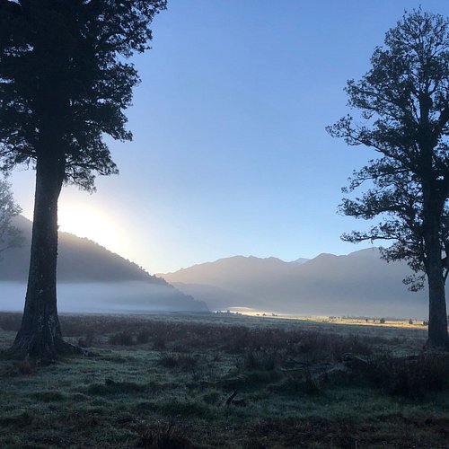
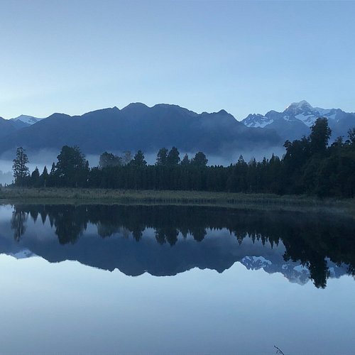
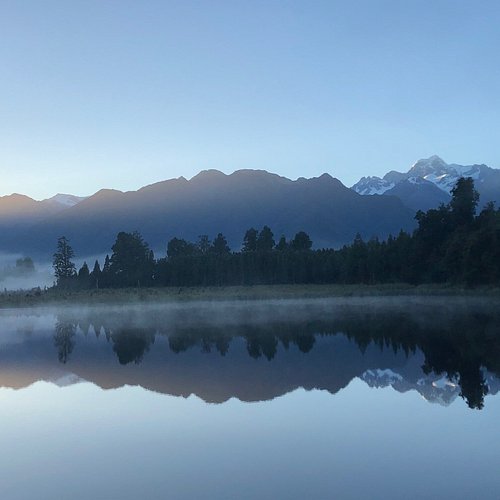
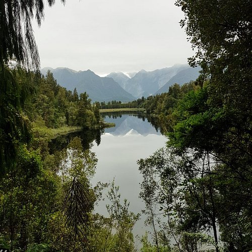
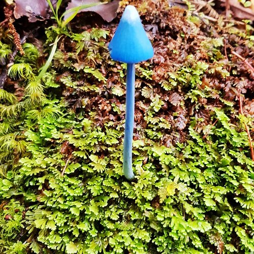
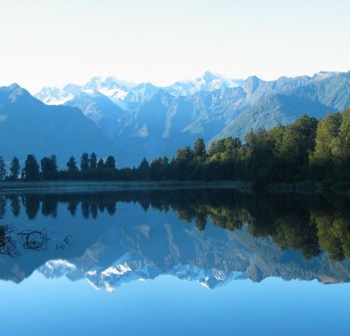
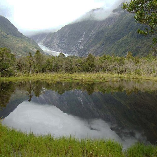
When thinking of Westland Tai Poutini National Park, one word should always come to mind: glacier. The speedy Fox and Franz Josef glaciers (both move up to 13 feet each day) are two popular sights and in some places, you can see the ice stretch back down to the sea. When you’re ready to get back to stable ground, walk around Lake Matheson (which also offers excellent birdwatching via kayak) to enjoy stunning views of Mount Cook.
Restaurants in Westland Tai Poutini National Park
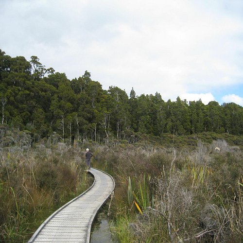
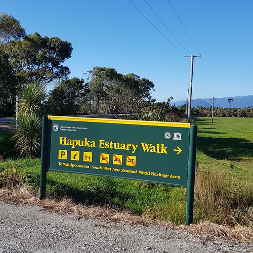
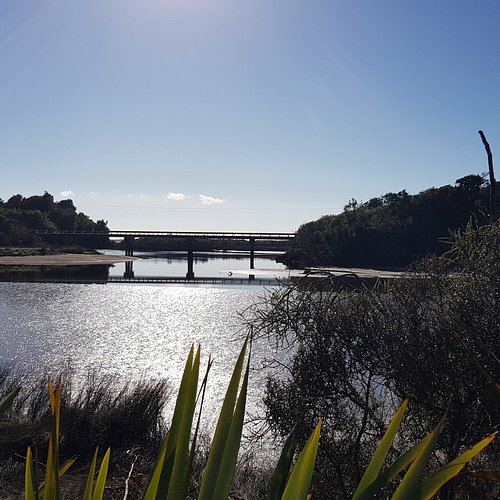
1. Hapuka Estuary Walk
Overall Ratings
5.0 based on 5 reviews
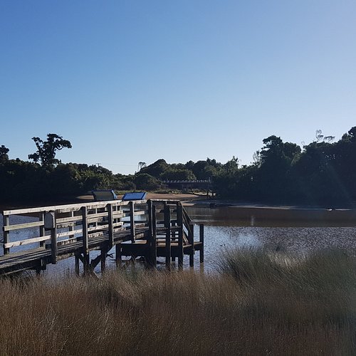
Hapuka Estuary Loop Walk-20mins/ 1km. This stunning boardwalk winds around the intertidal area of the Hapuka Estuary. Interpretation boards explain the ecology of the Estuary. A lookout gives you a view of The Open Bay Islands Taumaka and Popotai. Check the current track conditions and weather forecasts at the Department of Conservation, Haast Awarua Visitor Centre before starting your trip. •Always take warm and waterproof clothing as the weather can change rapidly. •Carry drinking water, insect repellent and sun protection at all times.
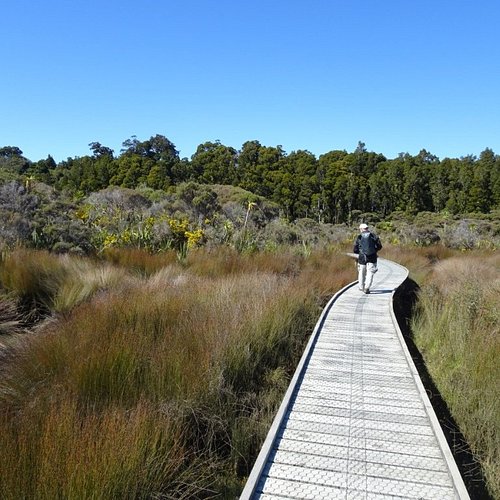
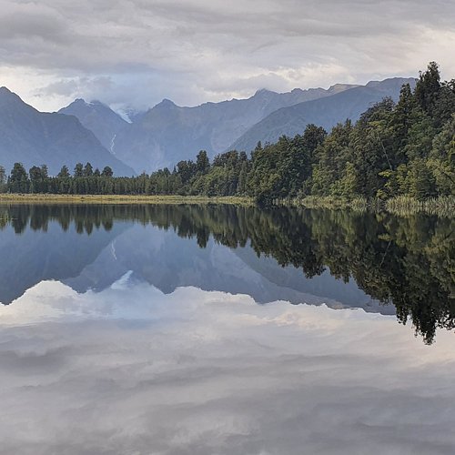
2. Lake Matheson Walk
Overall Ratings
4.5 based on 944 reviews
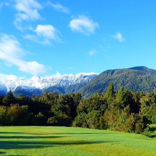
Lake Matheson is nestled in ancient forest and is famous for mirror views of Aoraki/Mount Cook and Mount Tasman. Its excellent reflecting properties are due to the dark brown colour of the water – the result of organic matter leached from the humus of the forest floor. Dawn and dusk are the best times to enjoy the reflections in the lake. Time: 1 hr 30 min return Getting there: Turn onto Cook Flat Road in the middle of Fox Glacier Weheka township. Travel 5 km along this road then turn right onto the side road to Lake Matheson.
Reviewed By KayM637 - Devonport, New Zealand
Make sure you do this walk on a sunny day, otherwise you will not get the mirrow affect of the Lake for photos. The loop track took us 1 1/2 hrs and has been upgraded and extened since 2005 with board walks and a walk to the island on the lake.
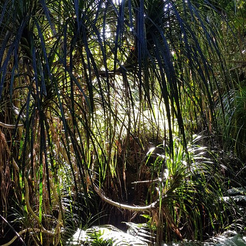
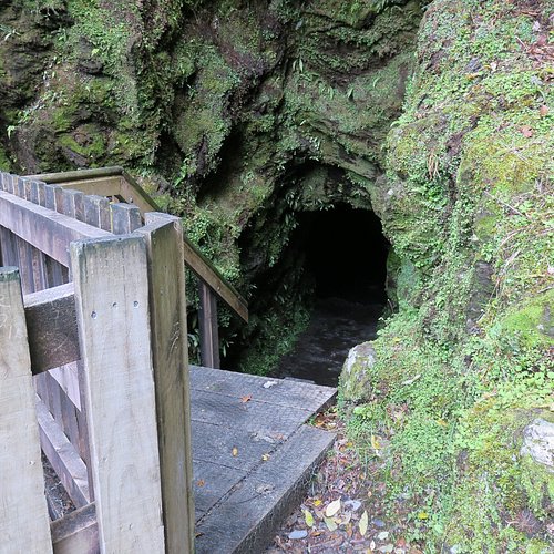
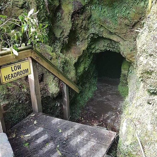
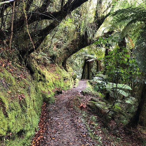
3. Tatare Tunnels Walk
Overall Ratings
4.5 based on 112 reviews
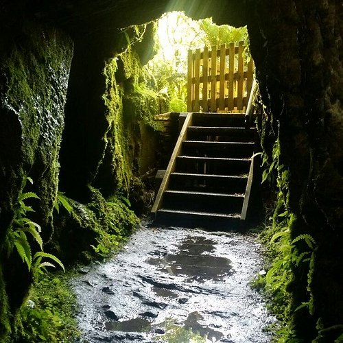
After 10 minutes walk on a four wheel drive road, the track climbs gently then drops to a view of the scenic Tatare Gorge. The track then becomes steep and narrow for the short climb to the Tatare Tunnels. If you wish to explore the tunnels you will need a torch and a raincoat, and you may get wet feet – the water will be ankle deep. The track stops at the old wooden flume at the end of the first tunnel. Know before you go •Check the current track conditions and weather forecasts at the Westland Tai Poutini National Park Visitor Centre before starting your trip. •Always take warm and waterproof clothing as the weather can change rapidly. •Carry drinking water, insect repellent and sun protection at all times.
Reviewed By AndrewW41
Took us 40 minutes to walk into the tunnel entrance, The last section is a narrow gravel walkers track that is up and down the hills, We walked 200meters into the tunnel (with no end in sight) in 100mm deep water most of the way, got back out and google says the tunnel is 500meters long... Cool tunnel about 1-1.5m wide and 2 meters high
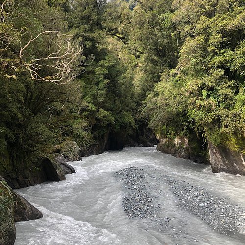
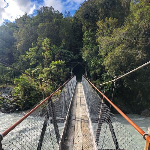
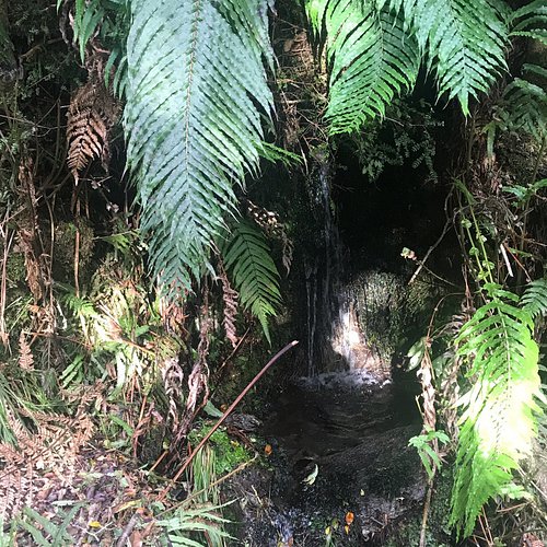
4. Callery Gorge Walk
Overall Ratings
4.0 based on 50 reviews

Reviewed By EverWonderer - Greater Melbourne, Australia
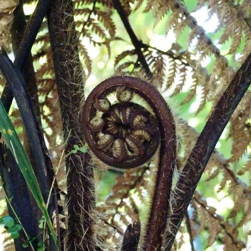
It's an easy walk (allow 1.5 hrs in total) to the beautiful gorge, past waterfalls and stunning ferns. I did my walk in the afternoon and only saw one other person on the trail. It's relatively flat, with some short gentle incline sections but can be done by kids. No need to be super fit. The suspension bridge at the end was the highlight
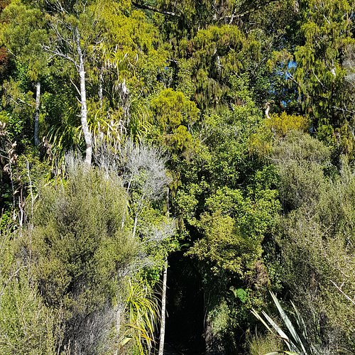
5. Canavan's Knob Walk
Overall Ratings
3.5 based on 7 reviews

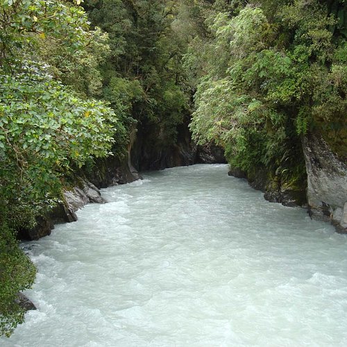
The first 800 metres of track is along the river stop bank. A short, but steady climb then takes you through rainforest to the top of this granite outcrop, where you will get commanding views of the sea and lowlands to one side, and up the Waiho River to the glacier and Southern Alps Kā Tiritiri o te Moana from the other. The granite of Canavans Knob is much older than the schist rocks of the glacier valley across the Alpine Fault Line, and therefore it survived the scraping of glacier ice 9000 years ago. Getting there 1.2 kilometres south of Franz Josef turn right into a sign-posted car park and the start of the Canavans Knob Walk. Time from car park: 1 hr return Distance from car park: 3.2 km return Alternatively, walk from Franz Josef across the Waiho River Bridge and turn sharp right onto a stop bank. Follow along until you see the track markers for the track. Time from Franz Josef township: 1 hr 40 min return Distance from Franz Josef township: 6.3 km return
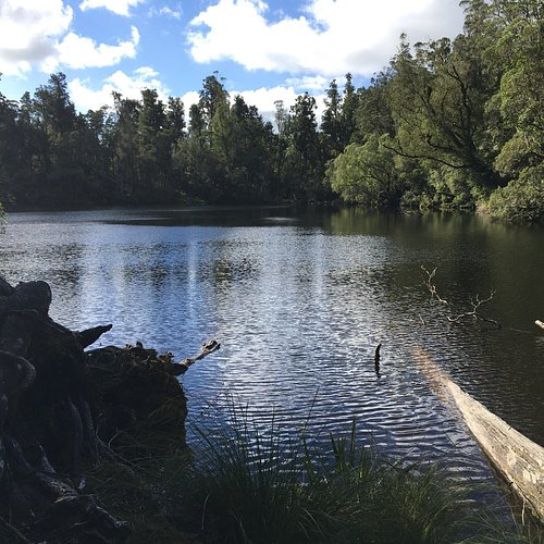
6. Lake Wombat Track
Overall Ratings
3.0 based on 7 reviews
Lake Wombat is a fern-lined walk which climbs steadily from the car park through rimu forest to a peaceful lake. Termed a kettle lake, Lake Wombat was formed by the melting of a huge piece of ice left amidst glacial debris about 9000 years ago. This walk offers good opportunities for bird watching if you stop quietly along the way. Getting there Drive or walk south from the Franz Josef Waiau township across the Waiho River bridge and turn left onto the Glacier Access Road or Te Ara a Waiau walkway. Drive or walk for approximately 2 km to where the Lake Wombat Walk begins, signposted on the right side of the road. See www.doc.govt.nz for more information.