


Top Things to do in Shenandoah National Park
10 Hiking Trails in Shenandoah National Park That You Shouldn't Miss
[object Object]
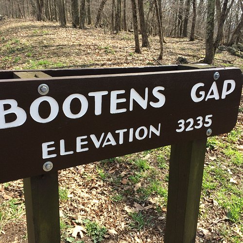
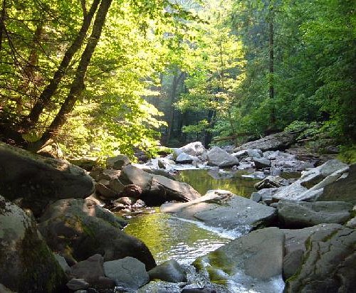
1. Bootens Gap - Jones Mountain/Staunton River - Laurel Prong Springs Loop
Overall Ratings
5.0 based on 1 reviews
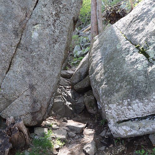
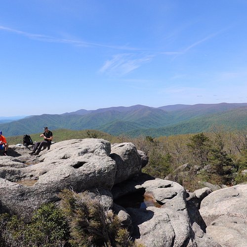
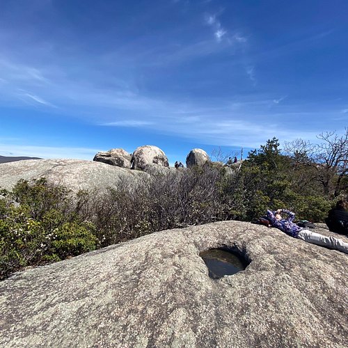
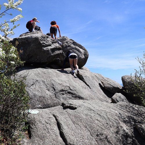
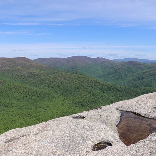
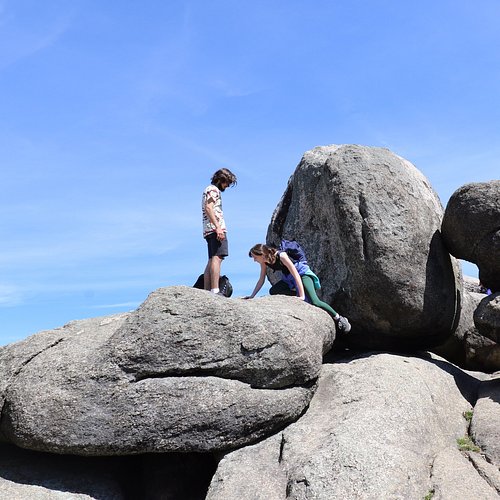
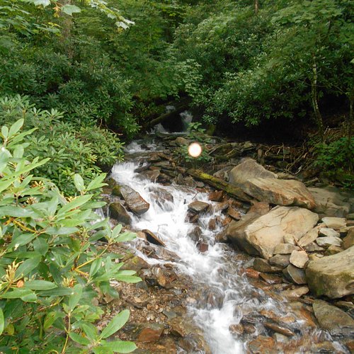
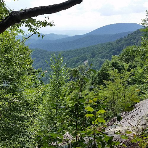
2. Old Rag Mountain Hike
Overall Ratings
5.0 based on 366 reviews
Reviewed By 352remil - Virginia, United States
Just got back from hiking this bad boy and would recommend it. I always wondered if it would be as hard as people say. While I wouldn't say only certain people should do it...you gotta be prepared for what you are getting into. Today being election Tuesday I figured there wouldn't be too many issues with overcrowding. I arrived at 10:30 am and the two main lots were full. I was one of the first cars in the 3rd overflow but while I was gathering my gear at least 10 more cars full of people arrived. There are portopotty's in the lower overflow lot but actual restrooms in the main parking area. While the ranger station at the lower overflow lot is closed be prepared to bring your wallet/pass with you because the ranger station is open in the main lot at the head of the trail. I did not read the signs that warn of this in the lower overflow lot so unfortunately had to return to my car adding another mile to the overall hike. People say plan the day to do the hike and they are right. I set out from the ranger station at 11 am and was done by 4:30 pm but the sun was disappearing rapidly and I speed walked the last several miles once getting to the Weakley Hollow Fire Road. I also didn't spend a ton of time at the overlooks nor the summit. So what is there to be cautious about? The rocks...oohh the rocks. Slippery when wet is not just a Bon Jovi album. If you've done any research you know about the rock scramble but the rocks along the way are not to be taken lightly either. I was behind a family and watched the father slip on a small rock. He went down hard about 2 miles into the trail hitting his head on some other larger rocks. The family decided to turn back at that time. The boulders are what everyone comes for though. When I bought my trail ticket ($15) the ranger warned of the mile long rock scramble at the top but I truly didn't appreciate what she meant until I got there. Once off the beaten path, it took a minute to orient on how to navigate the trail but once I figured out to look for the blue blazes, it made it slightly easier. I was able to traverse most of the scramble alone but did have to bite the bullet and ask for a hand in a some places mainly because the scramble forced an awkward body position making leverage impossible. Even though it was 61 degrees and a sunny day there was ice in several spots once leaving the tree line and there was some strong winds. Once slipping into an icy puddle, getting a grip on the boulders with the wet shoe was nigh impossible. That's why people recommend good hiking shoes with grip. Going down from the summit using the Saddle Trail to the Fire Road was a nice respite after all the bouldering. Be prepared for 5 more hiking miles after you summit if you do this route. Weakely Hollow Fire Road was well marked after getting off the saddle trail. There's now a new Ridge access trail back to the parking area but the sucker is mostly uphill and feels like torture at the end of a long day of traversing Old Rag.
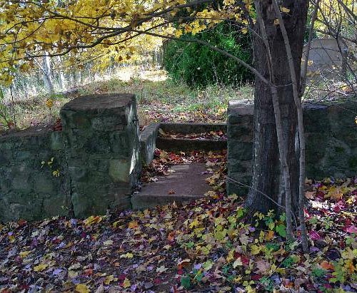
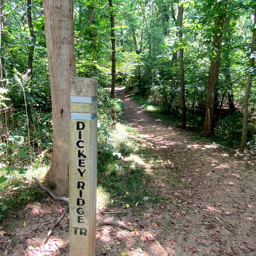
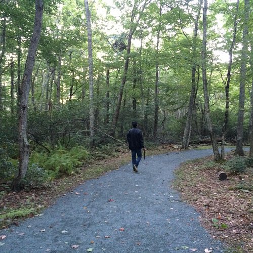
3. Dickey Ridge Trail
Overall Ratings
4.5 based on 20 reviews

Scenic trail in Shenandoah.
Reviewed By Bob19512014 - Gulfport, United States
This trail can be started even without entering the National park. The grade is easy and shady. Not a place for a wheelchair. Even the youngest or oldest can handle this trail.
4. Appalachian Trail
Overall Ratings
4.5 based on 192 reviews
Reviewed By Bowmanator22 - Charlotte, United States
We walked only a tiny section of the AT, but even stepping foot on this iconic trail was a thrill. Left me dreaming of future hiking adventures still to come! Must do, whatever you are able.
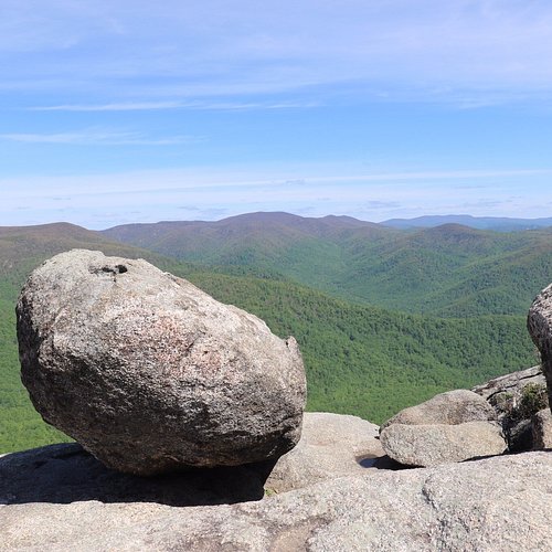
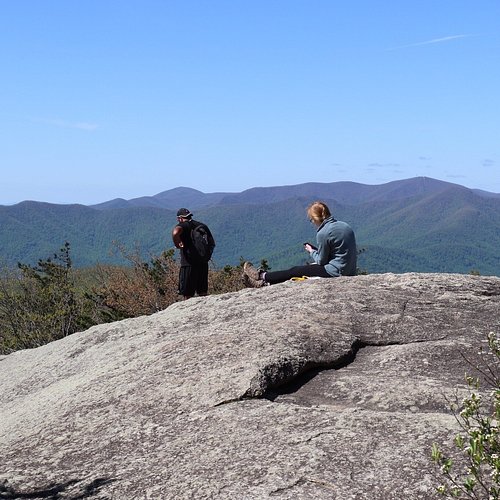
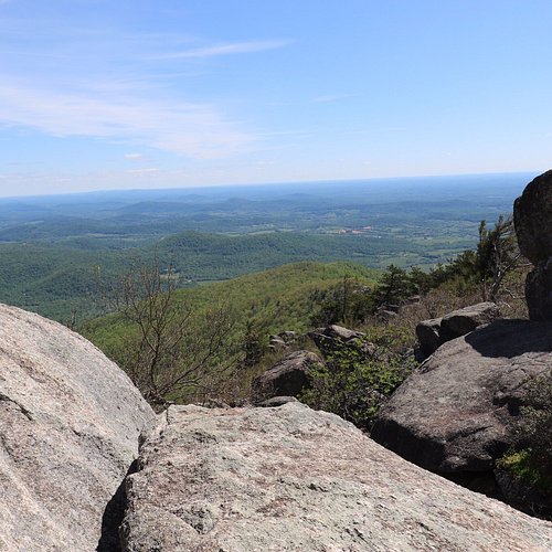
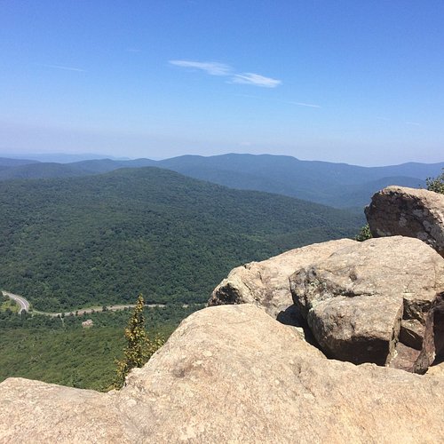
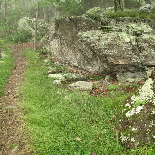
5. Mary's Rock Summit Trail
Overall Ratings
4.5 based on 111 reviews

Reviewed By Mashuganah - Springfield, United States
A hike of moderate difficulty with a beautiful, panoramic view at the end. A lovely, cool breeze was coming up from the valley when I was there. Those wanting more adventure can climb the rocks to the very peak. Take lots of water (one bottle mayn't be enough) and a snack for the top. Can be completed in a couple hours if you're in reasonable shape. The trail is very rocky so have some good shock absorbing hiking shoes.
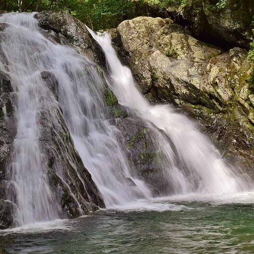
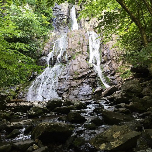
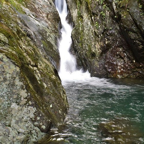
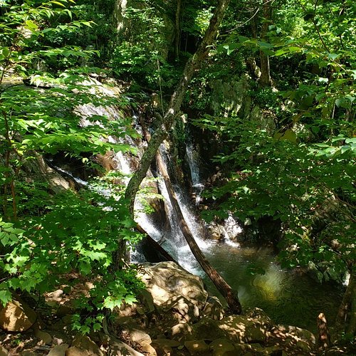
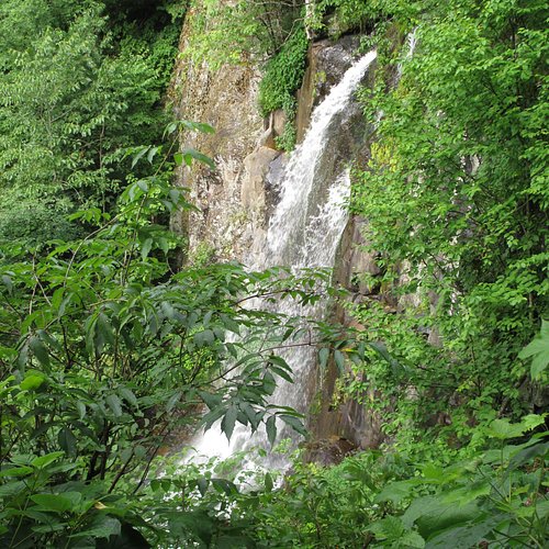
6. Jones Run Falls Trailhead
Overall Ratings
4.5 based on 13 reviews

Reviewed By Hadrian6
We recommend starting at the Jones Run Trailhead and extending your hike to a portion of the Doyles River Trail to see both the upper and lower falls there. Return to Skyline Drive using the Brown's Gap Road trail (a very gentle climb compared to the Jones Run trail) and connect back to the Jones Run Trailhead using a portion of the AT. This loop is a little over 6 miles. This is one of the best hikes we have done in a long time. There were very few people on the trail (we passed 5 in 5 hours) and the recent heavy rains had made all of the falls spectacular. We even saw a bear (very close!) on the Brown's Gap Road/Trail. Not too buggy.
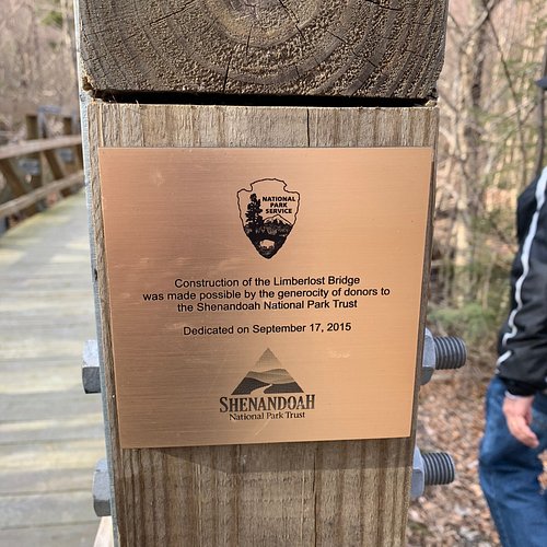
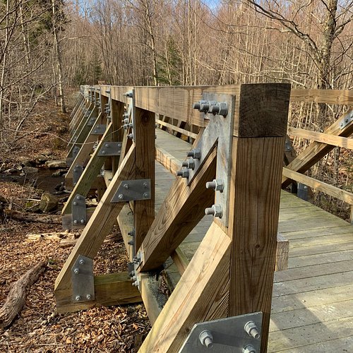
7. Limberlost Trail
Overall Ratings
4.5 based on 64 reviews

Reviewed By Samui - Washington DC, United States
We enjoyed a stroll around this well-maintained loop trail, taking advantage of the many benches to do some bird and small wildlife spotting.
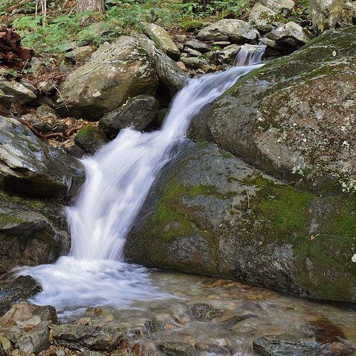
8. Cedar Run Trail
Overall Ratings
4.5 based on 5 reviews
Reviewed By as4nw - Washington DC, United States
live a couple hours away and have done this trail many times. it’s best be done as a loop with the white oak canyon hike (see the page for cedar run-white oak canyon on hikingupward.com or on AllTrails) and be rated higher. it doesn’t have views like old rag but it’s a great hike to do in the area if looking for a hike with lots of water/waterfalls/swimming holes and especially if you can do it on a weekday and away from the crowds. this is definitely a contender for the second hike i’d recommend for visitors to the area, if fit and can do moderately strenuous hikes (the loop as described above is 8-11 miles depending on the route you take and a little over 2000 feet of elevation gain). you can find all the info you need from the sources listed above. enjoy!
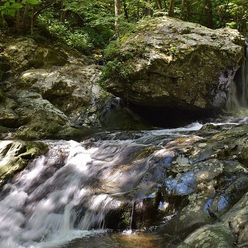
9. South River Falls Trail
Overall Ratings
4.0 based on 35 reviews
Reviewed By paxa - Washington DC, United States
This is a relatively short trail - only 2.6 miles out and back if just going to the observation point. It's downhill all the way out and uphill all the way back - with a couple of switchbacks - so be prepared for the real workout on return. Trail surface is rockier closer to the falls. Stream crossing is towards the end and pretty easy with multiple crossing points with no danger of getting your feet wet. Waterfall is not big, probably better if you continue to hike down to the base of it but that trail was not immediately obvious so we didn't bother. Overall a very worthwhile "moderate" difficulty level hike and scenic all the way.
10. Lewis Falls Trail
Overall Ratings
4.0 based on 9 reviews

Reviewed By EDWARDL782 - Sarasota, United States
We entered the trail from the parking lot of the Big Meadows Lodge, and saw our first bear within the first 15 minutes. The bear was busy looking for food, so it just crossed the trail in front of us and we continued down the hill. Note to hikers; this is a 3.3 mile loop route, but it descends 1,000 vertical feet on it's way to the falls. This of course means that you are going to ascend 1000 vertical feet on the way back and the trail is very rocky in place. Not difficult, and even though the Park brochure lists this as a "moderate" difficulty, if you are not used to hiking, this might be too difficult for you. The area on both sides of the trail is primarily dense woods, and until you get near the falls, there literally is no sight of the Shenandoah Valley or the horizon. The final 100 yards before the Falls overlook, crosses a stream so the rocks are slippery and the trail is very rocky. There is a railing once you pass the final stream, and it is safer to hang on to the railing as that part of the trail is very steep. It took us about 3.5 hours in total, we had a quick bite of lunch at the falls, and rested up for the trip back. This is a pet friendly trail, they must be on leash though. Again, if you are not used to hiking, this trail is not a beginner route. We did see a few kids on the trail, so go at your own risk.